Rule modeling method integrating city design indexes and construction control indexes

A technology for controlling indicators and urban design, applied in the field of urban three-dimensional modeling, can solve problems such as unintuitive, inflexible, time-consuming and labor-intensive planning effects, achieve real-time update, save time and labor costs, and solve modeling speed slow effect

Inactive Publication Date: 2015-12-30
GUANGXI UNIV
View PDF1 Cites 14 Cited by
  • Summary
  • Abstract
  • Description
  • Claims
  • Application Information

AI Technical Summary

Problems solved by technology

[0006] The purpose of the present invention is to provide a rule modeling method that integrates urban design and construction control indicators, so as to overcome the disadvant

Method used


Image

  • Rule modeling method integrating city design indexes and construction control indexes
  • Rule modeling method integrating city design indexes and construction control indexes
  • Rule modeling method integrating city design indexes and construction control indexes

Examples


Embodiment Construction

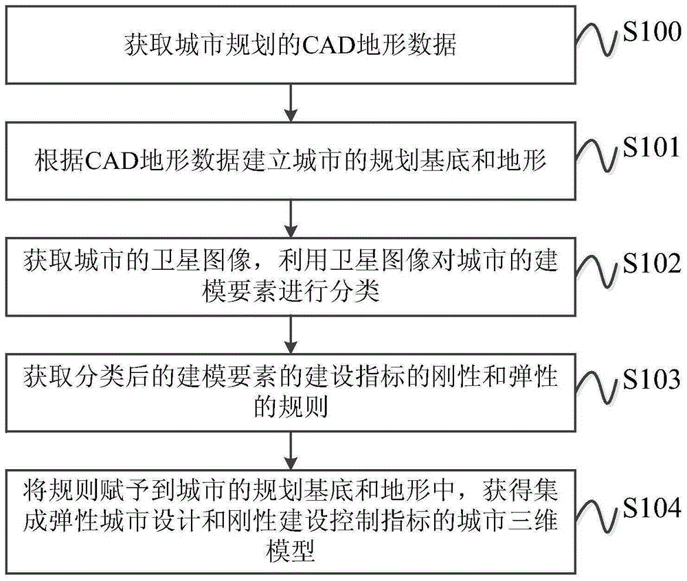
[0023] The specific embodiments of the present invention will be described in detail below in conjunction with the accompanying drawings, but it should be understood that the protection scope of the present invention is not limited by the specific embodiments.

[0024] like figure 1 As shown, the rule modeling method for integrating urban design and construction control indicators according to a specific embodiment of the present invention includes the following steps:

[0025] Step S100: Obtain CAD terrain data of urban planning.

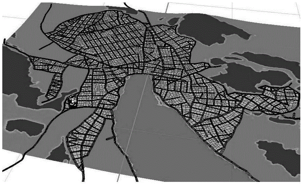
[0026] Step S101: Establish the planning base and terrain of the city according to the CAD terrain data.

[0027] In this step, first add the .dxf or .dwg format terrain data in the CAD file in the CAD terrain data to the ArcGIS platform, extract point, line, and area elements, save them as ShapeFile file topographic map data, and then process the processed ShapeFile file topographic map data is imported into urban modeling software such as CityE...


PUM


Abstract

The invention discloses a rule modeling method integrating city design indexes and construction control indexes. The method includes the steps that 1, CAD topography data for city planning are acquired; 2, the planned foundation and topography of a city are established according to the CAD topographic data; 3, a satellite image of the city is acquired, and modeling elements of the city are classified through the satellite image; 4, rules of rigidity and flexibility of the construction indexes of the classified modeling elements are acquired; 5, the rules are assigned to the planned foundation and topography of the city to obtain a city three-dimensional model integrating the flexible city design indexes and the rigid construction control indexes. The method solves the problems of planning effect invisibility, high time and labor consumption and inflexibility caused when city design indexes are separated from construction control indexes.

Description

technical field [0001] The invention relates to the field of urban three-dimensional modeling, in particular to a rule modeling method integrating urban design and construction control indicators. Background technique [0002] Urban design is a kind of planning that shows the layout of the city, the appearance of the city and the space of the city. It has diversity and flexibility in display effect. At present, urban design is mainly displayed in two dimensions, and three-dimensional urban models are often displayed at a fixed angle; and the tools and methods of urban three-dimensional modeling are cumbersome and complicated, time-consuming and labor-intensive, and the completed model can only show the appearance of the city at a specific time , the model cannot be simply changed. [0003] Construction control index planning (regulatory detailed planning) is a planning that determines the nature and intensity of land use, the location of roads and engineering pipelines, an...

Claims


Application Information

Patent Timeline
IPC IPC(8): G06F17/50G06T17/00
Inventor 骆燕文何江阮胜
Owner GUANGXI UNIV
Why Eureka
Try Eureka