Pseudo-range differential positioning method of long base line

A technology of pseudo-range difference and positioning method, which is applied in the field of satellite navigation and can solve the problem of increasing model positioning error

Inactive Publication Date: 2016-01-13
NO 20 RES INST OF CHINA ELECTRONICS TECH GRP
View PDF2 Cites 22 Cited by
  • Summary
  • Abstract
  • Description
  • Claims
  • Application Information

AI Technical Summary

Problems solved by technology

The traditional pseudo-range differential GNSS method assumes that the observation vectors of the same satellite at the user end and the reference station are parallel to each other. When the baseline i

Method used


Image

  • Pseudo-range differential positioning method of long base line
  • Pseudo-range differential positioning method of long base line
  • Pseudo-range differential positioning method of long base line

Examples


Embodiment Construction

[0027] The present invention will be further described below in conjunction with the accompanying drawings and embodiments, and the present invention includes but not limited to the following embodiments.

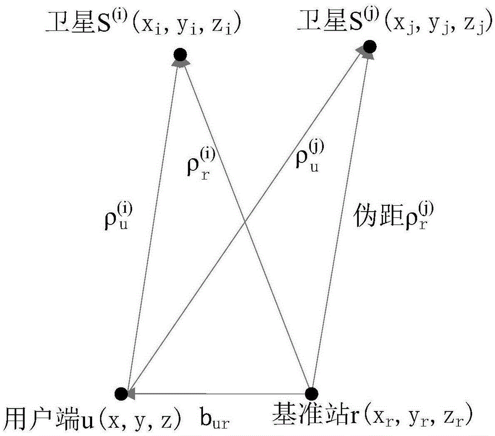
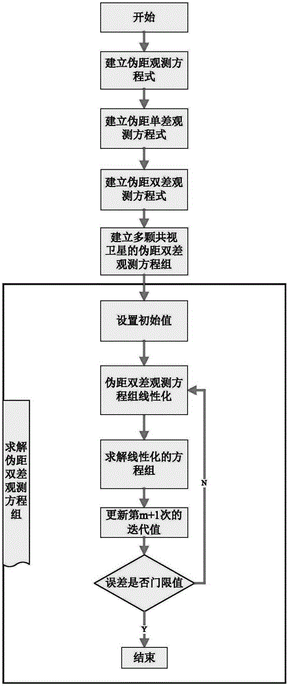
[0028] figure 1 is a schematic diagram of the satellite guidance pseudo-range difference model of the present invention, which consists of several satellites S (i) , user end u, and reference station r. Known reference station position, reference station and several satellites S (i) The pseudorange, the user terminal and several satellites S (i) pseudorange, and use these positions and pseudorange measurement information to solve the user terminal location. figure 2 It is a flow chart of the method of the present invention.

[0029] Step 1: Establish the pseudorange observation equation

[0030] Suppose a certain satellite S at time t (i) The coordinates in the geocentric Cartesian coordinate system are (x i ,y i ,z i ), the geocentric coordinates of the receiver ...


PUM


Abstract

The invention provides a pseudo-range differential positioning method of a long base line. A plurality of satellites, a user terminal and a base station form a satellite navigation pseudo-range differential model. A pseudo-range single-different equation relative to one same satellite is constructed by using pseudo-range observation equations of the base station, the user terminal, and the satellites; with pseudo-range single-different equations of different satellites, a non-linear pseudo-range dual-difference equation group containing multiple satellites is constructed; and then a position of the user terminal is obtained by using the Newton's method and the method of least squares. According to the positioning method, errors of the pseudo-range differential positioning model under base lines with different lengths can be eliminated and thus the increase with increasing of the length of the base line is prevented, so that a small error range can be kept and thus a high-precision positioning requirement can be completely met.

Description

technical field [0001] The invention relates to a pseudorange differential positioning method, which belongs to the field of satellite navigation. Background technique [0002] With the widespread application of the global satellite navigation system (GNSS), more and more electronic devices need to determine their precise positions through satellites. GNSS single-point positioning accuracy is far from meeting the needs of vehicle control, air traffic control, and aircraft formation. It is urgent to develop and research high-precision positioning equipment and positioning methods. The satellite receiver measurement information contains various errors: satellite clock error, satellite ephemeris error, tropospheric delay error, ionospheric delay error, multipath error, receiver noise, etc. Reducing measurement errors in satellite receiver measurement information is one of the effective methods to improve positioning accuracy. Differential GNSS is a widely used method that can ...

Claims


Application Information

Patent Timeline
IPC IPC(8): G01S19/42G01S19/41
CPCG01S19/42G01S19/41
Inventor 魏红波雷创李城梁张果程林
Owner NO 20 RES INST OF CHINA ELECTRONICS TECH GRP
Why Eureka
Try Eureka