
Method and device for constructing semantic association of urban land spatial three-dimensional survey data

A technology of survey data and semantic association, applied in the field of geospatial information, it can solve problems such as inability to express the quantity and shape of space resources, inability to evaluate the potential and suitable use of space resources, inability to realize optimal allocation of resources, dynamic simulation and real-time early warning, etc. Achieve the effect of broadening the scope and depth of applications and enriching the means of use

Active Publication Date: 2018-01-16
深圳市数字城市工程研究中心
View PDF3 Cites 2 Cited by
  • Summary
  • Abstract
  • Description
  • Claims
  • Application Information

AI Technical Summary

Problems solved by technology

[0004] However, the traditional two-dimensional land survey data is difficult to support the standardization, standardization and information management of many land development and construction business links such as spatial resource planning, utilization, evaluation, and registration under the three-dimensional utilization of urban land space, and cannot realize the three-dimensional utilization model. Resource optimization allocation, dynamic simulation and real-time early warning seriously restrict the three-dimensional utilization of urban land at the technical level
The specific manifestations are: the inability to express the quantity and form of space resources under the three-dimensional utilization mode, the inability to evaluate the potential and suitable uses of space resources, and the inability to realize the arrangement of space resources for production and living needs, etc.

Method used


Image

  • Method and device for constructing semantic association of urban land spatial three-dimensional survey data
  • Method and device for constructing semantic association of urban land spatial three-dimensional survey data
  • Method and device for constructing semantic association of urban land spatial three-dimensional survey data

Examples


Embodiment Construction

[0034] In order to make the object, technical solution and beneficial effects of the present invention more clear, the present invention will be further described in detail below in conjunction with the accompanying drawings and embodiments. It should be understood that the specific embodiments described here are only used to explain the present invention, not to limit the present invention.

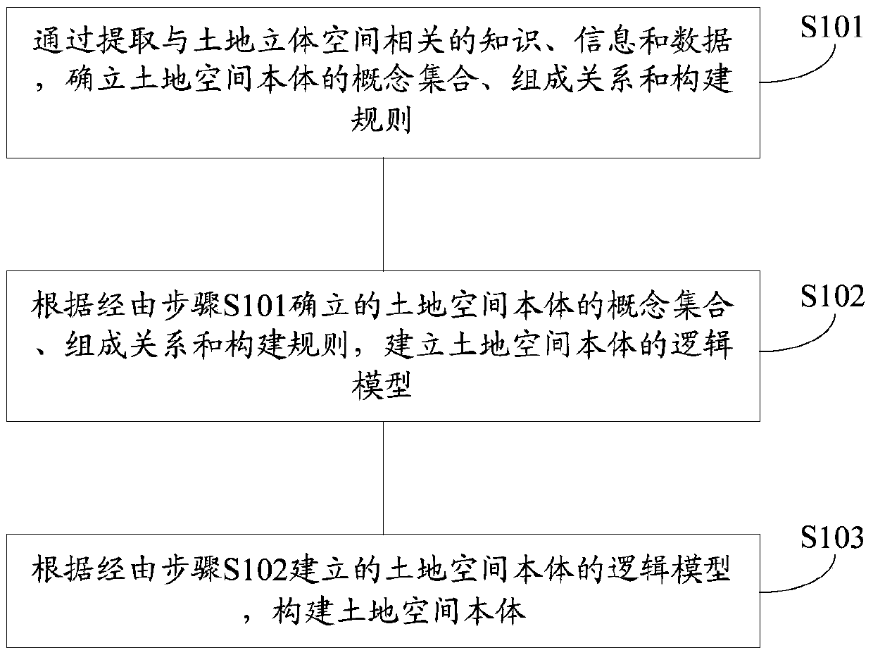
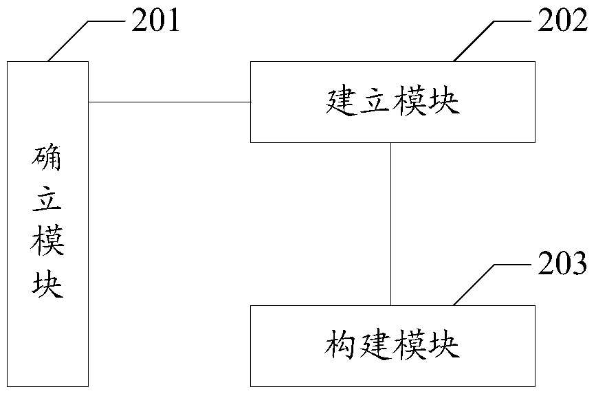
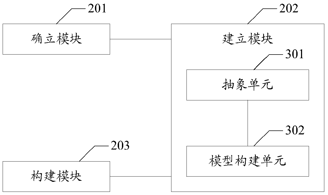
[0035] The embodiment of the present invention provides a method for constructing the semantic association of urban land space three-dimensional survey data, the method includes: establishing the concept set, composition relationship and construction rules of the land space ontology by extracting knowledge, information and data related to the land three-dimensional space; According to the established concept set, composition relationship and construction rules of the land space ontology, establish the logic model of the land space ontology; according to the logic model, construct the land...


PUM


Abstract

The invention belongs to the geography space information field, and provides a method and device constructing a city land space stereo investigation data semantic association so as to solve the disadvantages of the city land space stereo investigation data semantic association constructed by conventional two dimension land investigation data; the method comprises the following steps: extracting knowledge, information and data related to the land stereo space, and determining a concept set, a composition relation and construction rules of the land space noumenon; setting up a land space noumenon logic model of the land space noumenon according to the set concept set, the composition relation and construction rules of the land space noumenon; building the land space noumenon according to the set logic model. The method and device can provide decision supports in aspects of city land stereo utilization management, city land planning, resource and environment protection, and area coordination and sustainable development; the method and device can promote city land resource management field electron government affairs construction, and can push to realize a smart city construction long term strategy target.

Description

technical field [0001] The invention belongs to the field of geographic space information, and in particular relates to a method and a device for constructing semantic association of urban land space three-dimensional survey data. Background technique [0002] With the acceleration of urbanization, urban land has increasingly become a scarce resource, and the contradiction between supply and demand of urban land has become increasingly acute. In order to solve the above contradictions, relevant departments have proposed the three-dimensional utilization of urban land space. Practice has proved that the three-dimensional utilization of land space has greatly improved the utilization rate of urban land, and has become an effective way to realize the transformation of urban development and resolve the contradiction between land supply and demand. [0003] In order to rationally organize and effectively integrate the three-dimensional utilization of urban land, the relevant tec...

Claims


Application Information

Patent Timeline
Patent Type & Authority Patents(China)
IPC IPC(8): G06F17/30
CPCG06F16/29
Inventor 朱园媛王伟玺郭晗李晓明李媛
Owner 深圳市数字城市工程研究中心
Learn More