
Intelligent electronic tourist guide system based on geographic fencing technology

A geo-fencing, intelligent tour guide technology, applied in the field of tourism information services, can solve the problems of unreasonable time and money, low utilization, and the tour guide system cannot well meet the needs of tourists, to achieve a good user experience and improve the effect of response time.

Active Publication Date: 2016-02-17
NANJING UNIV +2
View PDF3 Cites 26 Cited by
  • Summary
  • Abstract
  • Description
  • Claims
  • Application Information

AI Technical Summary

Problems solved by technology

The main disadvantages of the hand-drawn tourist route map are: first, it has unreasonable use and inefficiency in terms of time and money
[0005] The existing tour guide system cannot well meet the needs of tourists in the actual situation. During peak tourism periods such as Golden Week, a self-service and intelligent tour guide system will be more needed

Method used


Image

  • Intelligent electronic tourist guide system based on geographic fencing technology
  • Intelligent electronic tourist guide system based on geographic fencing technology
  • Intelligent electronic tourist guide system based on geographic fencing technology

Examples


Embodiment

[0084] This embodiment uses the scenic spot data of a certain lake scenic spot in city A to conduct the experiment.

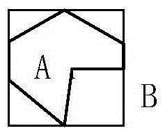
[0085]For the obtained raw data, a geo-fence is first constructed. Since the geo-fences of scenic spots have different shapes, the minimum outer rectangle MBR (Minimal Bounding Rectangle) is used to approximate the geo-fence of scenic spots. like image 3 , the geo-fence of scenic area A is approximately represented by rectangle B. A: Indicates the shape of the scenic spot (arbitrary polygon), B: Indicates the smallest enclosing rectangle of A.

[0086] Second, build a virtual fence as follows:

[0087] The first step is to enclose the geo-fenced area of ​​the scenic spot with a minimum enclosing rectangle (MBR (Minimal Bounding Rectangle). For example, Scenic Spot A is surrounded by the smallest enclosing rectangle B. These rectangles will be stored in the leaf nodes of the R tree. image 3 shown.

[0088] The second step is to frame the adjacent smallest ...


PUM


Abstract

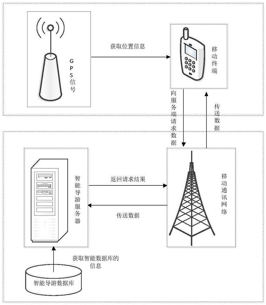
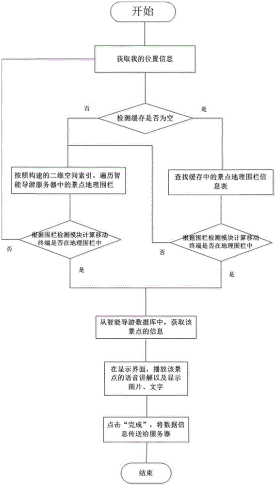
The invention discloses an intelligent electronic tourist guide system based on a geographic fencing technology. The system comprises a mobile terminal, an intelligent tourist guide server and an intelligent tourist guide database. A method for realizing the system comprises the steps: firstly, locating data are received by the mobile terminal and are sent to the intelligent tourist guide server through a network communication module; then, a scenic region where the mobile terminal is located is calculated by the intelligent tourist guide server through a geographic fencing technology according to the locating data, and information of the scenic region is found from the intelligent tourist guide database; finally, the information of the scenic region is sent to the mobile terminal by the intelligent tourist guide server through the network communication module, the a multimedia module of the mobile terminal is triggered to play voice, and meanwhile pictures, characters and voice playing states are displayed on the mobile terminal.

Description

technical field [0001] The invention relates to the field of travel information service, in particular to an intelligent electronic guide system based on geo-fence technology. Background technique [0002] Tourism has become an important activity to improve people's quality of life, especially the wide application of digital products, which has greatly promoted the tourism industry and brought great benefits to tourists in tourism. [0003] According to the "Communiqué on the Statistical Survey of National Travel Agencies in the Fourth Quarter of 2013" published by the National Tourism Administration on February 21, 2014, during the November long holiday last year, my country's tourism industry revenue reached 223.3 billion, a year-on-year increase of 223.3 billion. The Mid-Autumn Festival and National Day holiday increased by 6.1%. In contrast, the problems people encounter in the process of traveling are also endless, the most important of which are the navigation of touri...

Claims


Application Information

Patent Timeline
IPC IPC(8): H04W4/02
CPCH04W4/021
Inventor 窦万春牛祥波吴诗颖周作建
Owner NANJING UNIV
Learn More