A Altitude Correction Method for Earth-Space-Time-Domain Electromagnetic Data
A technology of height correction and electromagnetic data, which is applied in the field of airborne geophysical exploration, can solve the problems of height correction and the inability to accurately find the resistivity value, and achieve the effect of simple calculation
- Summary
- Abstract
- Description
- Claims
- Application Information
AI Technical Summary
Problems solved by technology
Method used
Image
Examples
Embodiment
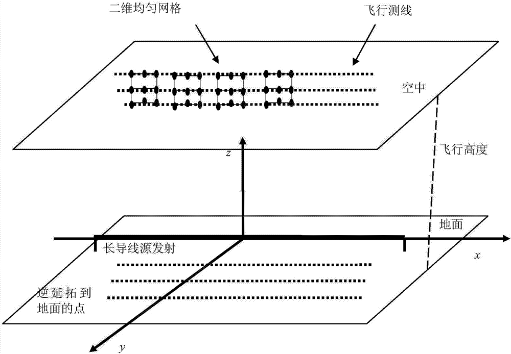
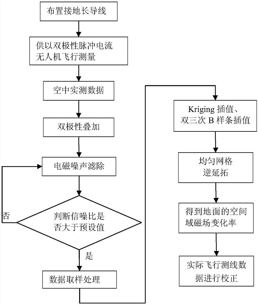
[0067] see figure 2 to combine figure 1 As shown, a height correction method for earth-space-time-domain electromagnetic data based on inverse continuation theory, including:
[0068] a. Reasonably arrange the position of the long ground wire, and design at least three flight routes parallel to the long wire in the detection area;
[0069] Such as figure 1 In the step 1 shown, the length of the ground wire source is 1-3 kilometers, and the air flight measurement line needs to be parallel to the ground wire source. -1 times range. Because the magnetic field change rate of each measuring point on the flying survey line needs to be interpolated into the magnetic field change rate of uniform grid points, if the flying survey line spacing is uniform, inter-line interpolation is not required, and the calibration accuracy is higher.
[0070] b. Use a long ground wire as the emission source to supply bipolar pulse current, conduct flight measurement through the receiving system c...
PUM
 Abstract
Description
Claims
Application Information
 - R&D
- Intellectual Property
- Life Sciences
- Materials
- Tech Scout
- Unparalleled Data Quality
- Higher Quality Content
- 60% Fewer Hallucinations
Browse by: Latest US Patents, China's latest patents, Technical Efficacy Thesaurus, Application Domain, Technology Topic, Popular Technical Reports.
© 2025 PatSnap. All rights reserved.Legal|Privacy policy|Modern Slavery Act Transparency Statement|Sitemap|About US| Contact US: help@patsnap.com


