Soil thickness inversion method based on remote sensing data

A technology of remote sensing data and soil, applied in the field of geographic surveying and mapping, can solve the problems of small human error, complex establishment, human error, etc., and achieve the effect of small human error, easy establishment, and high accuracy

Active Publication Date: 2016-04-27
中科卫星应用德清研究院 +1
View PDF4 Cites 6 Cited by
  • Summary
  • Abstract
  • Description
  • Claims
  • Application Information

AI Technical Summary

Problems solved by technology

[0009] The purpose of the present invention is to provide a soil thickness inversion method based on remote sensing data, which can meet the needs of large-scale regional research, has small human errors, high accuracy, is easy to establish, and saves time and effort, thereby overcoming the conventional measurement method. Restricted by terrain and area, it is easy to introduce human error, or establish complex, time-consuming and labor-intensive problems

Method used


Image

  • Soil thickness inversion method based on remote sensing data
  • Soil thickness inversion method based on remote sensing data
  • Soil thickness inversion method based on remote sensing data

Examples


Embodiment Construction

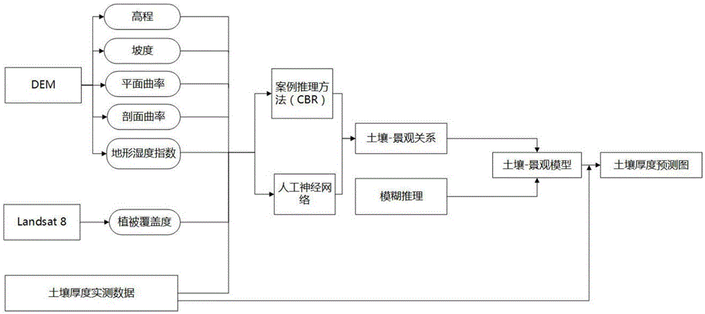
[0031] The invention provides a soil thickness inversion method based on remote sensing data, which mainly includes the following steps:

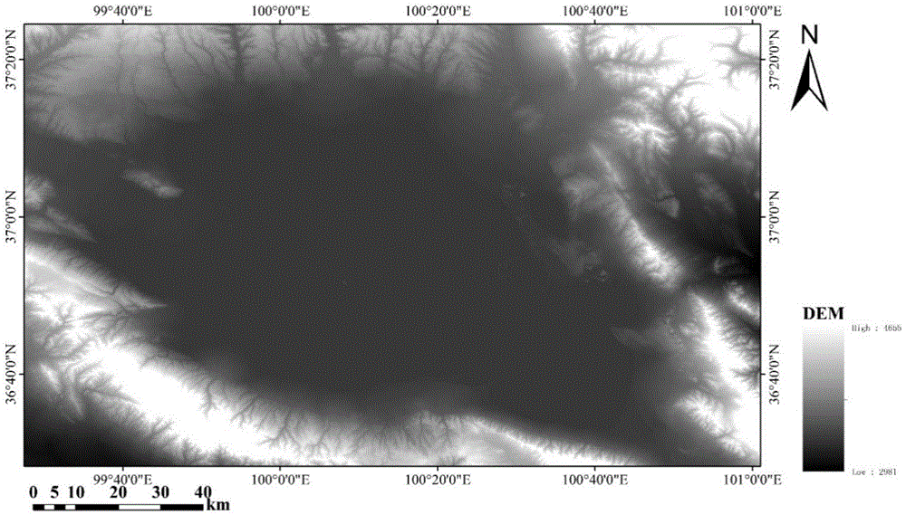
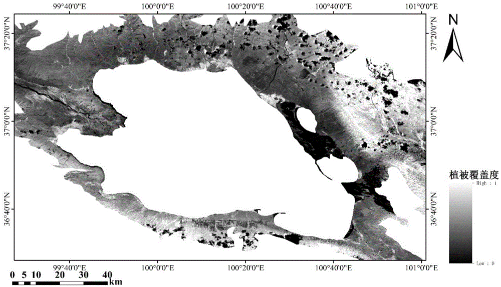
[0032] A. Select the environmental elements related to soil thickness, obtain the environmental element data of various points in the research area, and construct the environmental element database. The environmental elements include at least topographic factor indicators; The radar measures the soil thickness in the measured area, and obtains a large number of soil thickness sample points; C. extracts the environmental element data corresponding to the soil thickness sample points in the measured area from the environmental element database, and according to the soil thickness in the measured area Data and environmental element data, use the artificial neural network to establish the relationship between soil thickness and environmental elements, determine the correlation between each environmental element and soil thickness, and determine ...


PUM


Abstract

The invention discloses a soil thickness inversion method based on remote sensing data. The soil thickness inversion method comprises the following steps: A, selecting environment elements, acquiring environment element data of a research area and establishing an environment element database; B, selecting an actual measurement area from the research area, and carrying out soil thickness measurement on the real measurement area by using a ground penetrating radar; C, establishing a relationship between the soil thickness data and the environment element data by using an artificial neural network; D, establishing a soil-landscape relationship by using a case-based reasoning method; E, establishing a soil-landscape mode by using a fuzzy reasoning method; F, drawing a fuzzy membership degree prediction map of the soil thickness according to the soil-landscape model; G, acquiring a large-range soil thickness prediction map of the research area according to the fuzzy membership of the soil thickness. The soil thickness inversion method disclosed by the invention is little in personal error, high in accuracy, easy to establish and time-saving and labor-saving, and can meet the research requirements of a large-range area.

Description

technical field [0001] The invention relates to the technical field of geographic surveying and mapping, in particular to a soil thickness inversion method based on remote sensing data. Background technique [0002] As an important indicator of soil physical and chemical properties, soil thickness is affected by bedrock characteristics, surface vegetation cover, topography and other factors. This indicator is difficult to directly observe, but it is often called a constant, so its spatial variability is ignored. [0003] The traditional thickness data acquisition methods, including soil profile method, drilling method, etc., are sample-point acquisition methods with high measurement accuracy, but the sampling points are sparse, and can only be used in flat terrain and small-scale areas. It is far from meeting the requirements of large-scale regional research. If the traditional method is used to measure soil thickness in a large area, it will consume a lot of financial and ...

Claims


Application Information

Patent Timeline
Patent Type & Authority Applications(China)
IPC IPC(8): G06F19/00
CPCG16Z99/00
Inventor 张婷婷柴勋邵芸宫华泽
Owner 中科卫星应用德清研究院
Why Eureka
Try Eureka