A Soil Thickness Inversion Method Based on Remote Sensing Data
A technology of remote sensing data and soil, applied in the field of geographic surveying and mapping, can solve the problems of small human error, time-consuming and labor-consuming, human error, etc., and achieve the effect of small human error, high accuracy and easy establishment
- Summary
- Abstract
- Description
- Claims
- Application Information
AI Technical Summary
Problems solved by technology
Method used
Image
Examples
Embodiment Construction
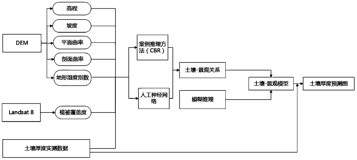
[0031] The invention provides a soil thickness inversion method based on remote sensing data, which mainly includes the following steps:
[0032] A. Select environmental elements related to soil thickness, obtain environmental element data at various points in the research area, and build an environmental element database. The environmental elements include at least topographic factor indicators; The radar measures the soil thickness in the measured area, and obtains a large number of soil thickness sample points; C. extracts the environmental element data corresponding to the soil thickness sample points in the measured area from the environmental element database, and according to the soil thickness in the measured area Data and environmental element data, use the artificial neural network to establish the relationship between soil thickness and environmental elements, determine the correlation between each environmental element and soil thickness, and determine the weight of...
PUM
 Abstract
Description
Claims
Application Information
 - R&D
- Intellectual Property
- Life Sciences
- Materials
- Tech Scout
- Unparalleled Data Quality
- Higher Quality Content
- 60% Fewer Hallucinations
Browse by: Latest US Patents, China's latest patents, Technical Efficacy Thesaurus, Application Domain, Technology Topic, Popular Technical Reports.
© 2025 PatSnap. All rights reserved.Legal|Privacy policy|Modern Slavery Act Transparency Statement|Sitemap|About US| Contact US: help@patsnap.com


