Stable imaging method applicable to two-dimensional wide-area scanning
An imaging method and wide-area technology, applied to navigation through velocity/acceleration measurement, navigation calculation tools, etc., can solve problems such as compensation accuracy limitation and image quality degradation
- Summary
- Abstract
- Description
- Claims
- Application Information
AI Technical Summary
Problems solved by technology
Method used
Image
Examples
Embodiment Construction
[0028] The present invention will be further described in detail below in conjunction with the accompanying drawings and preferred embodiments.
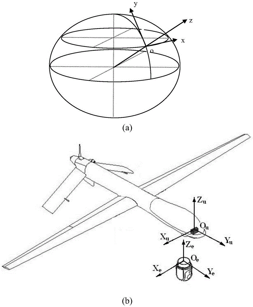
[0029] The stable imaging method suitable for two-dimensional wide-area scanning in this embodiment, its core is the cooperation of geographical stabilization and electronic image motion compensation, the forward movement of the photoelectric system is compensated by geographical stabilization, and the movement in azimuth is geographical stabilization Combined with electronic image motion compensation, the photoelectric system finally realizes clear imaging in the process of wide-area two-dimensional scanning. The specific method includes the following steps:
[0030] Step 1: Collect current aircraft data in real time: α, β, γ, h, θ AZ ,θ EL ; where α is the heading angle of the aircraft output by the inertial navigation system, β is the pitch angle of the aircraft output by the inertial navigation system, γ is the roll angle of th...
PUM
 Abstract
Description
Claims
Application Information
 - R&D
- Intellectual Property
- Life Sciences
- Materials
- Tech Scout
- Unparalleled Data Quality
- Higher Quality Content
- 60% Fewer Hallucinations
Browse by: Latest US Patents, China's latest patents, Technical Efficacy Thesaurus, Application Domain, Technology Topic, Popular Technical Reports.
© 2025 PatSnap. All rights reserved.Legal|Privacy policy|Modern Slavery Act Transparency Statement|Sitemap|About US| Contact US: help@patsnap.com


