

A Navigation Positioning Method Based on Coordinate System Transformation
A technology of navigation positioning and coordinate system, which is applied in the field of navigation positioning based on the transformation from the spatial rectangular coordinate system to the earth coordinate system, can solve the problems such as difficulty in increasing the working frequency of the GPS board, large amount of calculation, and restriction of the calculation speed, etc., to achieve improved The effect of solving reliability, reducing hardware requirements, and shortening solving time
Active Publication Date: 2014-08-27
BEIJING INST OF AEROSPACE CONTROL DEVICES
View PDF0 Cites 11 Cited by
- Summary
- Abstract
- Description
- Claims
- Application Information
AI Technical Summary
Problems solved by technology
[0021] It can be seen from the above formula that the amount of calculation is also very large, and the calculation is complicated. While ignoring high-order terms, unnecessary errors are caused. From the above existing methods, it can be seen that the calculation amount of the method is large , The method is complicated, not fast, imprecise and other shortcomings, and it is not fully satisfied in the fast and real-time calculation, which makes it difficult to increase the working frequency of the GPS board such as 20Hz, which restricts the calculation speed
Method used
View moreImage
Smart ImageViewing Examples

Examples
Embodiment 1
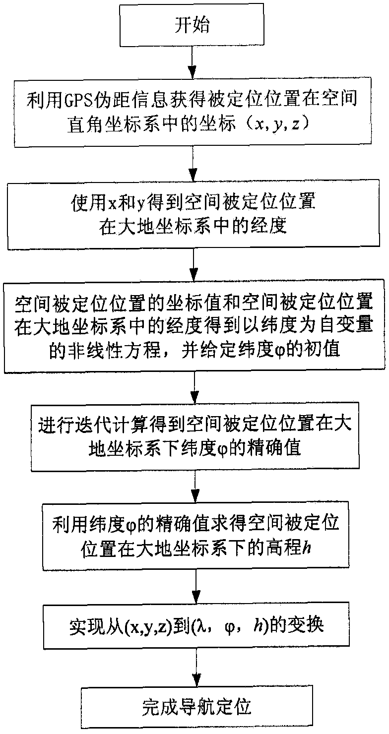
[0108] Embodiment 1: In order to verify the practicability and correctness of the inventive method, use the GPS board to collect the local geographic location data, and solve the coordinate system between spaces, where x=-2.176976641913008e+006, y=4.404777514661684e+006 , z=4.108039320533327e+006, using the WGS-84 earth coordinate system, the semi-major axis of the earth is 6378137m, the semi-minor axis is 6356752m, the latitude obtained by the above method is 39.899709785°, and the relative error with the 39.9° of this place is one million It can be seen that the accuracy is very high.
Login to View More PUM
 Abstract
The invention discloses a navigation and positioning method based on coordinate system transformation. The method adopts a direct solution method, mainly through calculating the initial value of latitude and iterative calculation, and it can be very fast and accurate only through more than two iterations. The coordinates of the positioned position are transformed from the spatial rectangular coordinate system to the earth coordinate system, which reduces the calculation amount of the solution, shortens the solution time, improves the work efficiency, and reduces the hardware requirements while improving the reliability of the solution. The cost of the receiver is reduced, and a reference navigation and positioning method for transforming from the space Cartesian coordinate system to the earth coordinate system is provided for the GPS or Beidou satellite navigation system, and the inertial navigation system.
Description
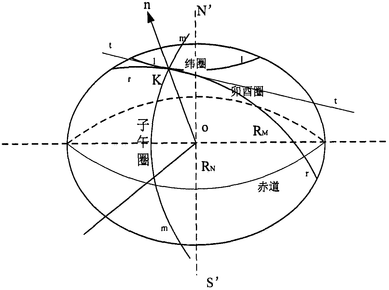
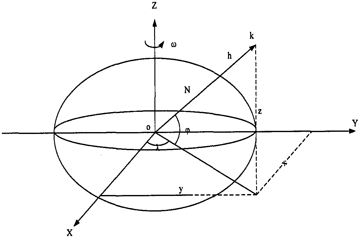
technical field [0001] The invention relates to a navigation and positioning method based on coordinate system transformation, in particular to a navigation and positioning method based on transformation from a space rectangular coordinate system to a geodetic coordinate system, which can be used for various satellite navigation and inertial navigation positioning. Background technique [0002] In the problem of navigation and positioning, positioning is to determine the position of the user on the earth and its external space, so many discussions cannot be separated from the earth. Whether it is GPS, or inertial navigation, the establishment and solution of positioning model equations, etc., all directly or indirectly use the geometric shape of the earth and its gravity field parameters. On the other hand, in the navigation and positioning of near-Earth aircraft, the positioning instrument is always affected by the earth's gravity field. Especially during the INS positioni...
Claims
Login to View More Application Information
Patent Timeline
 Patent Type & AuthorityPatents(China)
IPC IPC(8): G01S19/42
Inventor魏宗康段宇鹏夏刚刘建波踪华张晓玲刘生炳
OwnerBEIJING INST OF AEROSPACE CONTROL DEVICES