An automatic coastline extraction and classification method based on satellite images
A classification method and automatic extraction technology, applied in the field of marine surveying and remote sensing, can solve the problems of low efficiency, high manpower and material resources, long working cycle, etc., and achieve the effect of rich image color and automatic fast extraction
- Summary
- Abstract
- Description
- Claims
- Application Information
AI Technical Summary
Problems solved by technology
Method used
Image
Examples
Embodiment Construction
[0048] Embodiments of the present invention are described in further detail below in conjunction with the accompanying drawings:
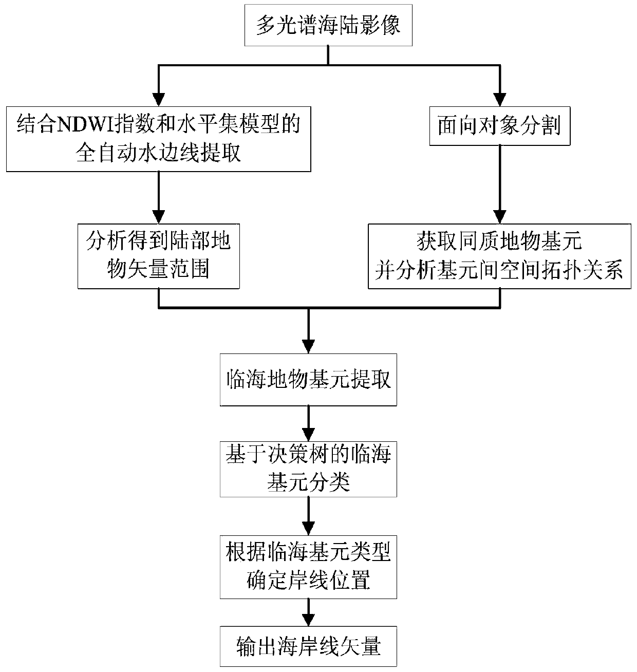
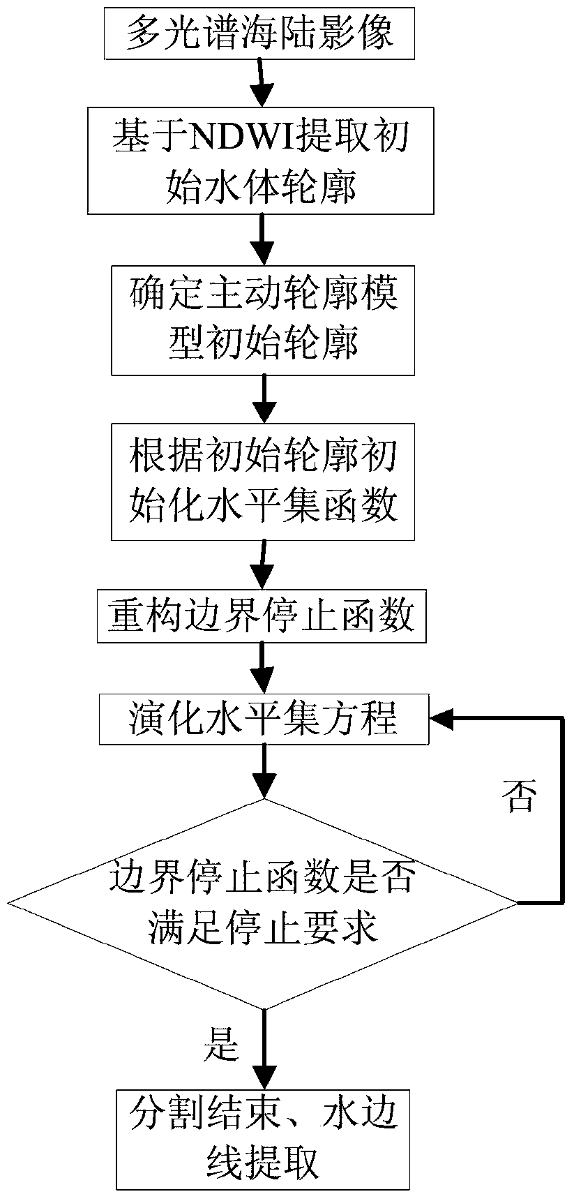
[0049] An automatic coastline extraction and classification method based on satellite images, such as figure 1 and figure 2 shown, including the following steps:
[0050] Step 1. After precise registration with the coastal zone area, such as image 3 The multispectral image shown is used as the data source, combined with the NDWI normalized water index and the level set model to obtain the precise outline of the water edge.
[0051] The waterside line refers to the instantaneous intersection line between the undulating sea surface and the land at a certain moment. Its extraction is of great significance for the subsequent study of coastline acquisition, intertidal zone classification and water depth inversion. The essence of waterside line extraction is the sea and land image. segmentation.
[0052] The concrete steps of described step 1 are: ...
PUM
 Abstract
Description
Claims
Application Information
 - R&D
- Intellectual Property
- Life Sciences
- Materials
- Tech Scout
- Unparalleled Data Quality
- Higher Quality Content
- 60% Fewer Hallucinations
Browse by: Latest US Patents, China's latest patents, Technical Efficacy Thesaurus, Application Domain, Technology Topic, Popular Technical Reports.
© 2025 PatSnap. All rights reserved.Legal|Privacy policy|Modern Slavery Act Transparency Statement|Sitemap|About US| Contact US: help@patsnap.com


