Raster map building method based on local map splicing

A raster map and partial technology, applied in the field of map creation, can solve problems such as inaccurateness, reduced operating efficiency, difficulty in applying large-scale environmental map construction, etc., and achieve the effect of reducing cumulative errors

Active Publication Date: 2016-07-27
HANGZHOU SHENHAO TECH
View PDF4 Cites 42 Cited by
  • Summary
  • Abstract
  • Description
  • Claims
  • Application Information

AI Technical Summary

Problems solved by technology

[0003] The existing raster representation requires sensors such as encoders and IMUs when used, and the method of using internal sensor information to accumulate estimated mileage information and then construct a map is not accurate enough because internal sensor errors will continue t...

Method used


Image

  • Raster map building method based on local map splicing
  • Raster map building method based on local map splicing
  • Raster map building method based on local map splicing

Examples


Embodiment Construction

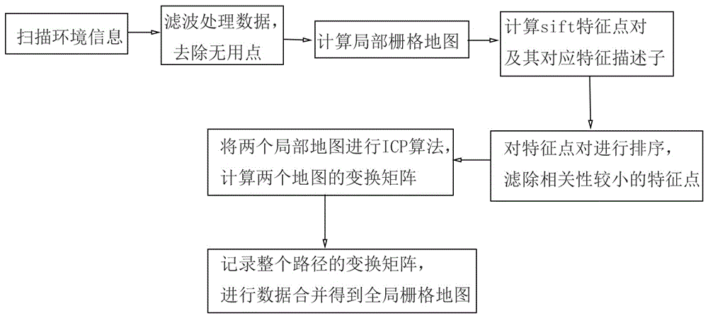
[0019] See attached picture. The grid map creation method described in this embodiment is used on a robot with at least a motion control system, an inertial navigation system, and a laser scanning sensor; it includes the following steps:

[0020] 1) The robot scans and records environmental information through its own laser ranging sensor;

[0021] 2) Filter the messy and irregular scanning data points obtained in step 1) to remove useless points;

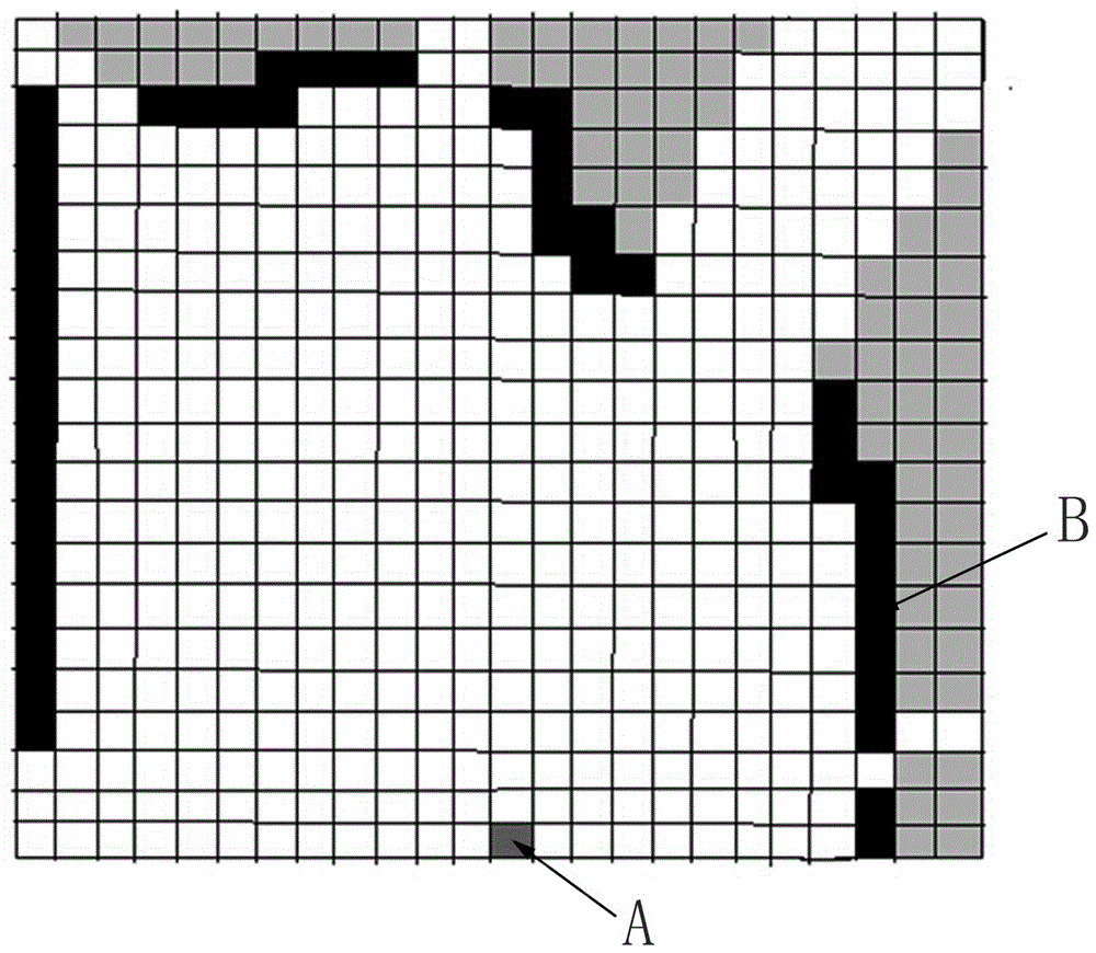
[0022] 3) Calculate the local grid map through the ray tracing method of the filtered data;

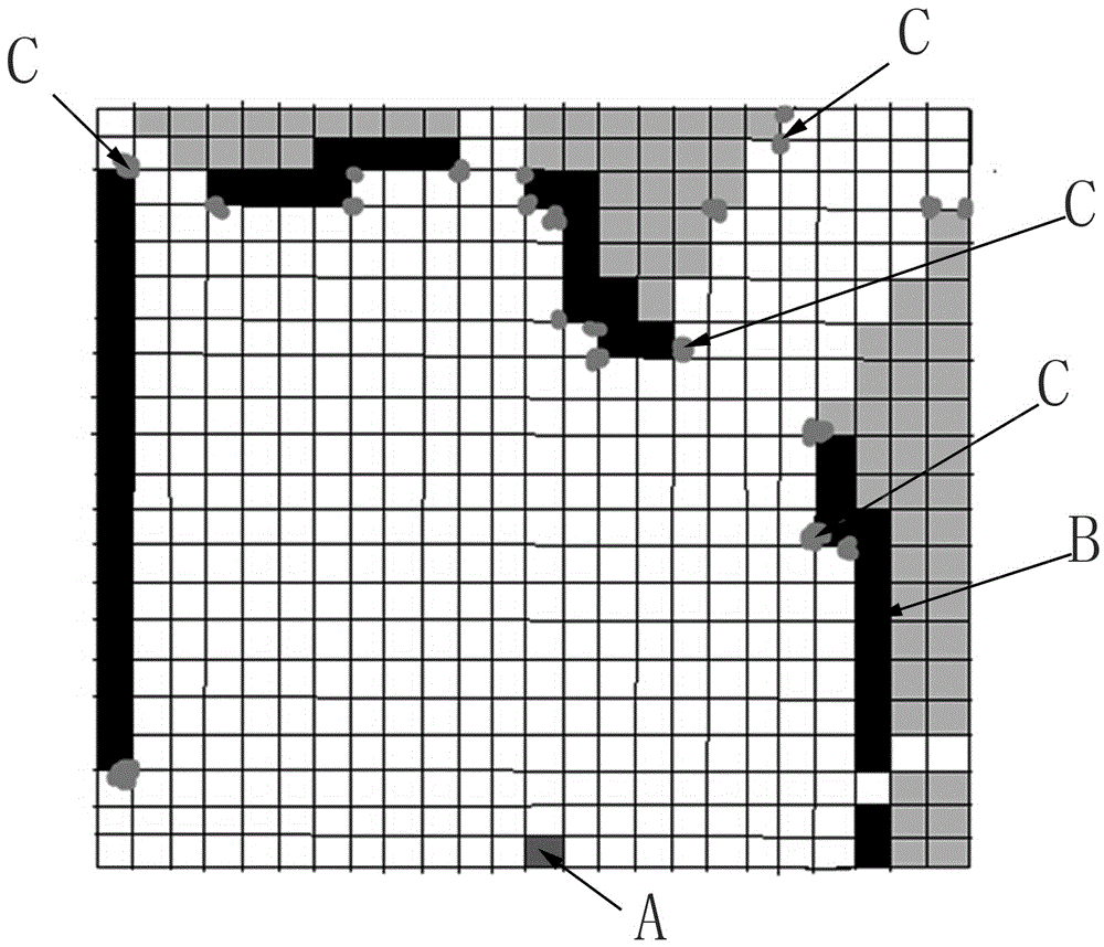
[0023] 4) Calculate the sift feature point pairs and their corresponding feature descriptors of the local grid map under two adjacent poses;

[0024] 5) Sort the feature point pairs according to the correlation of feature descriptors, and filter out the feature points with less correlation of feature descriptors;

[0025] 6) Perform the nearest point iterative algorithm ICP on the local maps in two adjacent poses, and calculate the tran...


PUM


Abstract

The invention discloses a raster map building method based on local map splicing.The method comprises the following steps that 1, a robot scans and records environment information; 2, scanning data points are filtered to remove useless points; 3, local raster maps are calculated based on the filtered data through a ray tracking method; 4, sift feature points and corresponding feature descriptors of the local raster maps under two adjacent poses are calculated; 5, according to relevancy of the feature descriptors, the feature points are ranked, and feature points with small feather feature descriptors are filtered away; 6, the two local maps are subjected to iterative closest point algorithm ICP, and a transformation matrix of the two local maps is calculated; 7, the steps 1-6 are repeated, a transformation matrix of the whole path is recorded and completed, and finally data is merged to obtain a global raster map.The map is built through one-time laser data, so that the estimation error of the map is mainly the observation error of a laser sensor, and no estimation error exits.

Description

technical field [0001] The invention belongs to the technical field of map creation, and in particular relates to a grid map creation method based on partial map splicing. Background technique [0002] There are four representation methods of maps in robotics: feature maps, topological maps, grid maps, and direct representation methods (AppearanceBasedMethods). Feature maps represent the environment with related geometric features (such as points, lines, surfaces). The topological map represents the indoor environment as a topological structure diagram with nodes and related connecting lines, where the nodes represent important points in the environment (corners, doors, elevators, stairs, etc.), and the edges represent the connection relationship between nodes, such as hallway etc. A grid map divides the environment into a series of grids, where each grid is given a possible value, indicating the probability that the grid is occupied. The direct representation method omit...

Claims


Application Information

Patent Timeline
IPC IPC(8): G01C21/20G06T3/40
CPCG01C21/20G06T3/4038
Inventor 王海瑞陈如申黎勇跃
Owner HANGZHOU SHENHAO TECH
Why Eureka
Try Eureka