

Method for positioning forest fire at night via unmanned aerial vehicle
A positioning method and a technology for preventing forest fires, which can be used in the interpretation of photos and other directions, which can solve the problems of real-time data and poor resolution.
Inactive Publication Date: 2016-08-17
BEIJING FORESTRY UNIVERSITY
View PDF5 Cites 5 Cited by
- Summary
- Abstract
- Description
- Claims
- Application Information
AI Technical Summary
Problems solved by technology
The advantage of using satellites to monitor forest fires is that it covers a large area, and data covering the whole country can be obtained once in 1 to 2 hours. However, due to the influence of its own orbital cycle and weather, the real-time and resolution of the data are not good.
Method used
View moreImage
Smart ImageViewing Examples

Examples
Embodiment Construction
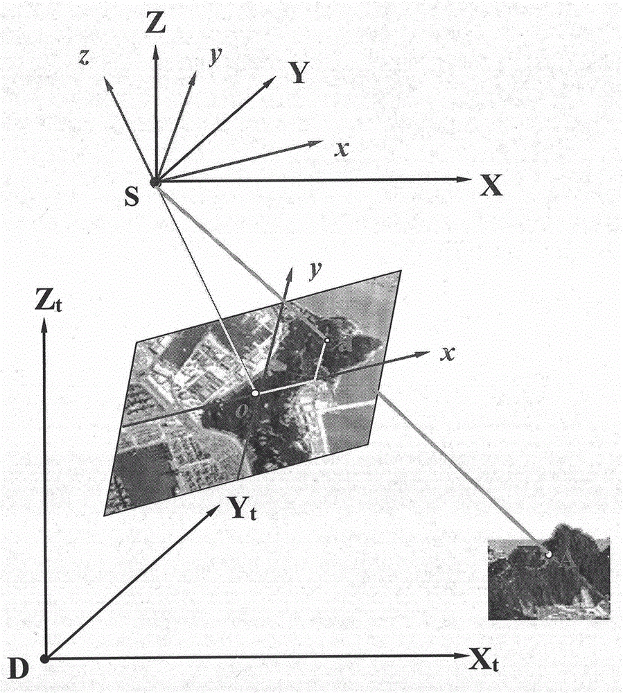
[0009] 1. Use the airborne POS system to record the 6 outer orientation elements of the image taken by the camera at a certain moment: X s , Y s ,Z s , ψ, ω, κ;
[0010] 2. Determine that the inner orientation element of the image taken by the airborne digital camera is x 0 、y 0 , f;
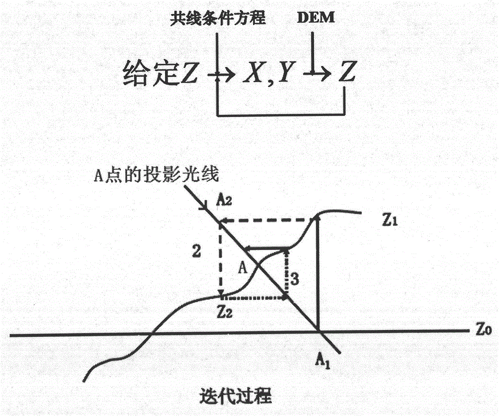
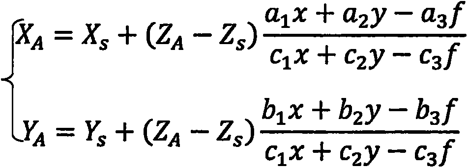
[0011] 3. The direction of the fire point is obtained by solving the collinear conditional equation;
[0012] 4. Use DEM data to iteratively solve to obtain the spatial coordinates of the fire point.
Login to View More PUM
 Abstract
The invention provides a method for positioning a forest fire at night via an unmanned aerial vehicle. An unmanned aerial vehicle with a POS system and a digital camera is used for positioning a forest fire at night. The onboard POS system can directly record six exterior orientation elements of an image shot by the camera at a certain moment; the interior orientation elements of the image shot by the camera are x0, y0 and f; it is supposed that any object space point A is a fire point, the object space coordinates of A is XA, YA and ZA, the image plane coordinates of a corresponding image point a of A is x and y, and an equation set for resolving the space coordinates of A is obtained through the collinearity equations; since only the direction of the fire point A can be obtained according to the position of a when the orientation of the aviation image in space is determined, the spatial position of the fire point A can be determined as long as the elevation of the point is obtained; and the projection light (XA and YA) of the fire point A can be determined in virtue of the equation set, and the spatial position of the fire point A can be obtained as the elevation information (ZA) of DEM data is used and an iterative solving method is employed.
Description
1. Technical field [0001] This technology uses the principle of photogrammetry to understand the coordinates of object points. 2. Technical Background [0002] At present, there are various forest fire monitoring and positioning methods at home and abroad, which can be divided into ground monitoring and aerial monitoring according to their deployment methods. In the field of aerial monitoring, the combination of meteorological satellites, polar satellites and remote sensing satellites is often used to monitor and locate large-scale forest fires. The advantage of using satellites to monitor forest fires is that it covers a large area, and data covering the whole country can be obtained in one to two hours. However, due to the influence of its own orbital period and weather, the real-time and resolution of the data are not good. The use of drones equipped with detection equipment to inspect and locate in inaccessible forest areas is also an important means of aerial monitorin...
Claims
Login to View More Application Information
Patent Timeline
 Patent Type & AuthorityApplications(China)
IPC IPC(8): G01C11/04
CPCG01C11/04
Inventor冯仲科于东海
OwnerBEIJING FORESTRY UNIVERSITY