

Seven-parameter conversion method between national three-dimensional coordinate system and random local plane coordinate system
A plane coordinate system and conversion method technology, applied in the field of geographic information, can solve the problems of obtaining conversion parameters, unable to obtain local coordinate system coordinates in real time, and is not conducive to the promotion and application of provincial CORS, so as to reduce projection deformation and expand applications Space, the effect of improving precision
- Summary
- Abstract
- Description
- Claims
- Application Information
AI Technical Summary
Problems solved by technology
Method used
Image

Examples
Embodiment Construction
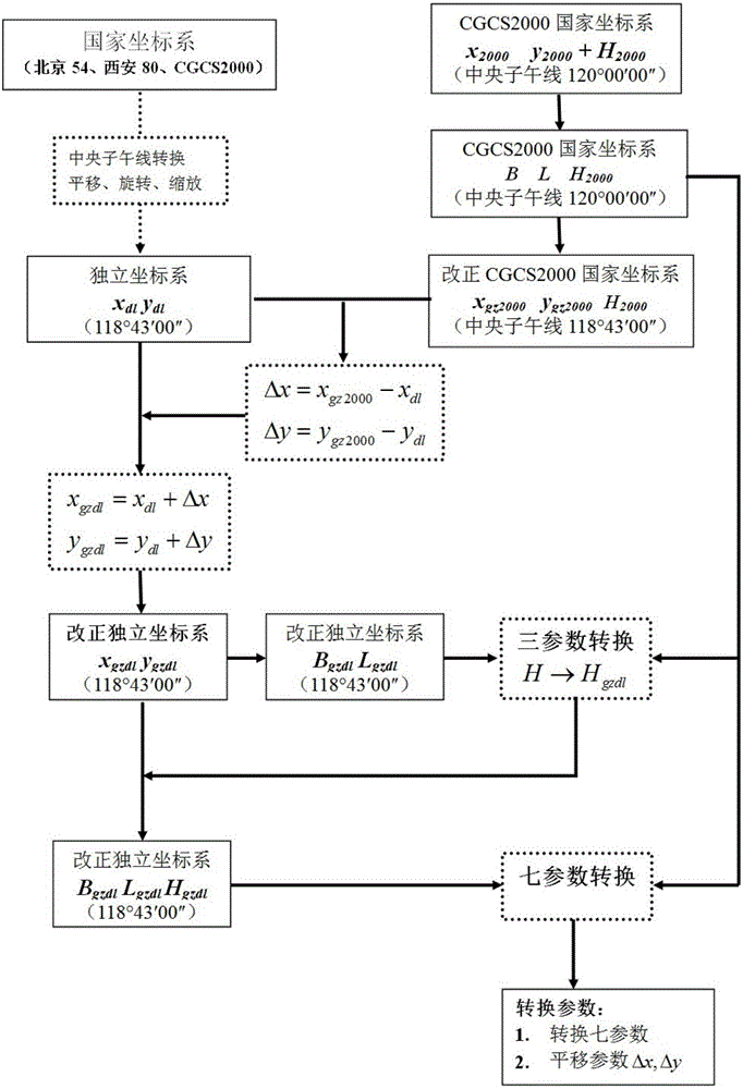
[0023] In order to facilitate those of ordinary skill in the art to understand and implement the present invention, the present invention will be described in further detail below in conjunction with the accompanying drawings and embodiments. It should be understood that the implementation examples described here are only used to illustrate and explain the present invention, and are not intended to limit this invention.
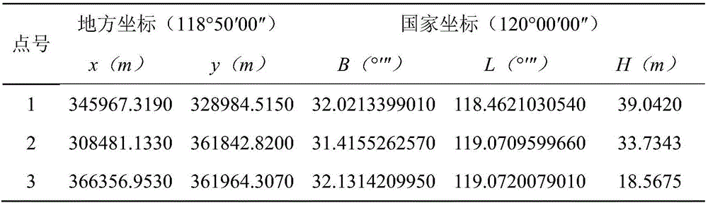
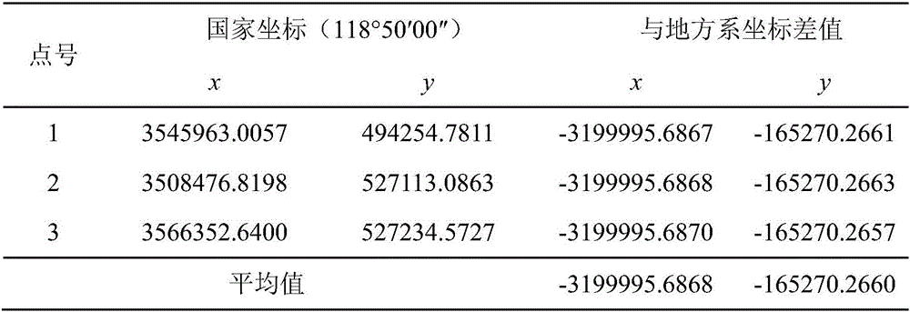
[0024] Aiming at the deficiency of the existing data processing method, the present invention proposes a new seven-parameter transformation calculation method between the high-precision national three-dimensional coordinate system and any local plane coordinate system. First, by unifying the central meridian of the national coordinate system and the local coordinate system, the influence of projection deformation on the calculation of the conversion parameters is greatly weakened. In addition, the three-parameter conversion model is used to weaken the defect t...
PUM
 Abstract
Description
Claims
Application Information