
Mass coverage drawing method based on map api

An overlay and map technology, applied in program control devices, network data browsing optimization, other database retrieval, etc., can solve the problems of slow drawing speed and slow loading of overlays, achieve good flexibility and practicability, and improve drawing The speed, the effect of improving the loading speed

Active Publication Date: 2019-09-13
HEFEI DAMING ENERGY SAVING TECH
View PDF4 Cites 0 Cited by
  • Summary
  • Abstract
  • Description
  • Claims
  • Application Information

AI Technical Summary

Problems solved by technology

[0004] The purpose of the present invention is to provide a method for drawing a large number of overlays based on a map API, so as to solve the problems of slow drawing speed of existing overlays and slow loading of overlays through a browser

Method used


Image

  • Mass coverage drawing method based on map api
  • Mass coverage drawing method based on map api
  • Mass coverage drawing method based on map api

Examples


Embodiment Construction

[0012] Combine below Figure 1 to Figure 3 , the present invention is described in further detail.

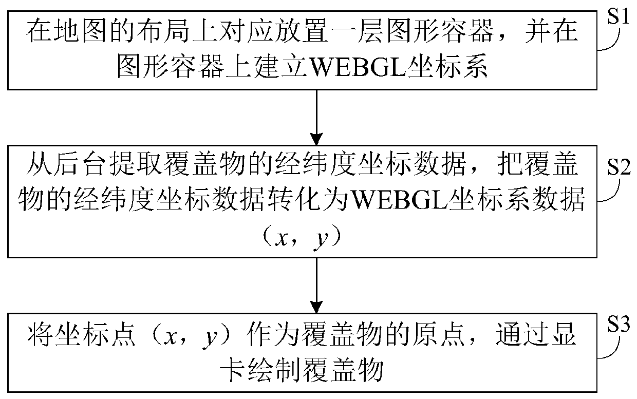
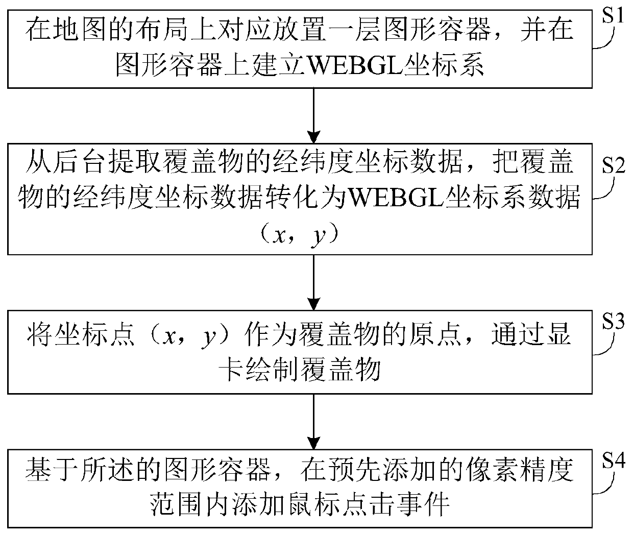
[0013] Such as figure 1 As shown, this embodiment provides a method for drawing a large number of coverings based on a map API, including the following steps S1 to S3:

[0014] S1. Correspondingly placing a layer of graphic containers on the layout of the map, and establishing a WEBGL coordinate system on the graphic container, the origin of the WEBGL coordinate system corresponds to the preset latitude and longitude coordinate points in the map;

[0015] Specifically, the origin of the WEBGL coordinate system here corresponds to the preset latitude and longitude coordinate points in the map: define the direction from north to south as the positive direction of the Y axis of the WEBGL coordinate system, and define the direction from west to east as the WEBGL coordinate system In the positive direction of the X-axis, the origin of the WEBGL coordinate system corresponds to the...


PUM


Abstract

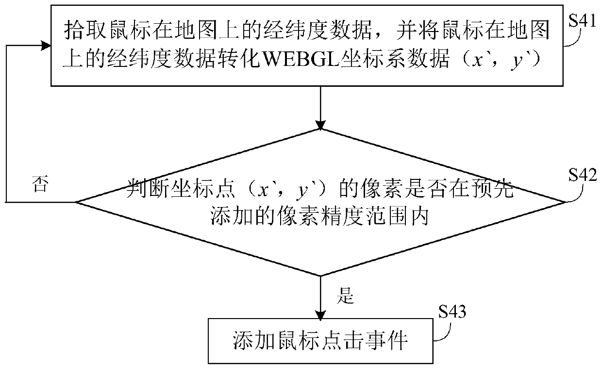
The invention discloses a massive cover drawing method based on a map application program interface (API), and belongs to the technical field of map API function application. The method comprises the following steps: correspondingly placing a layer of graphic containers on the layout of a map, and establishing WEBGL coordinates on the graphic containers, wherein the origins of the WEBGL coordinates are corresponding to longitude and latitude coordinate points preset in the map; extracting longitude and latitude coordinate data of covers from a background, and transforming the longitude and latitude coordinate data of the covers into data of the WEBGL coordinates, thereby obtaining transformed coordinate points (x, y) of the covers; taking the coordinate points (x, y) as the origins of the covers, and drawing the covers through a display card. WEBGL drawing is realized through the display card rather than through a browser to find loading graphics to greatly improve the drawing speed and the loading speed of the covers so as to avoid the phenomenon of decelerated map loading speed, even leading to collapse of the browser when the covers are excessive.

Description

technical field [0001] The present invention relates to the technical field of map API function application, in particular to a method for drawing massive overlays based on map API. Background technique [0002] With the development of the Internet of Things technology, the scope of map applications is constantly increasing, and map application programming interfaces (Application Programming Interface, API) are used in more and more fields, and map overlays are an indispensable part of map API applications. In the actual application process, it is often necessary to add a large number of overlays to the map. [0003] At present, there are still obvious defects in the application process of the map API: the current overlay adding method of the map API is that the browser accesses the graphics in the memory, and loads the graphics into the browser. Therefore, the loading speed of overlays is relatively slow, and when the number of map overlays is too large, the loading proces...

Claims


Application Information

Patent Timeline
Patent Type & Authority Patents(China)
IPC IPC(8): G06F16/957G06F9/455
Inventor 权循华杜庆朋李诚黎仁安陈利文陈辉苏辉
Owner HEFEI DAMING ENERGY SAVING TECH
Learn More