
Method for global optimization and distribution of agile satellite imaging tasks

A global optimization and allocation method technology, applied in satellite radio beacon positioning systems, measuring devices, instruments, etc., can solve the problems of orbit observation cycle allocation, large energy consumption, and time-consuming problems, and achieve imaging task planning Reasonable, optimize the observation results, and ensure the effect of imaging quality

Active Publication Date: 2017-01-25
BEIJING INST OF SPACECRAFT SYST ENG
View PDF8 Cites 6 Cited by
  • Summary
  • Abstract
  • Description
  • Claims
  • Application Information

AI Technical Summary

Problems solved by technology

[0004] At present, more researches on mission planning focus on the scheduling of single-satellite or multi-satellite integrated imaging missions. Most of the optimization indicators are the optimization of a single target, which cannot realize the allocation of orbit observation circles for multiple missions, and can only be done randomly or manually. The orbital circle and observation period of a certain target are selected through multiple tests, which makes it impossible to plan the imaging task reasonably, resulting in suboptimal observation results, unguaranteed imaging quality, high energy consumption, and manual selection through multiple tests. lead to more time consuming

Method used


Image

  • Method for global optimization and distribution of agile satellite imaging tasks
  • Method for global optimization and distribution of agile satellite imaging tasks
  • Method for global optimization and distribution of agile satellite imaging tasks

Examples


Embodiment

[0078] The orbit simulation parameters of an agile satellite are shown in Table 1:

[0079] Table 1 Orbit simulation parameters

[0080]

[0081]

[0082] The imaging target position and range are as Figure 4 , where T represents point targets, LA represents off-track targets, LP represents along-track targets, A represents area targets, and LS represents irregular long strip targets.

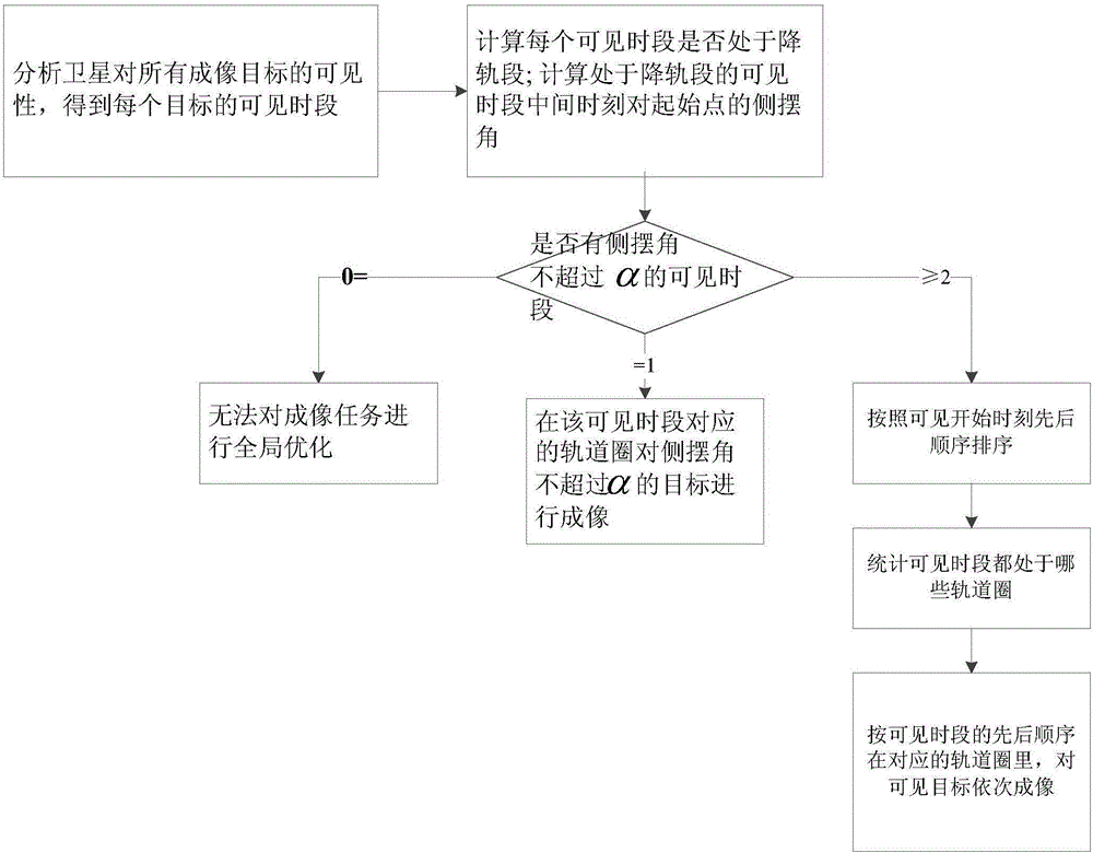
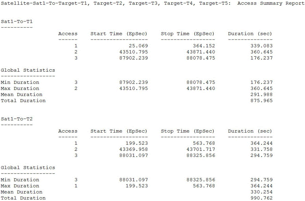
[0083] Utilize the method of the present invention to optimize the global distribution of satellite imaging tasks. According to constraints such as satellite energy, imaging efficiency, and imaging quality, select a visible time period with a roll angle of no more than 60 degrees, a total of 21, in the order of the start time of the visible time period Sort the visible periods that meet the conditions, and count the orbital circles where these visible periods are located. The global allocation results are shown in Table 2.

[0084] Table 2 Global optimal allocation results of an agile ...


PUM


Abstract

The invention discloses a method for global optimization and distribution of agile satellite imaging tasks and belongs to the field of agile satellite imaging task planning. The method includes analyzing visibility of a satellite for all imaging targets, selecting visible time periods in an inbound pass segment and in which a lateral swing angle that the satellite points to each target start point at an intermediate moment does not exceed a specific range, and sequentially the imaging visible targets in corresponding orbit laps according to the sequence of the visible time periods. The method takes multiple factors such as satellite energies, imaging efficiency and imaging quality from the perspective of satellite application and puts forward the optimization principle that the target imaging time periods are in the inbound pass segment and the lateral swing angle at the intermediate moment of each visible time period is smaller than the specific range, and multiple imaging tasks are distributed to the proper orbit laps to enable the imaging task planning to be more reasonable and meet the satellite application requirements, so that observation results are optimized, imaging quality is guaranteed and energy consumption is reduced.

Description

technical field [0001] The invention relates to an agile satellite imaging task global optimal allocation method, belonging to the field of agile satellite imaging task planning. Background technique [0002] At present, satellites in orbit have limited maneuverability, and there are only two imaging modes: traditional side-sway imaging and ground imaging. The observation period for a target is relatively simple, so it does not involve the global allocation of multiple targets according to orbital circles. [0003] With the development of aerospace technology, the maneuverability of satellites has been greatly enhanced, and they can maneuver along three axes, and can observe ground targets in any direction within the range allowed by their capabilities. Because it can be rotated in the pitch direction, when the satellite is in front, above, or behind the target, it can observe the target, and the available observation time is longer, and any period of time can be freely sele...

Claims


Application Information

Patent Timeline
IPC IPC(8): G01S19/00
CPCG01S19/00
Inventor 姜洋蒋方华高阳于龙江喜进军杨文涛张国斌王跃李少辉程侃贺玮余婧汪精华范立佳张强
Owner BEIJING INST OF SPACECRAFT SYST ENG
Learn More