Lane detection method based on smartphone sensor
A lane detection and smart phone technology, applied in instruments, measuring devices, surveying and navigation, etc., can solve the problems of low popularity, high impact and high cost of vehicle owners, and achieve the occupation of mobile phone resources and good power consumption, The effect of reducing quantity and low cost
- Summary
- Abstract
- Description
- Claims
- Application Information
AI Technical Summary
Problems solved by technology
Method used
Image

Examples
Embodiment Construction
[0035] The present invention is described in further detail in conjunction with accompanying drawing now. Before this, the symbols used in the present invention and their meanings are described as follows:
[0036]
[0037]
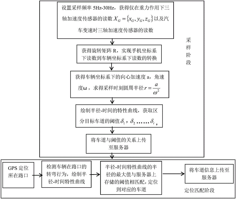
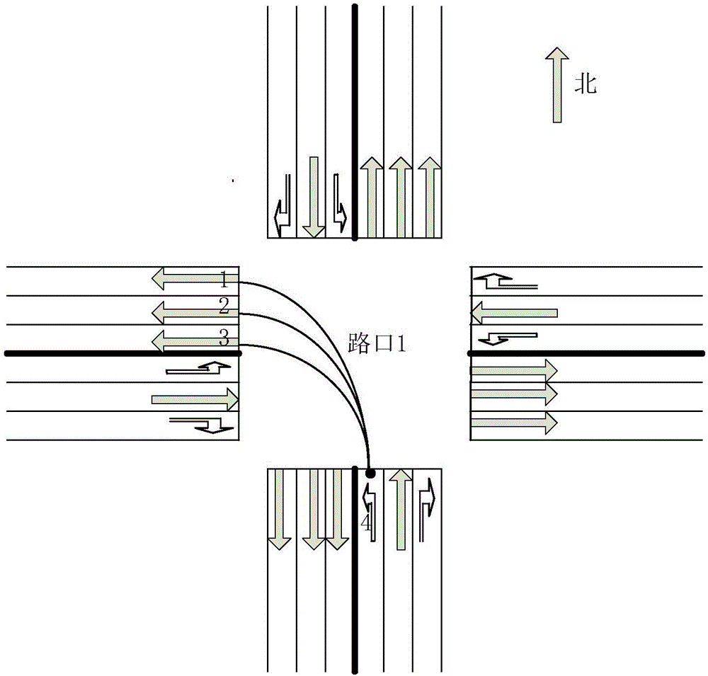
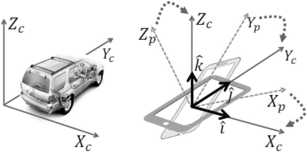
[0038] The present invention utilizes the location service function of the smart phone, and the two sensors of the three-axis acceleration sensor and the gyroscope without resorting to other hardware devices. When a vehicle passes through a certain intersection and generates a turning event, in the process of turning, the vehicle motion is regarded as a periodic circular motion. First of all, in the sampling stage, since the readings of the mobile phone sensors cannot be directly used in the vehicle coordinate system, the acquired sensor readings must be processed to obtain useful physical quantities in the vehicle coordinate system: centripetal acceleration and angular velocity of circular motion. Get the readings of the three-axis accelerometer u...
PUM
 Abstract
Description
Claims
Application Information
 - Generate Ideas
- Intellectual Property
- Life Sciences
- Materials
- Tech Scout
- Unparalleled Data Quality
- Higher Quality Content
- 60% Fewer Hallucinations
Browse by: Latest US Patents, China's latest patents, Technical Efficacy Thesaurus, Application Domain, Technology Topic, Popular Technical Reports.
© 2025 PatSnap. All rights reserved.Legal|Privacy policy|Modern Slavery Act Transparency Statement|Sitemap|About US| Contact US: help@patsnap.com