Three-dimensional route planning method for power line inspection of multi-rotor unmanned aerial vehicle

A multi-rotor UAV and power inspection technology, applied in the field of UAV, can solve the problems that cannot meet the power demand, have many altitude changes, and cannot be obtained effectively and quickly

Inactive Publication Date: 2017-08-22
CHENGDU EBIT AUTOMATION EQUIP CO LTD
View PDF5 Cites 24 Cited by
  • Summary
  • Abstract
  • Description
  • Claims
  • Application Information

AI Technical Summary

Problems solved by technology

Due to the low resolution of the map and the projection of the satellite map, the route planning model based entirely on the map has a large error and cannot meet the power demand. It is often necessary to continuously optimize the route to get a correct route;
[0006] (2) There are many changes in height
The application of power inspection requires that the waypoints near the iron tower are distributed at different heights, and the required position cannot be obtained effectively and quickly based on the flat map or Google Earth pseudo-3D mode

Method used


Image

  • Three-dimensional route planning method for power line inspection of multi-rotor unmanned aerial vehicle
  • Three-dimensional route planning method for power line inspection of multi-rotor unmanned aerial vehicle
  • Three-dimensional route planning method for power line inspection of multi-rotor unmanned aerial vehicle

Examples


Embodiment Construction

[0035] The three-dimensional route planning method for multi-rotor unmanned aerial vehicle power inspection of the present invention comprises the following steps:

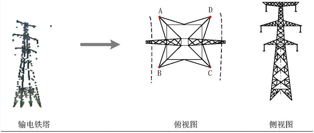
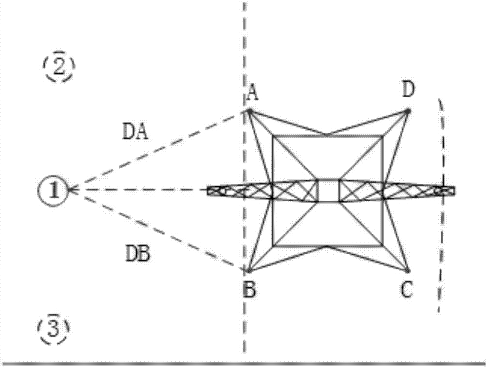
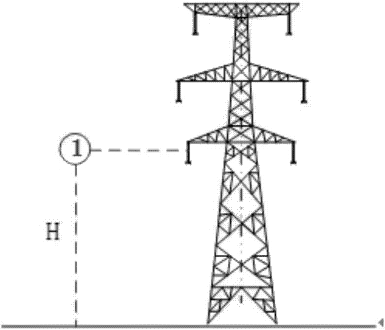
[0036] S1. Establish a route drawing board; perform orthographic projection on the transmission line iron tower to obtain the iron tower top view drawing board and the iron tower side view drawing board; decompose the iron tower into two parts, the top view and the side view, which are used to determine the horizontal latitude and longitude and height information of the waypoint respectively, figure 1 It is an exploded view of the transmission line tower; figure 2 Draw a schematic diagram of the top view of the tower; image 3 Draw a schematic diagram of the side view of the tower;

[0037] S2, establish the coordinate system of the drawing board of the iron tower top view; Figure 4 As shown, since the distribution position and orientation of each iron tower are different, the relative position relationship be...


PUM


Abstract

The invention discloses a three-dimensional route planning method for power line inspection of a multi-rotor unmanned aerial vehicle. The method comprises the following steps: establishing a route drawing board; establishing an iron tower top view drawing board coordinate system; determining a horizontal longitude-latitude position of a waypoint (X, Y) and platform-lens orientation of the waypoint; determining height information H of the waypoint; carrying out task attribute configuration on the waypoint with determined three-dimensional position information, so as to obtain route data; and finally inputting the obtained route data into a map. By taking an iron tower as an object, the three-dimensional position information of the waypoint can be rapidly obtained through calculation, so that the problems that the planning of the three-dimensional route for the power line inspection cannot be effectively finished by virtue of a conventional ground station and is complicated and the like are solved. The three-dimensional route planning method is suitable for being popularized and applied in the technical field of unmanned aerial vehicles.

Description

technical field [0001] The invention relates to the technical field of unmanned aerial vehicles, in particular to a method for planning a three-dimensional route of a multi-rotor unmanned aerial vehicle for power inspection. Background technique [0002] With the introduction of new technologies, new methods and new management concepts, unmanned aerial vehicles (UAVs) have gradually gained attention and have begun to be used in inspections of transmission lines, which has made up for the shortcomings of traditional manual inspections to a certain extent, especially in high mountains and other places where manual inspections are not easy. The advantages of developed regions are more obvious. Among them, the multi-rotor UAV has a slow flying speed and has a fixed-point hovering function, which can observe specific inspection targets in detail, which is conducive to defect discovery. [0003] At present, there are two main methods in the power inspection process of multi-rotor...

Claims


Application Information

Patent Timeline
Patent Type & Authority Applications(China)
IPC IPC(8): G01C21/24
CPCG01C21/24
Inventor 张瑜朱汉川
Owner CHENGDU EBIT AUTOMATION EQUIP CO LTD
Why Eureka
Try Eureka