Geographic grid-based government affair information resource integration method

A technology of geographic grids and information resources, applied in geographic information databases, data processing applications, electronic digital data processing, etc., can solve the problems of lack of data integration method research and integrated analysis of deeper analysis, and achieve rapid information extraction. and resource integration

Active Publication Date: 2017-08-25
CHINESE ACAD OF SURVEYING & MAPPING
View PDF4 Cites 36 Cited by
  • Summary
  • Abstract
  • Description
  • Claims
  • Application Information

AI Technical Summary

Problems solved by technology

For government information exchange and government information users, there is a lack of

Method used


Image

  • Geographic grid-based government affair information resource integration method
  • Geographic grid-based government affair information resource integration method
  • Geographic grid-based government affair information resource integration method

Examples


Embodiment 1

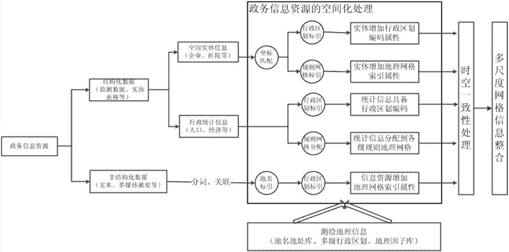
[0097] see figure 2 , shows an example of the integration of government information and spatial information according to a specific embodiment of the present invention, and the application of deep integration of government information resources.

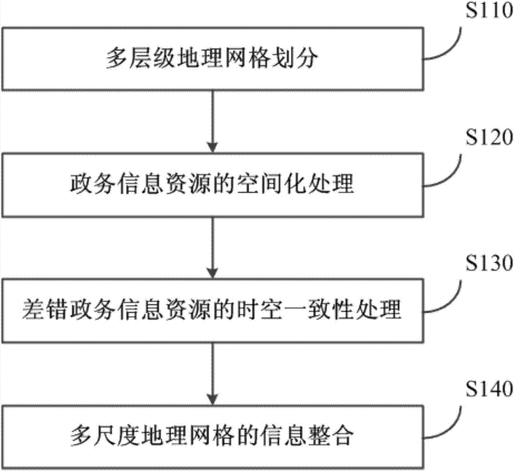
[0098] The government information resources from different sources are spatially processed according to structured data and unstructured data, coordinate coordinates are matched, and administrative division coding attributes and geographic grid index attributes are added, and then spatiotemporal consistency processing and Multi-scale grid information integration.

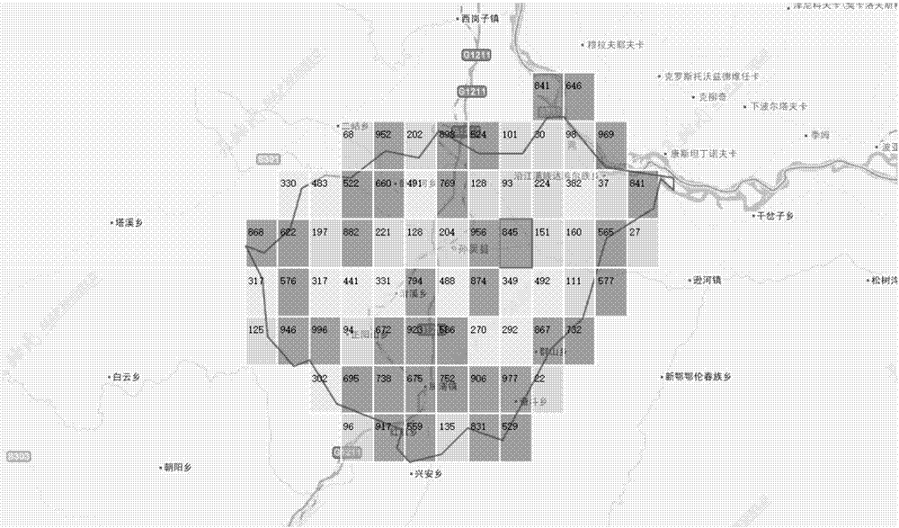
[0099] Later, see image 3 , Figure 4 , the multi-level nested grid is integrated analysis of grid-related information such as the number of enterprises and regional economy as follows. The number is the number of enterprises, and the grayscale (or color) indicates the GDP value. The number marked on the grid is the number of enterprises, and the depth of the gray sca...


PUM


Abstract

The invention discloses a geographic grid-based government affair information resource integration method. The method comprises the steps of performing multilevel geographic grid division; performing spatialization processing of government affair information resources; performing time-space coherence processing of the government affair information resources; and performing information integration of multi-scale geographic grids. By fully utilizing a geographic grid division technology, a grid coding method, a text word segmentation and extraction method and a spatial statistical analysis technology, the fusion of government affair information and space information is realized; deep integration and application of the government affair information resources are performed; and grid analysis of single type of data is upgraded to grid internal integration analysis of government affair information resources of multiple types and multiple scales, so that comprehensive government affair data space distribution, comparison and associative analysis can be carried out in a specified region. The information extraction and resource integration can be quickly realized in regional planning and emergency of governments.

Description

technical field [0001] The present application relates to an information processing method, in particular to a geographic grid-based government information resource integration method. Background technique [0002] Government information resources occupy an extremely important position in the resources of the whole society, and are a kind of national resources with important value. At present, there are big problems in the integration and sharing of government information resources in our country. A large number of information islands exist, which makes it difficult for the existing integration and sharing planning to continue to play an effective role, and also restricts the further development of my country's e-government. The integration of information resources is a complex system engineering, which involves many factors such as technology, economy, humanities and so on. At the same time, the diversification and complexity of government information resources in terms o...

Claims


Application Information

Patent Timeline
IPC IPC(8): G06F17/30G06Q50/26
CPCG06F16/29G06Q50/26
Inventor 何望君刘纪平张福浩仇阿根石丽红
Owner CHINESE ACAD OF SURVEYING & MAPPING
Why Eureka
Try Eureka