Method of calculating true thickness of rock stratum vector based on GPS data

A technology based on GPS data and true thickness, which is applied in the field of calculating the true thickness of rock formation vectors based on GPS data, can solve problems such as low efficiency, slow speed, and error-prone, and achieve the effect of wide application prospects and high efficiency

Inactive Publication Date: 2017-09-22
克拉玛依职业技术学院
View PDF6 Cites 3 Cited by
  • Summary
  • Abstract
  • Description
  • Claims
  • Application Information

AI Technical Summary

Problems solved by technology

The early rock thickness calculation methods in my country were mainly based on the Leonowski formula. The calculation results of these methods have only size and no direction, and the calculation is cumbersome, slow, error-prone, and inefficient.

Method used


Image

  • Method of calculating true thickness of rock stratum vector based on GPS data
  • Method of calculating true thickness of rock stratum vector based on GPS data
  • Method of calculating true thickness of rock stratum vector based on GPS data

Examples


Embodiment

[0029] A method for calculating the true thickness of a rock formation vector based on GPS data, comprising:

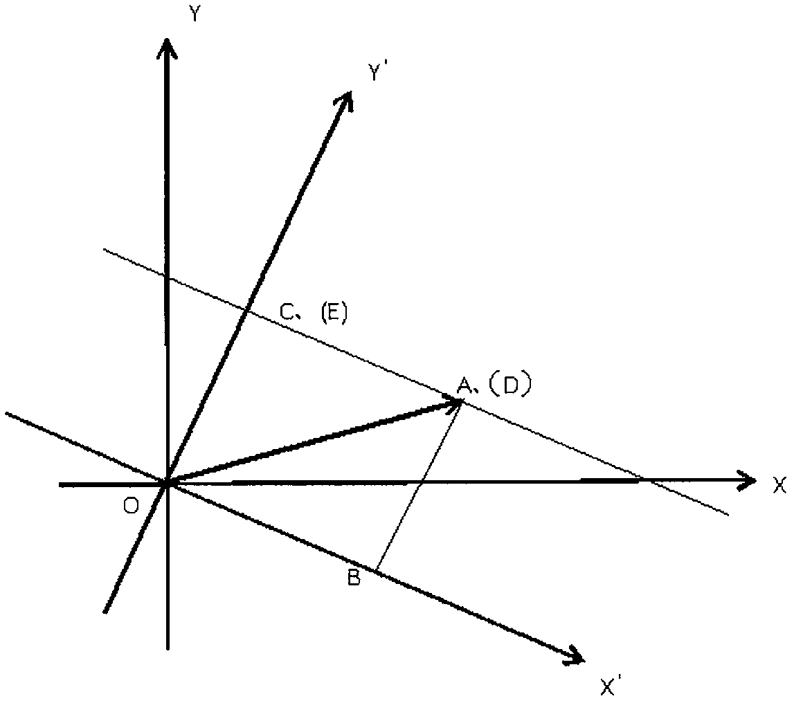
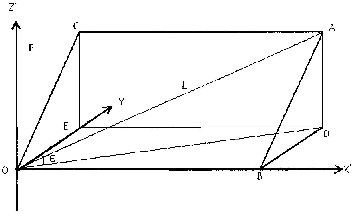
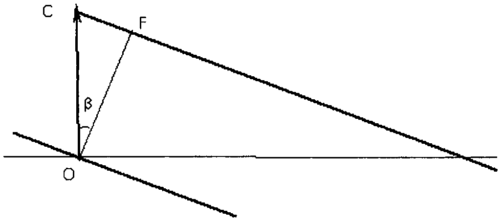
[0030] Step 1. Locate and make geological records at the occurrence or lithology change. GPS locator is used for positioning. Geological records include lithology description and use of compass to measure the occurrence. The true thickness of the rock formation vector is calculated using the formula (X):

[0031]

[0032] in, The true thickness of a rock formation vector controlled by a measurement (between two points), X: the distance on the X-axis corresponding to the longitude difference between two GPSs, Y: the distance on the Y-axis corresponding to the latitude difference between two GPSs, Z: the distance between two GPS latitudes GPS point elevation difference, λ: rock formation dip azimuth, β: rock formation true dip.

[0033] Step 2, numbering the sample collection and calculation results;

[0034] Step 3, input the numbered data into the computer, and...


PUM


Abstract

The invention provides a method of calculating true thickness of a rock stratum vector based on GPS data. On the basis of a rock stratum vector thickness general calculation method, through a series of rigorous mathematical arguments, a brand-new vector formula as described in the specifications for using the GPS data to calculate the true thickness of the rock stratum is deduced, and thus, rock stratum thickness measurement totally gets rid of the traditional measuring rope and requirements on intervisibility conditions. Compared with the prior art, the method of calculating the true thickness of the rock stratum vector based on the GPS data caters to the trend of great revolution of electronic information in geological survey, errors and frauds in wire length and slope measurement records can be avoided, and data acquired by various photoelectric distance measuring instruments such as a total station can be compatible.

Description

technical field [0001] The invention relates to the technical field of geological mineral reserves, in particular to a method for calculating the true thickness of rock layer vectors based on GPS data. Background technique [0002] The calculation of rock thickness is often encountered in the measurement of large-scale geological sections and the calculation of solid deposit reserves. It can be seen that the calculation of rock thickness is very important. The calculation of rock formation thickness can be divided into scalar method and vector method. The early rock thickness calculation methods in my country were mainly based on the Leonowski formula. The calculation results of these methods have only size and no direction, and the calculation is cumbersome, slow, error-prone, and low in efficiency. [0003] Therefore, it is necessary to improve the calculation formula of rock formation thickness, and provide a new method for calculating the true thickness of rock formati...

Claims


Application Information

Patent Timeline
Patent Type & Authority Applications(China)
IPC IPC(8): G01B7/06
CPCG01B7/06
Inventor 王满许边远
Owner 克拉玛依职业技术学院
Why Eureka
Try Eureka