Vehicle non-effective traveling track recognition method and urban road facility planning method
A technology of driving trajectory and vehicle trajectory, which is applied in the planning of urban road facilities and the identification of non-effective driving trajectory of vehicles. It can solve the problems of aggravated urban congestion, nowhere to park, and rising costs, and achieve the effect of improving traffic capacity and rational planning
- Summary
- Abstract
- Description
- Claims
- Application Information
AI Technical Summary
Problems solved by technology
Method used
Image
Examples
Embodiment 1
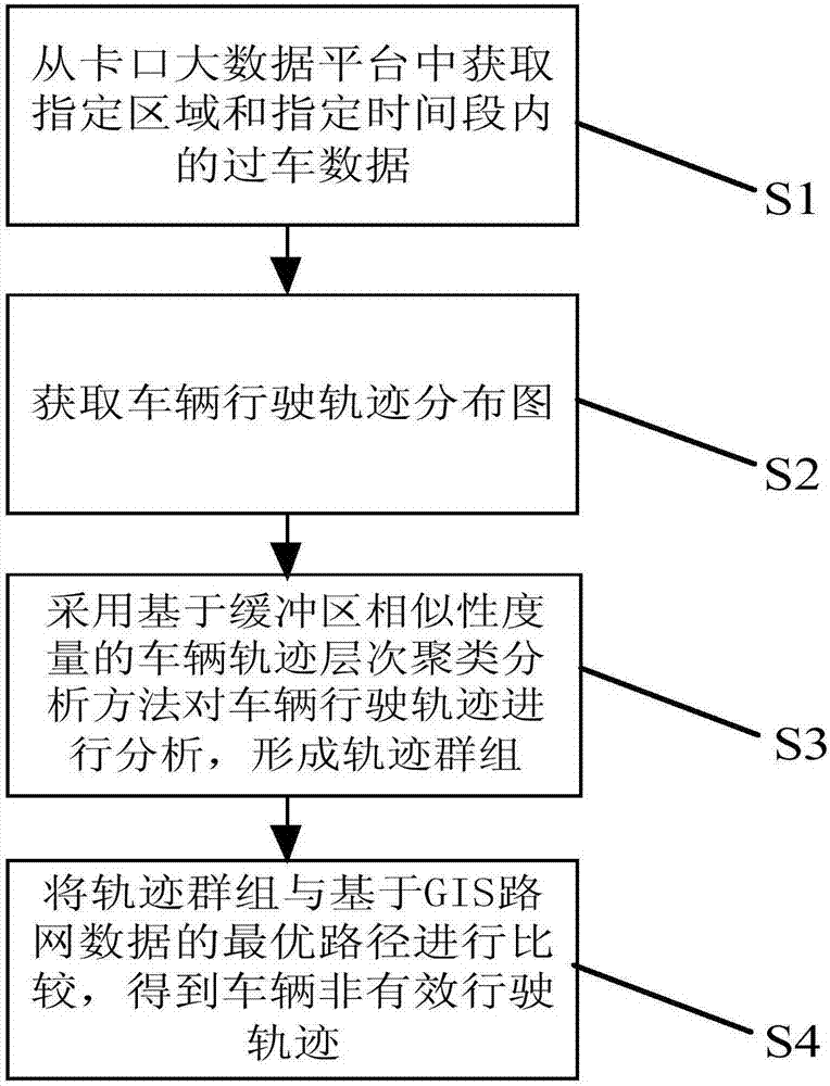
[0042] Such as figure 1 As shown, a vehicle non-effective driving track identification method includes the following steps:
[0043] S1. Obtain the passing data in the specified area and within the specified time period from the checkpoint big data platform;
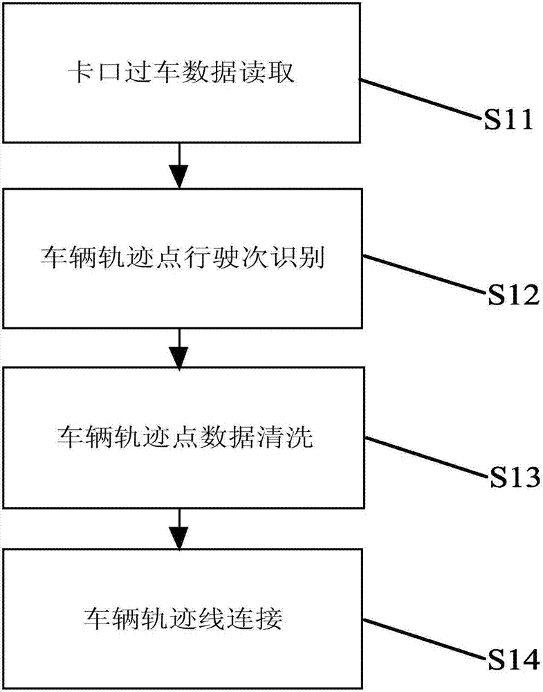
[0044] Such as figure 2 As shown, the specific steps for obtaining data in step S1 are as follows:
[0045] S11. Reading data of passing vehicles at the bayonet. Obtain the checkpoint passing data in the specified area and within the specified time period from the checkpoint big data platform. The checkpoint big data platform includes the license plate number of the vehicle in the designated area, the model, the time point when driving in the designated area, The latitude and longitude of the corresponding position at each time point, the license plate number, the vehicle type, each time point, and the latitude and longitude of the corresponding position at each time point are taken as the objects to be analyzed.
...
Embodiment 2
[0067] A method for planning urban road facilities, including all the steps in Embodiment 1, the bayonet in the above steps refers to a camera that captures license plates and vehicle violations. When the cameras are relatively dense, the value of T in step S12 is 10min; when the density of cameras is general, the value of T in step S12 is 20min; The value of T in is 30min. In this way, more effective vehicle trajectory lines can be obtained.
[0068] Then it also includes the following steps: judging whether the driving trajectory is a closed curve; if the non-effective driving trajectory is a closed curve, then establishing a parking lot facility in this closed area; if the non-effective driving trajectory is a non-closed curve, and there is an optimal driving road , add road signs and other facilities to guide vehicles or increase road construction planning.
PUM
 Abstract
Description
Claims
Application Information
 - R&D
- Intellectual Property
- Life Sciences
- Materials
- Tech Scout
- Unparalleled Data Quality
- Higher Quality Content
- 60% Fewer Hallucinations
Browse by: Latest US Patents, China's latest patents, Technical Efficacy Thesaurus, Application Domain, Technology Topic, Popular Technical Reports.
© 2025 PatSnap. All rights reserved.Legal|Privacy policy|Modern Slavery Act Transparency Statement|Sitemap|About US| Contact US: help@patsnap.com


