
A method and device for increasing electronic eye information, navigation chip and server

A technology to increase electronic and electronic eyes, applied in the field of geographic information systems, can solve the problems of long cycle time and high cost of electronic eye information, achieve high timeliness, improve application, and reduce workload

Active Publication Date: 2020-08-28
NAVINFO
View PDF5 Cites 0 Cited by
  • Summary
  • Abstract
  • Description
  • Claims
  • Application Information

AI Technical Summary

Problems solved by technology

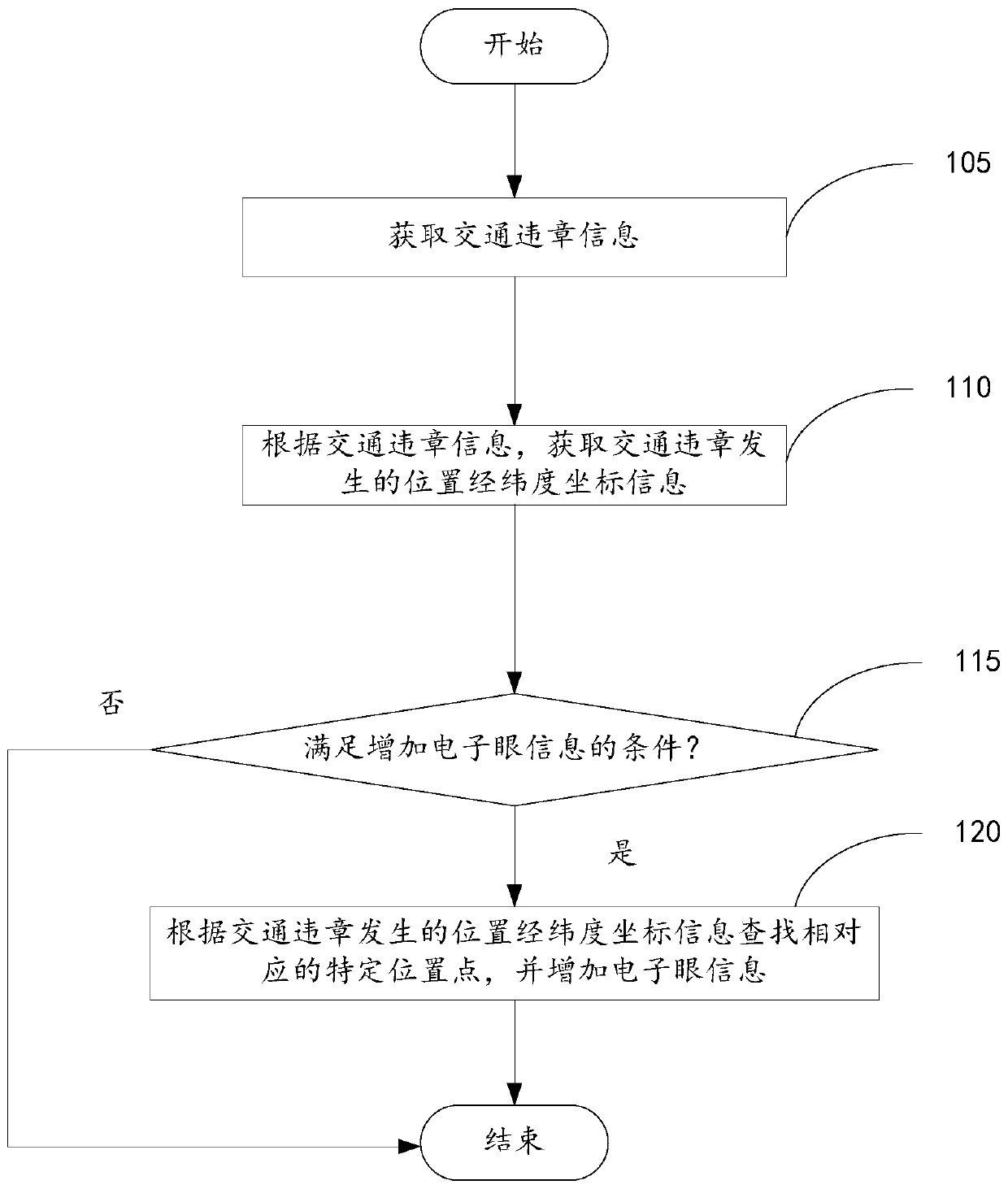
[0005] In view of this, the embodiment of the present invention provides a method and device for adding electronic eye information, a navigation chip and a server to solve the problem of high cost and long period of adding electronic eye information in the electronic map

Method used


Image

  • A method and device for increasing electronic eye information, navigation chip and server
  • A method and device for increasing electronic eye information, navigation chip and server
  • A method and device for increasing electronic eye information, navigation chip and server

Examples


example

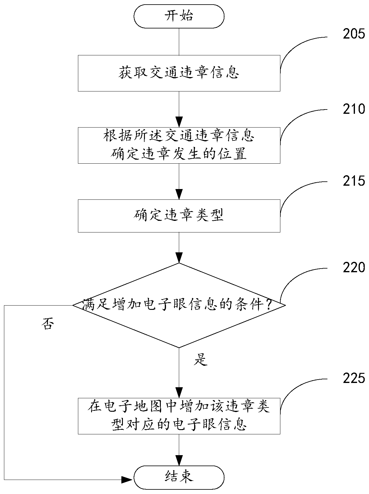
[0086] Based on the same idea, figure 2 It shows an example process of adding electronic eye information in the electronic map disclosed in the embodiment of the present invention, including the following processing methods:

[0087] Step 205, obtain traffic violation information; the electronic map provider can obtain a large amount of traffic violation information through the traffic management department, or submit the user's traffic violation information to the server of the electronic map provider through the electronic map user, thereby obtaining a large amount of traffic violation information. traffic violation information. Although there are many administrative regions in our country, when each administrative region produces traffic violation information, the basic format will remain the same except that the key information inside will change, such as the time, location, type of violation, etc. of traffic violations. According to the format of traffic violation infor...


PUM


Abstract

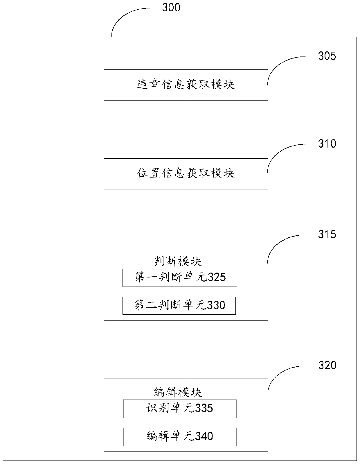
The invention discloses a method and a device for increasing electronic eye information, a navigation chip and a server. The method comprises: obtaining traffic violation information; according to the traffic violation information, obtaining longitude and latitude coordinate information of the position where traffic violation occurs; determining whether the position where traffic violation occurs satisfies a condition of increasing electronic eye information, for the position which satisfies the condition, according to the longitude and latitude coordinate information of the position where traffic violation occurs, searching a corresponding special position point in electronic map data, and increasing the electronic eye information on the special position point. The technical scheme can reduce workload of artificial acquisition, and improve efficiency of manual operation. In addition, the method and the device can effectively reduce cost and improve use rate of big data, and timeliness is higher. The method and the device are especially suitable a company which already has wheel path big data, and improve application of the big data.

Description

technical field [0001] The invention relates to the field of geographic information systems, in particular to a method and device for increasing electronic eye information, a navigation chip and a server. Background technique [0002] With the continuous expansion of urban population, the number of vehicles is also gradually increasing, and urban roads are also expanding accordingly. However, because the increase in the number of traffic policemen is far behind the growth rate of vehicles and urban roads, and in order to reduce the burden on traffic policemen and realize the automation of road law enforcement, electronic eyes can be installed on many roads, especially at busy intersections. Penalize drivers who violate traffic rules, and can also remind users to obey traffic rules. [0003] With the popularity of smart phones, geographic information systems have also been used more and more, such as electronic maps and navigation based on electronic maps. In order to remin...

Claims


Application Information

Patent Timeline
Patent Type & Authority Patents(China)
IPC IPC(8): G06F16/29G01C21/34
CPCG01C21/34G06F16/29
Inventor 黄小宝纪刚黄芬芬
Owner NAVINFO
Learn More