

Underwater terrain matching aided inertial navigation positioning method and positioning system
A technology of underwater terrain matching and inertial navigation system, which is applied in the direction of navigation, measuring devices, instruments, etc. through speed/acceleration measurement, to achieve the effect of improving accuracy and efficiency
- Summary
- Abstract
- Description
- Claims
- Application Information
AI Technical Summary
Problems solved by technology
Method used
Image

Examples
Embodiment Construction
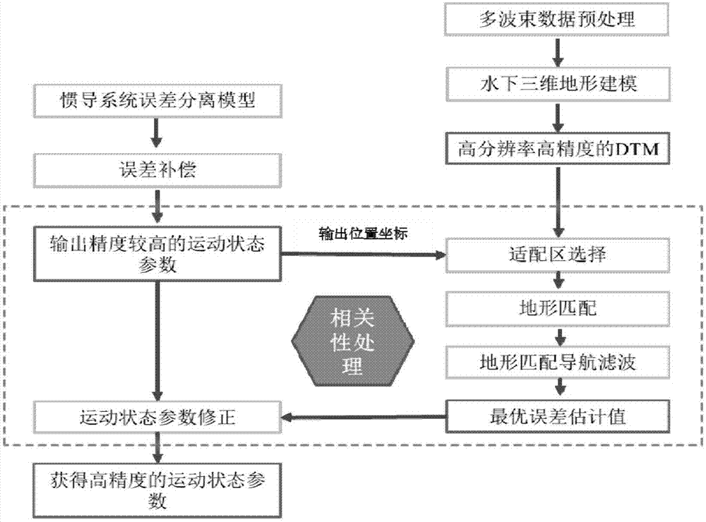
[0045] In order to make the technical means, creative features, goals and effects achieved by the present invention easy to understand, the present invention will be further described below in conjunction with specific illustrations.
[0046] First of all, the present invention involves the following technical terms:
[0047] inertial navigation system
[0048] Inertial Navigation System (INS, hereinafter referred to as inertial navigation system) is an autonomous navigation system that does not rely on external information and does not radiate energy to the outside (Ding Guoqiang, 2010). Its working environment includes not only the air, the ground, but also underwater. The basic working principle of inertial navigation is based on Newton's laws of mechanics. By measuring the acceleration of the carrier in the inertial reference system, integrating it with time, and transforming it into the navigation coordinate system, the position in the navigation coordinate system can be...
PUM
 Abstract
Description
Claims
Application Information