Calculation method of working distance of ground-air detection infrared imaging system based on lowtran7 atmospheric software

An infrared imaging system and action distance technology, applied in design optimization/simulation, special data processing applications, etc., can solve the problems of large calculation error, limited application range and high calculation accuracy, and achieve the effect of improving efficiency and enhancing general applicability

Active Publication Date: 2020-08-11
NANJING UNIV OF SCI & TECH
View PDF6 Cites 0 Cited by
  • Summary
  • Abstract
  • Description
  • Claims
  • Application Information

AI Technical Summary

Problems solved by technology

Professional atmospheric software has high calculation accuracy but is complex to use, while empirical formulas are usually relatively simple, have limited scope of application, large calculation errors, and cannot describe complex atmospheric conditions

Method used


Image

  • Calculation method of working distance of ground-air detection infrared imaging system based on lowtran7 atmospheric software
  • Calculation method of working distance of ground-air detection infrared imaging system based on lowtran7 atmospheric software
  • Calculation method of working distance of ground-air detection infrared imaging system based on lowtran7 atmospheric software

Examples


Embodiment Construction

[0044]It is easy to understand that, according to the technical scheme of the present invention, without changing the essence of the present invention, those skilled in the art can imagine many ways to calculate the working distance of the ground-air detection infrared imaging system based on Lowtran7 atmospheric software in the present invention. kind of implementation. Therefore, the following specific embodiments and drawings are only exemplary descriptions of the technical solution of the present invention, and should not be regarded as the entirety of the present invention or as a limitation or limitation on the technical solution of the present invention.

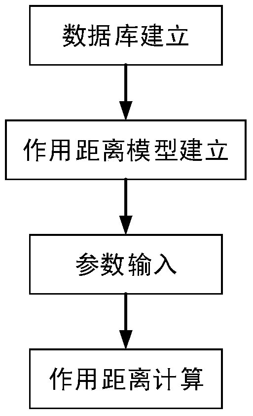
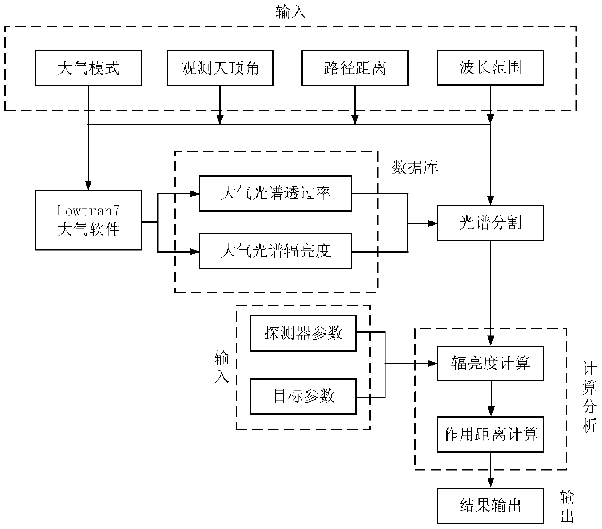
[0045] combine figure 1 and figure 2 , the present invention proposes based on the Lowtran7 atmospheric software the ground-space detection infrared imaging system action distance calculation method steps are as follows:

[0046] Step 1: Calculation of atmospheric radiance and atmospheric transmittance

[0047] 1....


PUM


Abstract

The invention provides a Lowtran7 atmosphere software-based method for calculating an action distance of a ground-air detection infrared imaging system. Firstly a ground-air detection target and background radiation are analyzed, and the action distance of the infrared system is modeled from the perspective of contrast; secondly Lowtran7 atmosphere software is called to generate a database of atmospheric radiant brightness, atmospheric transmissivity, wavelengths, path distances and zenith observation angles under different atmospheric conditions; discrete data is integrated by utilizing a spectral segmentation method; the action distances under the corresponding path distances are calculated; and the maximum path distance which enables the path distance to be equal to the calculated distance is calculated out to serve as the final action distance of the infrared system.

Description

technical field [0001] The invention belongs to the technical field of infrared system modeling and simulation, mainly relates to the technical field of infrared system modeling for target detection action distance, and specifically relates to a method for calculating the action distance of an infrared imaging system for ground-air detection based on Lowtran7 atmospheric software. Background technique [0002] Infrared imaging system has been more and more widely used due to its great advantages in bad weather or night tracking and guidance, and the importance of infrared imaging system performance evaluation has become more and more prominent. For the infrared imaging system, the operating range is its most important evaluation index, and the operating range refers to the farthest distance that the infrared imaging system can detect, distinguish or identify the target under certain atmospheric conditions. There are two main methods of evaluating the action distance: measure...

Claims


Application Information

Patent Timeline
Patent Type & Authority Patents(China)
IPC IPC(8): G06F30/20
CPCG06F30/367
Inventor 任侃田杰陈钱顾国华钱惟贤周骁骏张海越汪鹏程万敏杰顾煜洁王伟杰姚哲毅呙星
Owner NANJING UNIV OF SCI & TECH
Why Eureka
Try Eureka