

Simulation method of global real cloud layer of three-dimensional geographic information system
A technology of geographic information system and simulation method, which is applied in the simulation field of global real cloud layer of three-dimensional geographic information system, can solve the problems such as lack of three-dimensional sense, and achieve the effect of small amount of data, simple data source and high calculation efficiency
- Summary
- Abstract
- Description
- Claims
- Application Information
AI Technical Summary
Problems solved by technology
Method used
Image

Examples
Embodiment Construction
[0032] The following will clearly and completely describe the technical solutions in the embodiments of the present invention with reference to the accompanying drawings in the embodiments of the present invention. Obviously, the described embodiments are only some, not all, embodiments of the present invention.
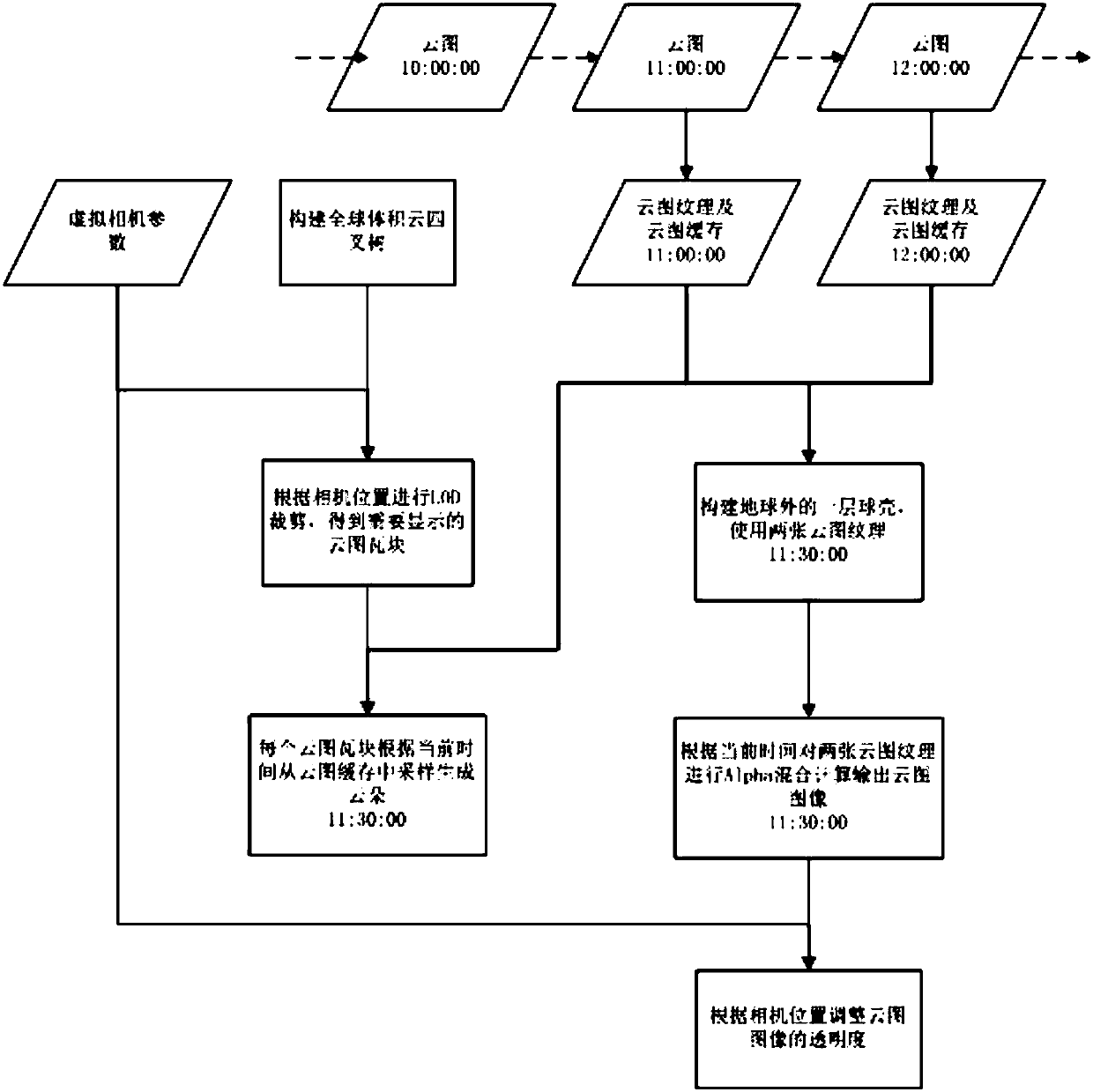
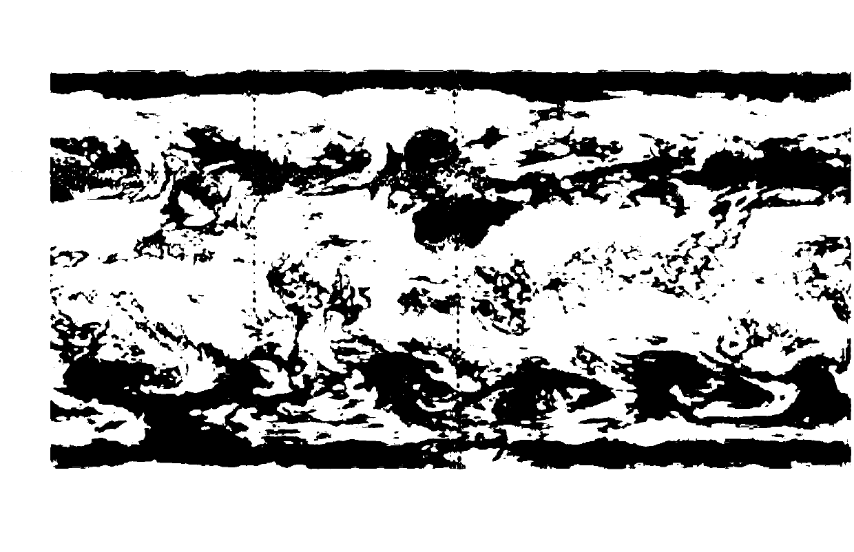
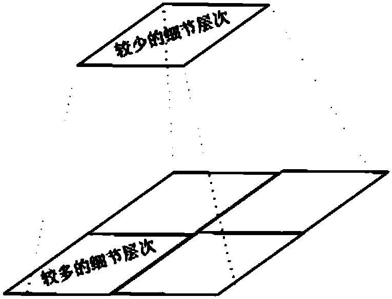
[0033] refer to Figure 1-8 , a method for simulating global real clouds in a three-dimensional geographic information system, comprising the following steps: 1) analyzing the cloud image, displaying the cloud image curled at the height of the earth's atmosphere, and generating a cloud image cache; 2) constructing a global volumetric cloud tile of a quadtree structure ;3) Schedule volumetric cloud tiles according to the height of the camera or viewing angle; 4) Generate clouds in the tiles by sampling in the cloud image cache; 5) Make global cloud effects change with time by using multiple consecutive global cloud images; 6) Adjust the transparency of the cloud layer...
PUM
 Abstract
Description
Claims
Application Information