Method for establishing digital map for indoor service robot autonomous navigation

A service robot and autonomous navigation technology, which is applied in the field of digital map establishment for autonomous navigation of indoor service robots, can solve the problems of high robot requirements, expensive lidar, limited environmental features, etc., and achieves low hardware requirements, small data volume, and cost reduction. Effect

Active Publication Date: 2018-02-16
昆山联骥机器人有限公司
View PDF9 Cites 2 Cited by
  • Summary
  • Abstract
  • Description
  • Claims
  • Application Information

AI Technical Summary

Problems solved by technology

This method has good autonomy, but it has high requirements on the robot and needs to be equipped with expensive lidar, and its elect

Method used


Image

  • Method for establishing digital map for indoor service robot autonomous navigation

Examples


Embodiment 1

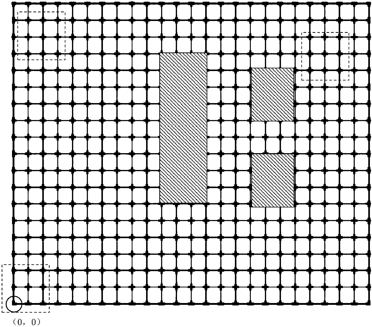
[0009] Such as figure 1 As shown, the method for establishing a digital map for autonomous navigation of an indoor service robot of the present invention includes a step of measuring indoor environmental characteristic data, and a step of inputting the above data into the built-in memory of the robot, wherein in the measurement room In the step of environmental feature data, the feature data of the indoor environment are manually measured, and the feature data of the indoor environment include indoor length, width, and the position of fixed obstacles, and then the indoor plane is divided into grids, and each grid is used as A map calculation point, according to the measured data and a preset map resolution to compile a two-dimensional array MAP[m][n] of the map, where MAP is the name of the array, m represents the row, n represents the column, any one The map calculation points described above are all elements in the array MAP, and the elements include four types: passable, im...


PUM

PropertyMeasurementUnit
Lengthaaaaaaaaaa

Abstract

A method for establishing a digital map for indoor service robot autonomous navigation includes the steps of measuring indoor environmental characteristic data, and inputting the data to a robot built-in memory; the indoor environmental characteristic data are manually measured and include the indoor length, width and positions of fixed obstacles, then an indoor plane is subjected to lattice division in average, each lattice can serve as a map calculation point, and a map two-dimensional array is compiled according to the measured data and the preset map resolution ratio. The map can be artificially conveniently designed, the method is suitable for indoor commercial environment, and the robot path planning and autonomous navigation and autonomous obstacle avoidance functions can be achieved based on the map; the map is stored by the two-dimensional array, the amount of data is small, requirements to robot hardware are low, an SLAM laser radar is not needed, the cost is reduced, and mapinformation is not limited to a barrier-free state and a barrier state and also can be set as more states.

Description

Technical field: [0001] The invention relates to the field of physics, in particular to measurement technology, in particular to a method for establishing a digital map for autonomous navigation of an indoor service robot. Background technique: [0002] The application of indoor service robots is gradually expanding. Establishing the indoor map where the robot is located is the prerequisite for the robot to realize autonomous navigation. Chinese patent CN201310009149.1 discloses a method for establishing a digital map for robot autonomous navigation. This digital map establishment method is based on a grid-shaped map method, and collects the environmental information of the robot in real time through 2D laser radar to extract environmental features. The information collected utilizes SLAM technology to carry out the establishment of grid map, obtains global environment grid map; Described global environment grid means that obstacle grid is marked as 1 (hazard), and blank gr...

Claims


Application Information

Patent Timeline
IPC IPC(8): G01C21/20G01C21/00
Inventor 柳杨华王璐璐姚文彪胡忠华
Owner 昆山联骥机器人有限公司
Why Eureka
Try Eureka