
Laser scanning multidimensional near-distance remote sensing system and method for synchronously acquiring ground object information

A technology of laser scanning and synchronous acquisition, which is applied in the direction of radio wave measurement system, electromagnetic wave re-radiation, instruments, etc., can solve the problems of insufficient three-dimensional laser radar information, complex and large equipment, high cost, etc., to solve the problem of insufficient information , compact and simple structure, reliable and stable performance

Pending Publication Date: 2018-07-13
PEKING UNIV
View PDF11 Cites 11 Cited by
  • Summary
  • Abstract
  • Description
  • Claims
  • Application Information

AI Technical Summary

Problems solved by technology

[0003] In order to overcome the deficiencies of the above-mentioned prior art, the present invention provides a laser scanning multi-dimensional short-distance remote sensing system and a synchronous acquisition method for simultaneously acquiring ground object information. The system is a simultaneous acquisition of polarization, reflection intensity information and color point cloud Capable low-cost, moderately accurate, short-range, and multi-dimensional information acquisition laser radar equipment can solve the problem that there is currently no three-dimensional laser radar with the ability to simultaneously acquire polarization, reflection intensity information, and color point clouds, and the current three-dimensional laser radar In the application of plant quantitative measurement and parameter inversion, there are contradictions between insufficient information, complex and large equipment, excessive precision and high cost

Method used


Image

  • Laser scanning multidimensional near-distance remote sensing system and method for synchronously acquiring ground object information
  • Laser scanning multidimensional near-distance remote sensing system and method for synchronously acquiring ground object information
  • Laser scanning multidimensional near-distance remote sensing system and method for synchronously acquiring ground object information

Examples


Embodiment Construction

[0019] Below in conjunction with accompanying drawing, further describe the present invention through embodiment, but do not limit the scope of the present invention in any way.

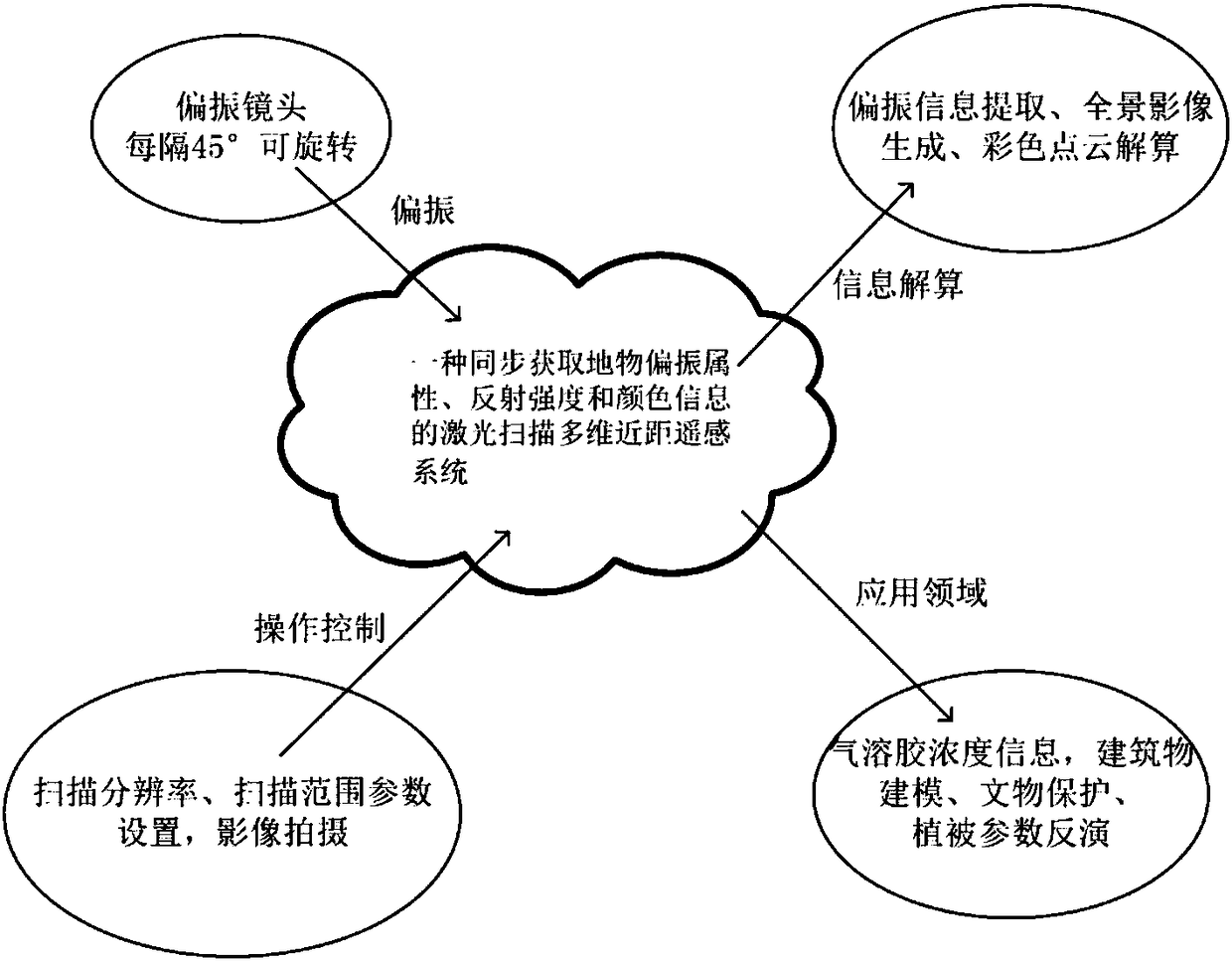
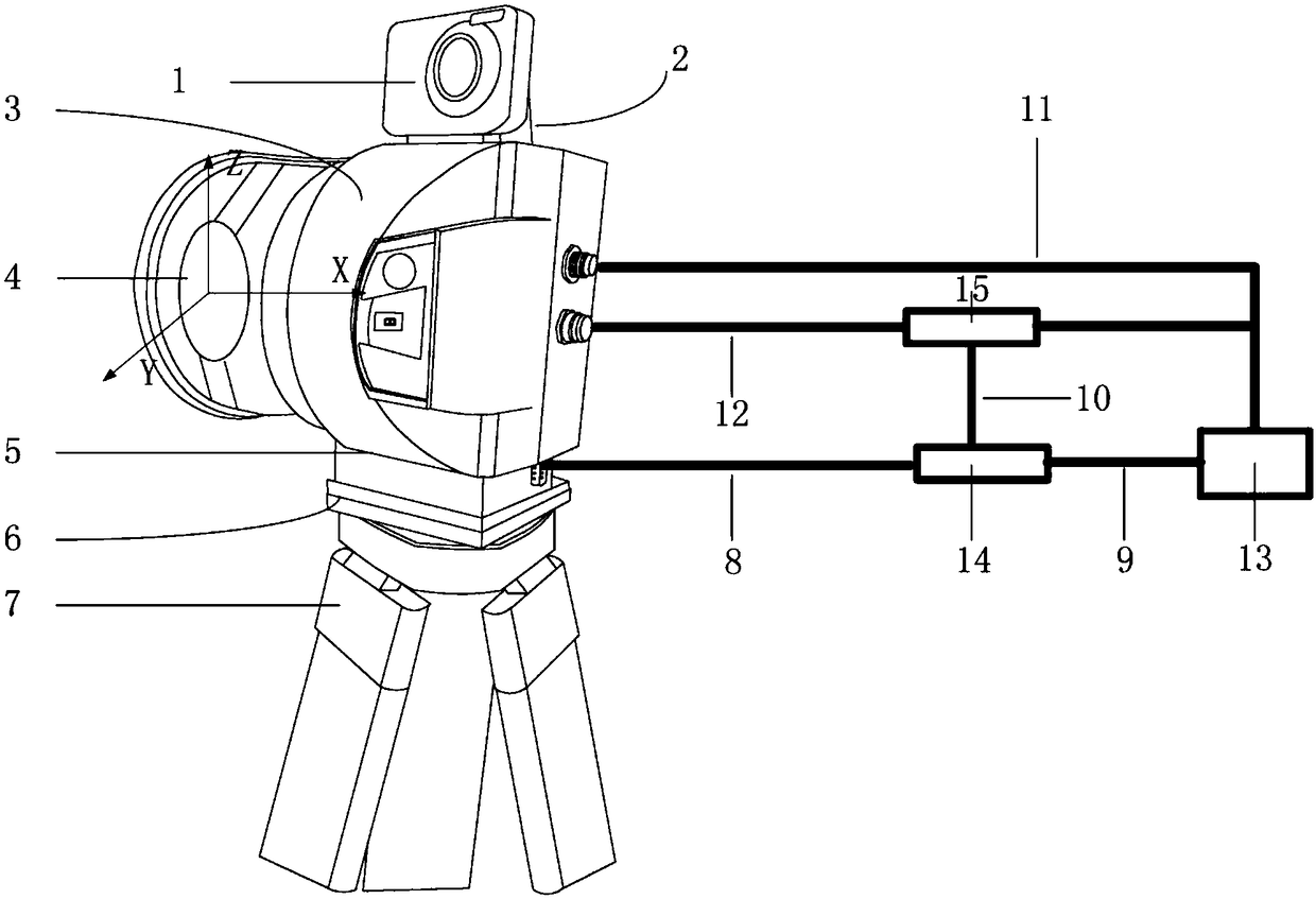
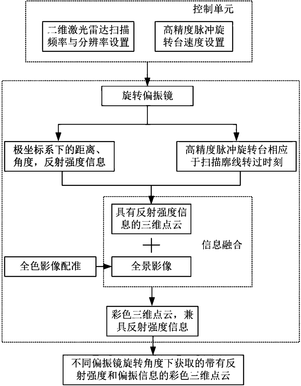
[0020] figure 1 The composition and related application fields of the remote sensing system provided by the present invention are shown. The present invention integrates a two-dimensional laser radar, a rotating polarizer, a high-precision pulse rotating table, and an image data acquisition unit into a laser radar device that can simultaneously acquire polarization information, reflection intensity, and three-dimensional color point clouds in a three-dimensional space for scanning ground objects. . A variety of information obtained can be used for atmospheric aerosol concentration retrieval, 3D modeling, and plant parameter retrieval. The invention has compact and simple structure, reliable and stable performance, and can be widely used in acquisition of three-dimensional color point cloud data wit...


PUM


Abstract

The invention discloses a laser scanning multidimensional near-distance remote sensing system and method for synchronously acquiring ground object information and a synchronous acquiring method. The system comprises a two-dimensional laser radar, a rotating polarizer, a high-precision pulse rotating table and an image data acquiring unit and is used for simultaneously acquiring and scanning polarization information, reflection intensity and three-dimensional colored point cloud in ground object three-dimensional space. The three-dimensional laser radar has ability of synchronously acquiring polarization, reflection intensity information and colored point cloud, is compact and simple in structure, reliable and stable in performance, low in cost, moderate in precision, near-distance and capable of acquiring information multi-directionally and can be widely applied in acquiring three-dimensional colored point cloud data carrying polarization information and reflection intensity information in various indoor and outdoor environments, and the problem of contradiction among insufficient information amount, complex structure and big size of equipment, excessive accuracy and high cost whencurrent three-dimensional laser radar is applied in plant quantitative measurement and parameter inversion is solved.

Description

technical field [0001] The invention relates to laser scanning multi-dimensional short-distance remote sensing data acquisition technology, in particular to a laser scanning multi-dimensional short-distance remote sensing system and a synchronous acquisition method for synchronously acquiring ground object polarization attributes, reflection intensity and color point cloud information. Background technique [0002] Remote sensing technology can detect the target object under the condition of far away from the target and non-contact target. As an emerging active remote sensing technology, lidar can quickly and accurately obtain 3D point cloud data on the surface of the scanned object, so that 3D lidar can be used in 3D construction. A large number of successful applications have been achieved in areas such as modeling, digital cities, cultural relics protection, quantitative measurement and inversion of plant parameters, etc. As the demand continues to be raised, new requirem...

Claims


Application Information

Patent Timeline
Patent Type & Authority Applications(China)
IPC IPC(8): G01S17/02G01S17/89
CPCG01S17/89G01S17/86
Inventor 林沂史振伟晏磊
Owner PEKING UNIV
Learn More