

A collaborative real-time processing system for graphs
A real-time processing and co-processing technology, which is applied in the intersecting fields of infrared remote sensing, navigation guidance, image recognition and spectral analysis, can solve the problem of inability to collect moving target map data in real time, map equipment cannot collect spectra and images at the same time, and low degree of automation, etc. problems, to achieve the effects of reducing manual intervention, coherent map/spectral data, and improving reliability
- Summary
- Abstract
- Description
- Claims
- Application Information
AI Technical Summary
Problems solved by technology
Method used
Image

Examples
Embodiment Construction
[0046] In order to make the object, technical solution and advantages of the present invention clearer, the present invention will be further described in detail below in conjunction with the accompanying drawings and embodiments. It should be understood that the specific embodiments described here are only used to explain the present invention, not to limit the present invention. In addition, the technical features involved in the various embodiments of the present invention described below can be combined with each other as long as they do not constitute a conflict with each other.
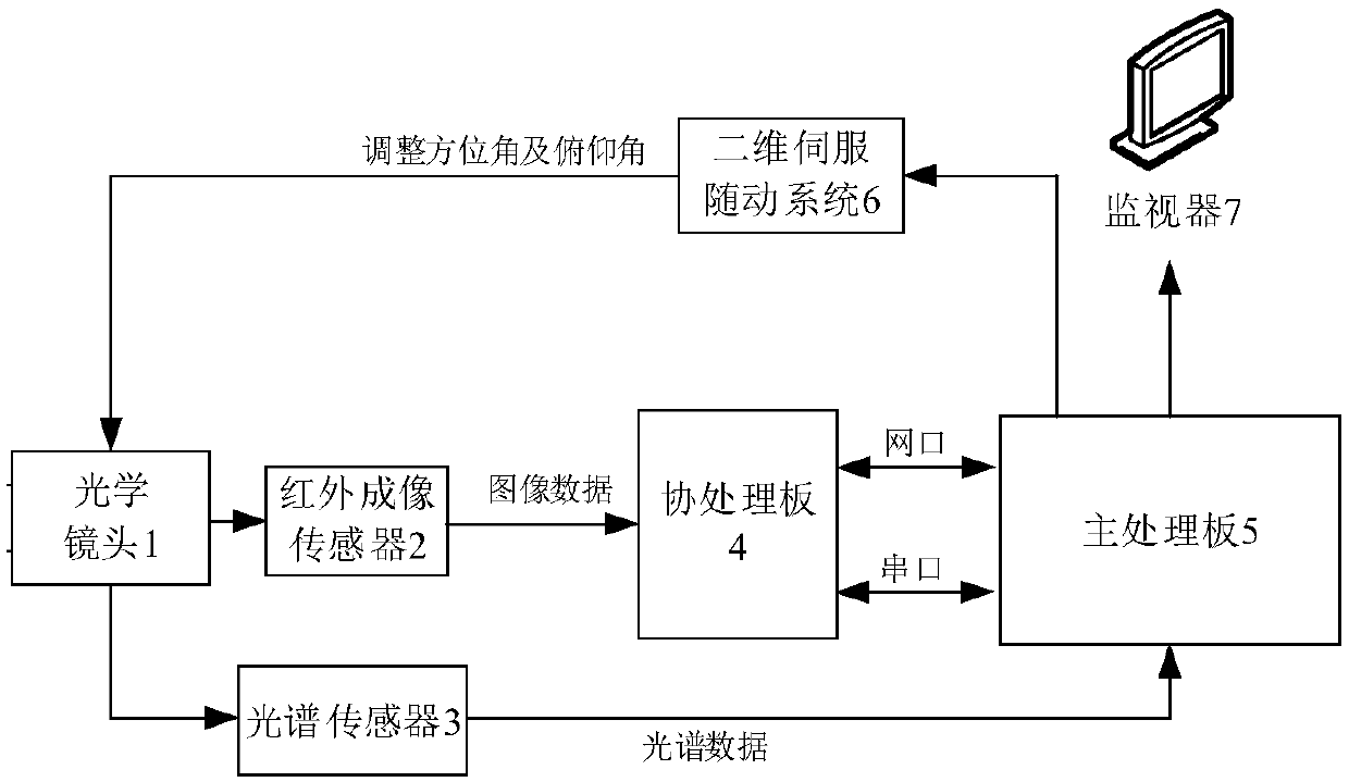
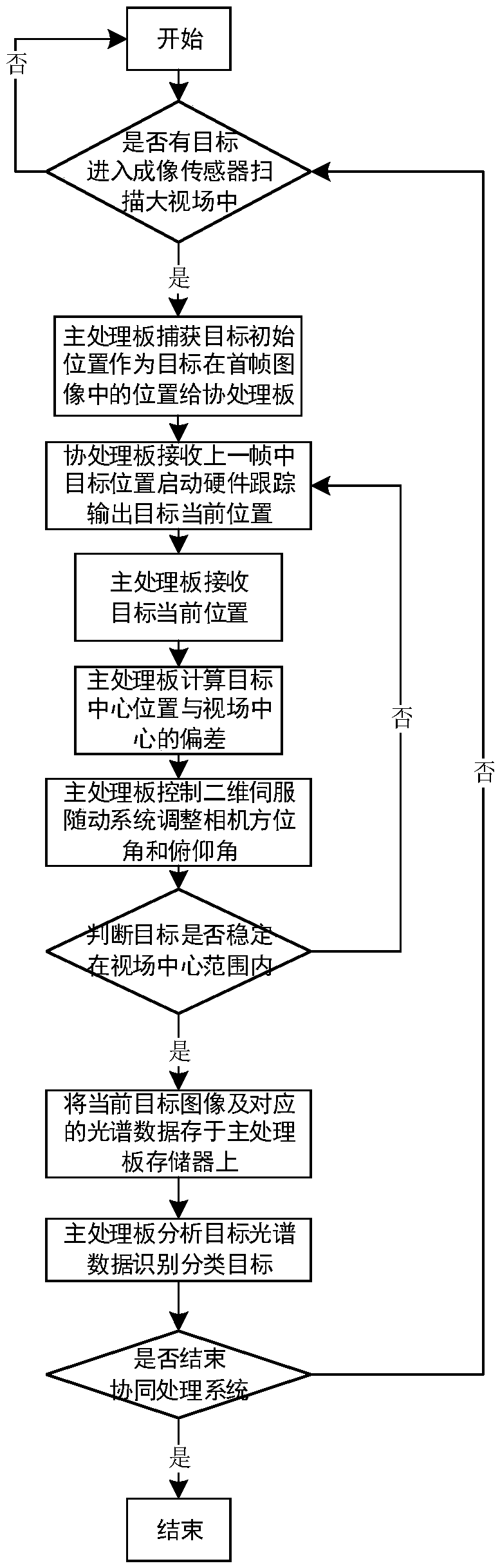
[0047] The map collaborative real-time processing system provided by the present invention, the system will automatically scan and capture the moving target in the field of view of the imaging sensor, and obtain the current position of the target through hardware tracking, and adjust the azimuth and pitch angle of the optical lens in real time through the two-dimensional servo servo system , so ...
PUM
 Abstract
Description
Claims
Application Information