Accessibility Analysis Method of Medical Facilities Based on Vehicle Trajectory Data and Population Distribution
A technology of population distribution and vehicle trajectory, applied in the field of geographic information science, can solve problems such as ignoring the rationality of the layout and selecting the friction coefficient, and achieve the effect of improving accuracy and operability
- Summary
- Abstract
- Description
- Claims
- Application Information
AI Technical Summary
Problems solved by technology
Method used
Image
Examples
no. 1 example
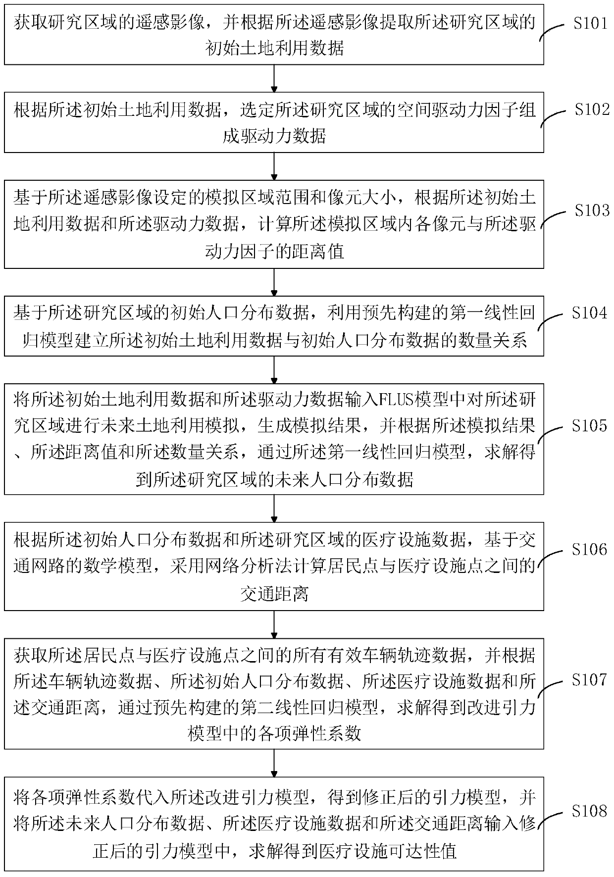
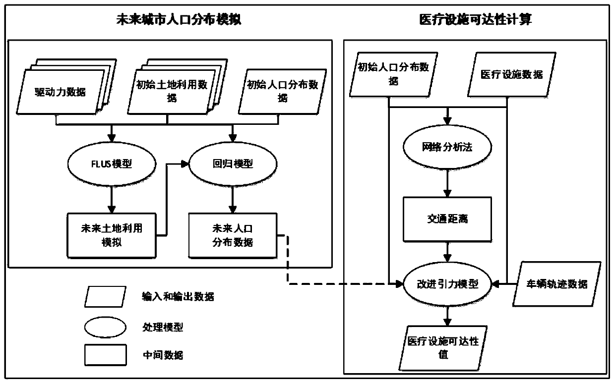
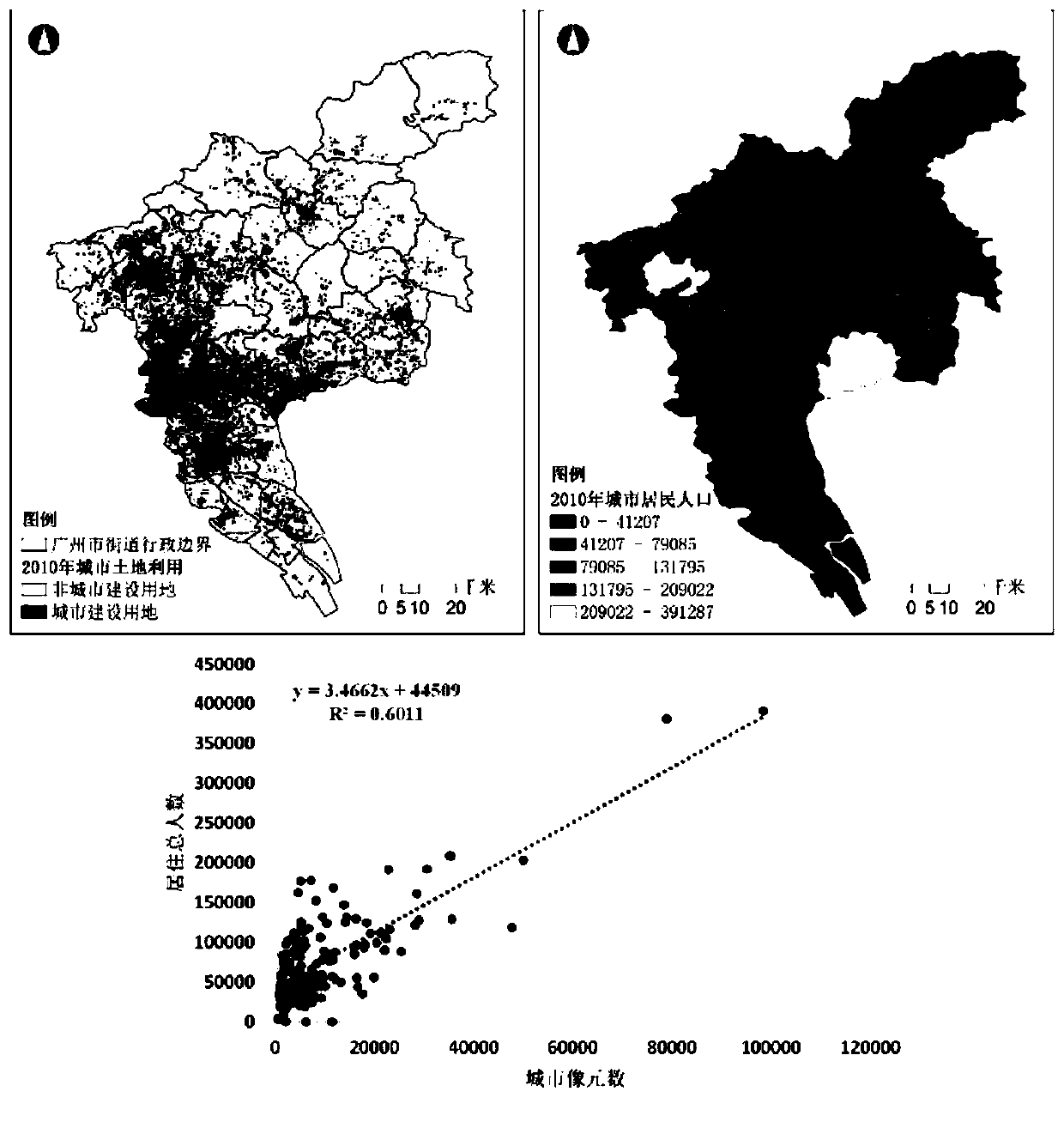
[0050] In this embodiment, the research object of this embodiment is the central urban area delineated in the "Guangzhou City Master Plan (2011-2020)", including Liwan, Yuexiu, Tianhe, Haizhu, Baiyun District, south of the North Second Ring Expressway The area of , with an area of 501.76 square kilometers, contains 98 town (street) spatial units. This example is divided into two steps: future population simulation and facility accessibility calculation. Since urban socioeconomic planning and infrastructure construction often focus on the overall layout and development of the city, in the first step, the entire city of Guangzhou was chosen as the research scope for simulation. , and then cut the simulation results to be consistent with the scope of the study area; considering that urban medical resources are concentrated in large general hospitals with large scale, complete medical facilities, sufficient medical staff and advanced technology, and patients who take taxis usua...
PUM
 Abstract
Description
Claims
Application Information
 - R&D
- Intellectual Property
- Life Sciences
- Materials
- Tech Scout
- Unparalleled Data Quality
- Higher Quality Content
- 60% Fewer Hallucinations
Browse by: Latest US Patents, China's latest patents, Technical Efficacy Thesaurus, Application Domain, Technology Topic, Popular Technical Reports.
© 2025 PatSnap. All rights reserved.Legal|Privacy policy|Modern Slavery Act Transparency Statement|Sitemap|About US| Contact US: help@patsnap.com


