Global multi-target all-day real-time monitoring system and method

A real-time monitoring system and real-time monitoring technology, applied in the field of satellite optical remote sensing, can solve the problems of limited application, low high-orbit resolution, and the orbit revisit period cannot meet the needs of real-time monitoring, so that the constellation uses fewer satellites and saves manpower. The effect of material resources

Active Publication Date: 2018-08-24
BEIJING RES INST OF SPATIAL MECHANICAL & ELECTRICAL TECH
View PDF6 Cites 4 Cited by
  • Summary
  • Abstract
  • Description
  • Claims
  • Application Information

AI Technical Summary

Problems solved by technology

[0003] The technical problem to be solved by the present invention is: to overcome the deficiencies of the prior art, to provide a global multi-target all-time real-time monitoring system and method, to realize the simultaneous implementation of all-weather and all-weather video-like real-time monitoring for global multi-targets, and to solve the problems based on conventional Technical geostationary orbit monitoring low orbit cannot cover the whole world, high orbit resolution is low and application is limited; and other orbit revisit cycles cannot meet real-time monitoring needs and other problems

Method used


Image

  • Global multi-target all-day real-time monitoring system and method
  • Global multi-target all-day real-time monitoring system and method
  • Global multi-target all-day real-time monitoring system and method

Examples


Embodiment Construction

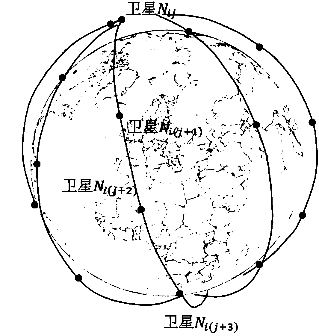
[0044] Mobility Carrier Module Design

[0045] Realization of satellite dynamic imaging

[0046] Most of the existing research is based on the traditional static imaging method, that is, the imaging method of the satellite's directional push-broom to the ground. The satellite does not perform imaging during the attitude maneuvering process, the spatial orientation of the image plane is fixed to the ground, and the push-broom speed of the camera on the ground surface is consistent with the speed direction of the sub-satellite point. On-the-fly imaging is to adjust the direction of the optical axis in real time through the maneuvering of the attitude, which can realize the imaging task that the direction of the optical axis to the ground is constantly changing. The calculation formula is:

[0047]

[0048] In the formula, is the coordinates of the ground point in the WGS84 coordinate system; [X GPS Y GPS Z GPS ] T is the position coordinate of the satellite in the G...


PUM


Abstract

The invention belongs to the field of optical remote sensing of satellites, and discloses a global multi-target all-day real-time monitoring system and method. The system comprises a motorized carriermodule, an image acquisition module, and a ground center module, wherein the motorized carrier module consists of 24 satellites uniformly distributed on 4 orbital planes; and the local time of a satellite ascending node is 10:30, and the height of an orbit is a sun-synchronous orbit. The system can simultaneously monitor multiple targets in real time and obviously improve the time resolution of photographic observation, so that a real-time monitoring effect similar to a video is achieved; and furthermore, by optimal arrangement of remote sensing constellations, customization of multiple observation targets by a user, and motorized control of an attitude of a satellite covering all the targets, all-day video-similar real-time monitoring can be simultaneously performed on global multiple targets.

Description

technical field [0001] The invention belongs to the field of satellite optical remote sensing, and relates to a global arbitrary multi-target all-time real-time monitoring system and method based on imaging in motion. Background technique [0002] Space-based real-time monitoring. At present, only the geostationary orbit can realize all-day monitoring of fixed targets, and the orbit coverage and spatial resolution are limited. Due to the lack of agile maneuverability of existing remote sensing satellites, if a common sun-synchronous orbit is used to achieve a 10-minute revisit period for equatorial targets, at least 20 satellites are needed, and the time resolution of 10 minutes obviously does not meet the real-time monitoring requirements. In order to achieve global observation coverage and a temporal resolution of seconds, hundreds of satellites must be needed according to the traditional imaging mode, which will occupy a large amount of space resources and cause a large a...

Claims


Application Information

Patent Timeline
Patent Type & Authority Applications(China)
IPC IPC(8): H04B7/185H04N5/225
CPCH04B7/1851H04B7/18517H04N23/55H04N23/54
Inventor 吴俊李娜许云飞李玲隋叶叶程少园孙世君
Owner BEIJING RES INST OF SPATIAL MECHANICAL & ELECTRICAL TECH
Why Eureka
Try Eureka