Satellite-borne laser height measuring instrument footprint positioning method based on passive target

A laser altimeter and positioning method technology, applied in radio wave measurement systems, instruments and other directions, can solve problems such as inability to implement, inability to determine the center position of the spot footprint, and non-unique echo waveforms

Inactive Publication Date: 2018-09-11
WUHAN UNIV +1
View PDF12 Cites 10 Cited by
  • Summary
  • Abstract
  • Description
  • Claims
  • Application Information

AI Technical Summary

Problems solved by technology

If the selected area is an approximately flat surface, such as a desert area, the echo pulse signal in this area recorded by the altimeter is similar to the transmitted pulse, and they are both approximately Gaussian pulses, and there is a huge gap between the echo signals in the area...

Method used


Image

  • Satellite-borne laser height measuring instrument footprint positioning method based on passive target
  • Satellite-borne laser height measuring instrument footprint positioning method based on passive target
  • Satellite-borne laser height measuring instrument footprint positioning method based on passive target

Examples


Embodiment Construction

[0027] In order to make the object, technical solution and advantages of the present invention clearer, the present invention will be further described in detail below in combination with specific implementation cases and with reference to the accompanying drawings.

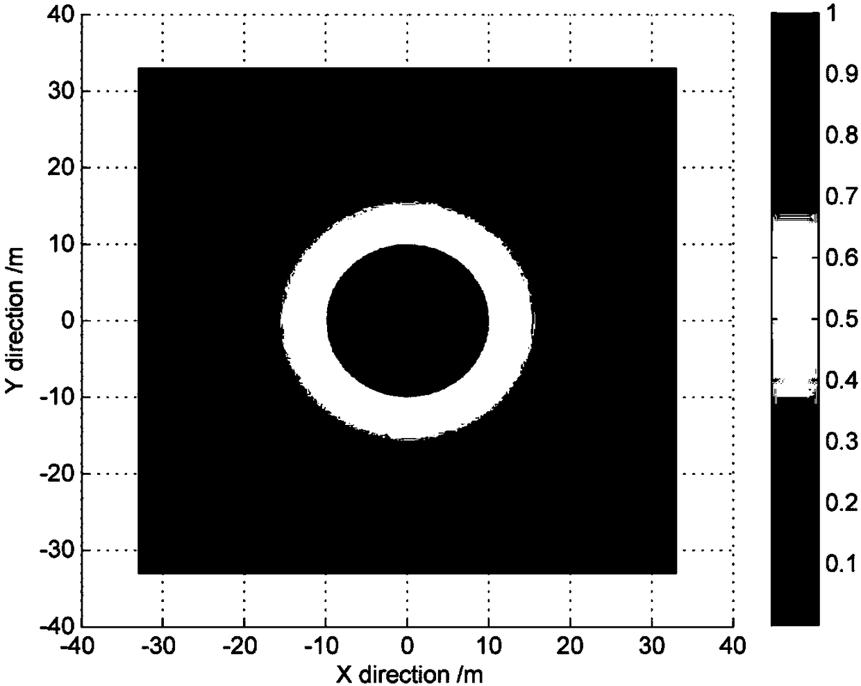
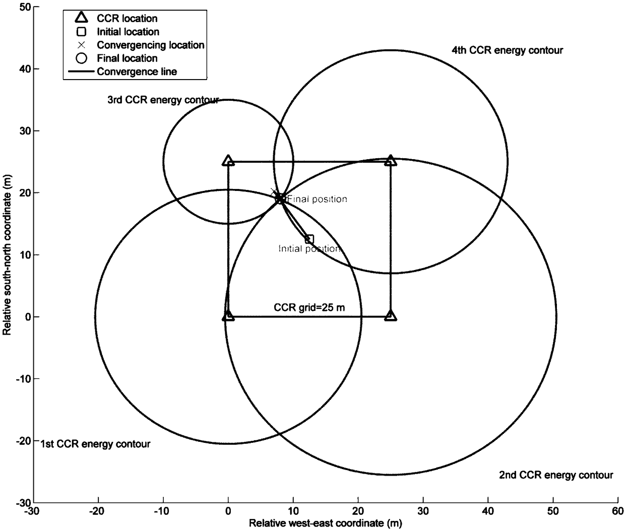
[0028] The invention provides a method for locating footprints of a spaceborne laser altimeter based on a passive target. By arranging a corner reflector array in a flat terrain area, marking information is added to the echo signal of the measured target to obtain marked information. After the waveform is obtained, through waveform analysis, the CCR reflected energy contour circle is extracted and combined with the steepest descent method to locate the footprint. During specific implementation, the automatic operation process can be realized through computer software technology. The embodiment process includes the following steps:

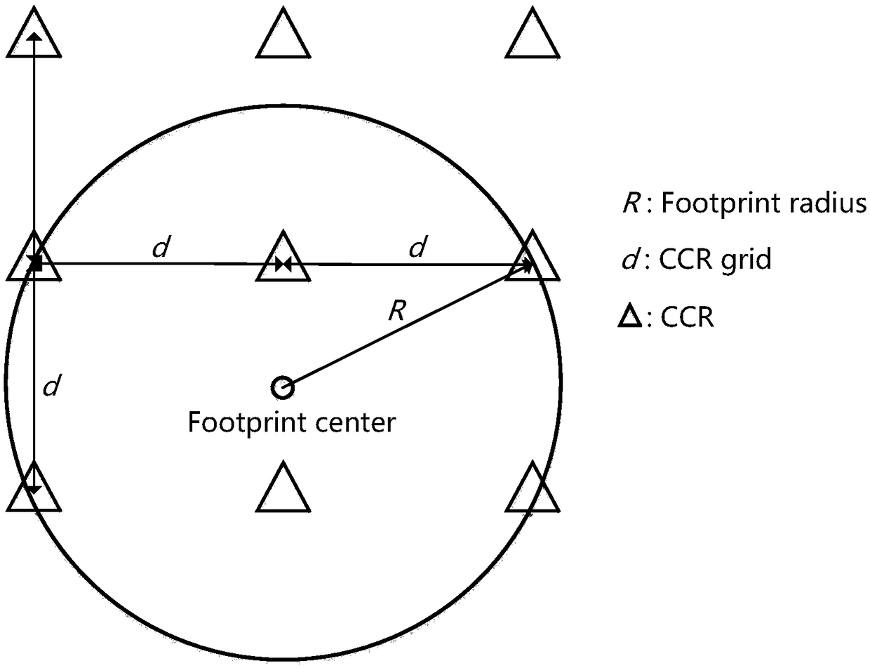
[0029] Step 1. Design corner reflection for layout

[0030] The size of the CCR...


PUM


Abstract

The invention comprises a satellite-borne laser height measuring instrument footprint positioning method based on a passive target, solving the problem that echo signals of a flat terrain area are high in similarity by arranging an angle reflector array in the flat terrain area to mark the target echo to be measured in the flat terrain area, so that the high-precision positioning of the height measurement instrument footprint can be realized in a manner of waveform analysis in the flat terrain area, and the authenticity verification of the footprint position which is resolved by the height measurement instrument is finally realized. The method comprises angle reflector caliber design, angle reflector layout scheme, CCR energy contour line circle extraction, and footprint center extractionbased on a steepest descent method. The system includes a CCR caliber calculation module, a CCR layout scheme module and a CCR-based footprint positioning module. According to the technical scheme, the positioning of the height measurement instrument footprint can be achieved through the waveform analysis mode in the flat terrain area.

Description

technical field [0001] The invention relates to a method for locating footprints of a spaceborne laser altimeter based on a passive target, in particular to a method for locating footprints of a spaceborne laser altimeter based on a passive target and a system technical solution for locating the position of footprints, Furthermore, the method for authenticating the footprint position calculated by the space-borne laser altimeter belongs to the technical field of the authenticity testing field of the footprint position of the space-borne laser altimeter. Background technique [0002] The space-borne laser altimeter for earth observation is a space-based high-precision laser measurement device, which can obtain the distance value between the altimeter and the measured surface according to the transit time of the emitted laser pulse, combined with the high-precision attitude determination system The measured laser pointing and satellite attitude information can be used to obtai...

Claims


Application Information

Patent Timeline
IPC IPC(8): G01S7/497
Inventor 李松马跃余峰周辉田昕杨晋陵易洪
Owner WUHAN UNIV
Why Eureka
Try Eureka