
A Shortest Path Planning Method Based on Unidirectional Search Model

A shortest path and model technology, applied in the directions of road network navigators, navigation, instruments, etc., can solve problems such as difficulty in meeting the requirements of fast path planning, huge data files, and reduced algorithm operation efficiency, achieving a small number of search nodes and computing The effect of high efficiency and improved computing efficiency

Active Publication Date: 2021-05-14
BEIJING INSTITUTE OF TECHNOLOGYGY
View PDF3 Cites 0 Cited by
  • Summary
  • Abstract
  • Description
  • Claims
  • Application Information

AI Technical Summary

Problems solved by technology

Therefore, if the adjacency matrix is ​​used to store road node and boundary value information, it will inevitably generate huge data files, which will reduce the operating efficiency of the algorithm, and it is difficult to meet the requirements of fast path planning for modern urban road traffic network

Method used


Image

  • A Shortest Path Planning Method Based on Unidirectional Search Model
  • A Shortest Path Planning Method Based on Unidirectional Search Model
  • A Shortest Path Planning Method Based on Unidirectional Search Model

Examples


Embodiment Construction

[0029] The present invention will be described in detail below with reference to the accompanying drawings and examples.

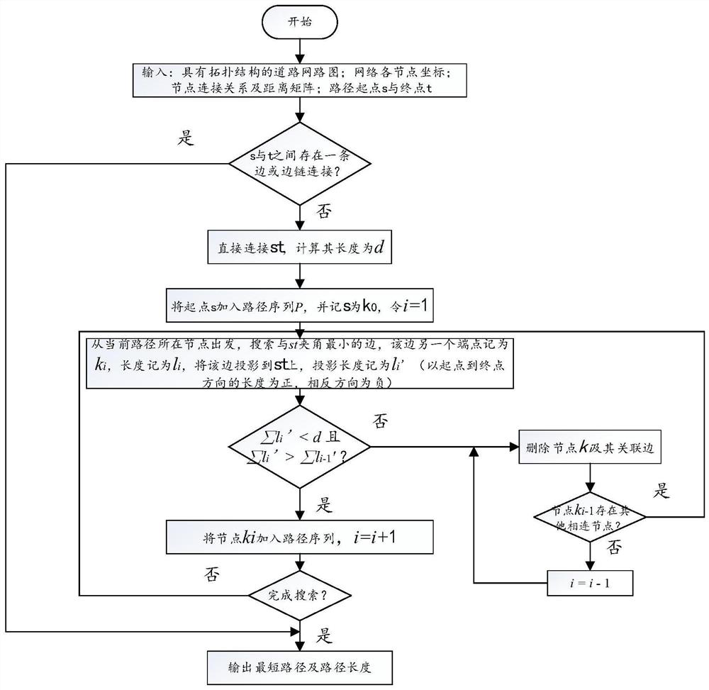
[0030] The present invention provides a shortest path planning method based on a unidirectional search model, such as figure 1 As shown, it can quickly solve the shortest path in the road network under the condition of given start point and end point, and has good real-time performance.

[0031] The input is a road network graph with a topological structure, which includes the coordinates of each node in the network, a weight matrix representing the connection relationship and distance of each node; or specify the nodes that must be passed or the roads that are prohibited.

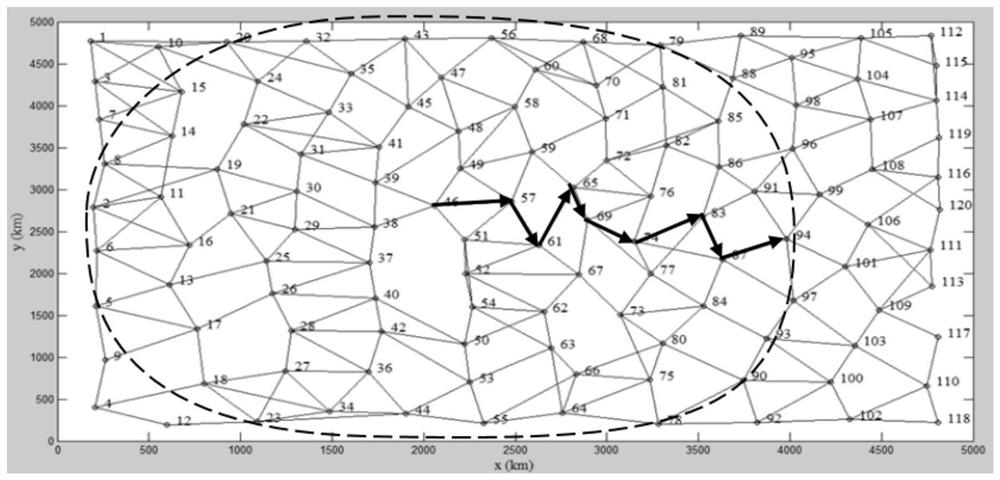
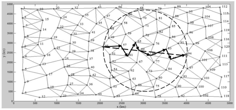
[0032] In this example, a medium-scale road network diagram with 120 nodes is selected, and a shortest path planning method based on a one-way search model is described in detail. road network diagram Figure 4 As shown, the starting point is defined as node 16, and the end point is ...


PUM


Abstract

The invention provides a shortest path planning method based on a one-way search model. According to the geometric principle of the shortest straight line segment between two points, in the search process, the path is close to a straight line, and the classic Dijkstra algorithm takes the starting point as the center, Compared with the method of layer-by-layer outward expansion, the number of search nodes is small, the memory is small, and the calculation efficiency is high. In the road network with more than 500 nodes, the calculation efficiency is increased by more than 90%; and through parameter settings, in the planning During the path process, avoiding forbidden sections or passing nodes that must be passed makes the method more suitable for path planning in actual traffic conditions.

Description

technical field [0001] The invention belongs to the technical field of path planning, and in particular relates to a shortest path planning method based on a unidirectional search model. Background technique [0002] Path planning is the process of finding the best driving route from the starting point to the destination before or during the driving of the vehicle based on the road network with topological structure. It is a specific application of the shortest path problem in the vehicle navigation system. Path planning has a wide range of applications in many fields, such as: path planning of robotic manipulators, autonomous collision-free movement of robots, autonomous obstacle avoidance flight of drones, traveling salesman problem, vehicle problem in logistics management, and similar Resource management and configuration issues, etc. In daily life, path planning can be used for GPS navigation, road planning based on GPS system, urban road network planning and navigation,...

Claims


Application Information

Patent Timeline
Patent Type & Authority Patents(China)
IPC IPC(8): G01C21/34
CPCG01C21/3446
Inventor 刘彤沈宏梁刘冬宇周培德邓志红肖烜
Owner BEIJING INSTITUTE OF TECHNOLOGYGY
Learn More