A landslide monitoring and early identification method based on multi-data-source SBAS technology
A multi-data source, early identification technology, applied in measurement devices, radio wave measurement systems, radio wave reflection/re-radiation, etc. question
- Summary
- Abstract
- Description
- Claims
- Application Information
AI Technical Summary
Problems solved by technology
Method used
Image
Examples
Embodiment
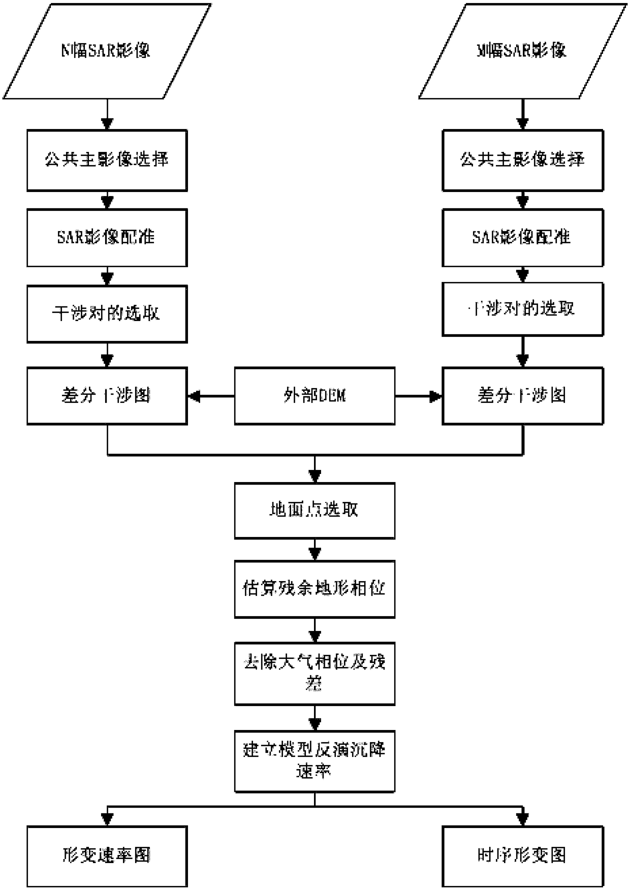
[0078] Example: such as figure 1 As shown, a landslide monitoring and early identification method in Aba Prefecture, Sichuan based on multi-data source SBAS technology, including the following steps:
[0079] Step 1. Obtain multiple SAR image data covering the same period of time in the monitoring range;
[0080] Step 2, selection of public main image;
[0081] Step 3, SAR image registration;
[0082] Step 4, selection of interference pairs;
[0083] Step 5, generation of differential interferogram;
[0084] Step 6. Select the stable point on the ground;
[0085] Step 7. Estimating the residual terrain phase;
[0086] Step 8, remove atmospheric phase and residual;
[0087] Step 9: Build a model to invert the settlement rate.
[0088] In step 1 of this embodiment, for mountainous areas, under the conditions of large vegetation coverage and frequent geological disasters such as landslides and earthquakes, in order to monitor large-scale deformation of the surface, and als...
PUM
 Abstract
Description
Claims
Application Information
 - R&D
- Intellectual Property
- Life Sciences
- Materials
- Tech Scout
- Unparalleled Data Quality
- Higher Quality Content
- 60% Fewer Hallucinations
Browse by: Latest US Patents, China's latest patents, Technical Efficacy Thesaurus, Application Domain, Technology Topic, Popular Technical Reports.
© 2025 PatSnap. All rights reserved.Legal|Privacy policy|Modern Slavery Act Transparency Statement|Sitemap|About US| Contact US: help@patsnap.com


