
GIS-based aviation meteorological information publishing method and system

A meteorological information and meteorological technology, applied in meteorology, weather condition forecasting, measuring devices, etc., can solve the problems of data lag, affecting the timely and accurate formulation of air routes, and achieve the effect of accurate meteorological data

Inactive Publication Date: 2019-01-08
浩亚信息科技有限公司
View PDF1 Cites 1 Cited by
  • Summary
  • Abstract
  • Description
  • Claims
  • Application Information

AI Technical Summary

Problems solved by technology

[0003] In order to overcome the deficiencies in the prior art, one of the purposes of the present invention is to provide a GIS-based aviation weather information release method, which can solve the problem of only relying on the data of the weather center or causing data lag, thereby affecting the airport staff's awareness of the route. Timely and accurate formulation of questions
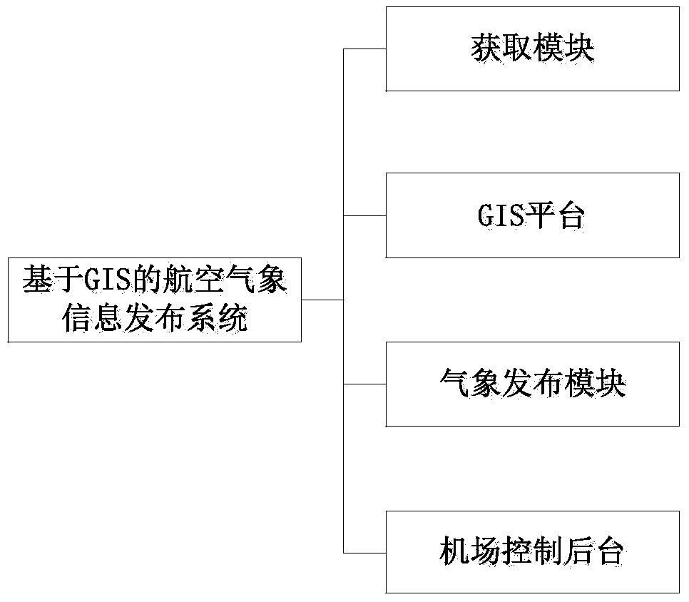
[0004] The second object of the present invention is to provide a GIS-based aeronautical weather information release system, which can solve the problem that only the data from the meteorological center usually or cause data lag, thereby affecting the timely and accurate formulation of the route by the airport staff

Method used


Image

  • GIS-based aviation meteorological information publishing method and system
  • GIS-based aviation meteorological information publishing method and system

Examples


Embodiment Construction

[0025] Below, the present invention will be further described in conjunction with the accompanying drawings and specific implementation methods. It should be noted that, under the premise of not conflicting, the various embodiments described below or the technical features can be combined arbitrarily to form new embodiments. .

[0026] GIS (Geographic Information System or Geo-Information system, GIS) is a geographic information system. The GIS platform is a specific and very important spatial information system that can process spatial data according to geographic coordinates or spatial positions. GIS technology transforms maps into This unique visual effect and geographical analysis function are integrated with general database operations (such as query and statistical analysis, etc.), so GIS technology can be widely used in forecasting the weather information of airport routes. The present invention proposes a kind of GIS-based aeronautical weather information dissemination...


PUM


Abstract

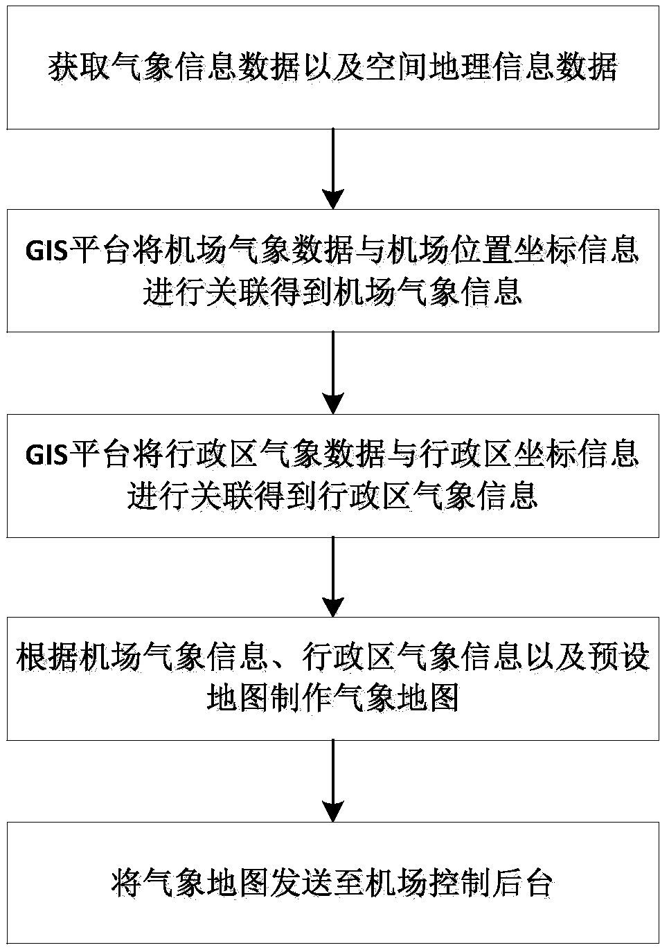
The invention provides a GIS-based aviation meteorological information publishing method. The method comprises the following steps of: obtaining meteorological information data and spatial geographicinformation data, wherein the meteorological information data comprises airport meteorological data, administrative district meteorological data, and the spatial geographic information data comprisesairport position coordinate information and administrative district coordinate information; associating the airport meteorological and the airport position coordinate information by a GIS platform toobtain airport meteorological information; associating the administrative district meteorological data and the administrative district coordinate information by the GIS platform to obtain administrative district meteorological information; making a meteorological map according to the airport meteorological information, the administrative district meteorological information and a preset map; and sending the meteorological map to an airport control background. According to the GIS-based aviation meteorological information publishing method, the obtained meteorological data is more accurate, andthe meteorological map is made to ensure that workers at the airport control background can know meteorological information on air lines more intuitionally.

Description

technical field [0001] The invention relates to the field of weather information release, in particular to a GIS-based aviation weather information release method and system. Background technique [0002] With the development of the national economy, my country's aviation industry has also developed at a high speed, but the current aircraft must detect the weather in the route area when flying. If there is bad weather, the flight path or flight plan will be formulated in time to avoid Bad weather affected flights and reduced waiting times for passengers. The current weather detection for the route is based on the ground control platform to predict the weather of the route according to the data of each local meteorological center. However, this kind of data only based on the meteorological center usually leads to data lag, which affects the timely and accurate formulation of the route by the airport staff. Contents of the invention [0003] In order to overcome the deficie...

Claims


Application Information

Patent Timeline
Patent Type & Authority Applications(China)
IPC IPC(8): G01W1/10
CPCG01W1/10
Inventor 林嘉豪张振永袁兆箐王沁波舒展陈建宇
Owner 浩亚信息科技有限公司
Learn More