Subarea assessment and early warning method and system of geological disasters of power transmission lines
A technology for transmission lines and geological disasters, applied in the direction of alarms, instruments, etc., can solve the problems of unscientific risk assessment system, complicated occurrence factors and process, and achieve the effect of accurate assessment results and improved accuracy.
- Summary
- Abstract
- Description
- Claims
- Application Information
AI Technical Summary
Problems solved by technology
Method used
Image
Examples
Embodiment Construction
[0048] In order to better understand the present invention, the content of the present invention will be further described below in conjunction with the accompanying drawings and examples.
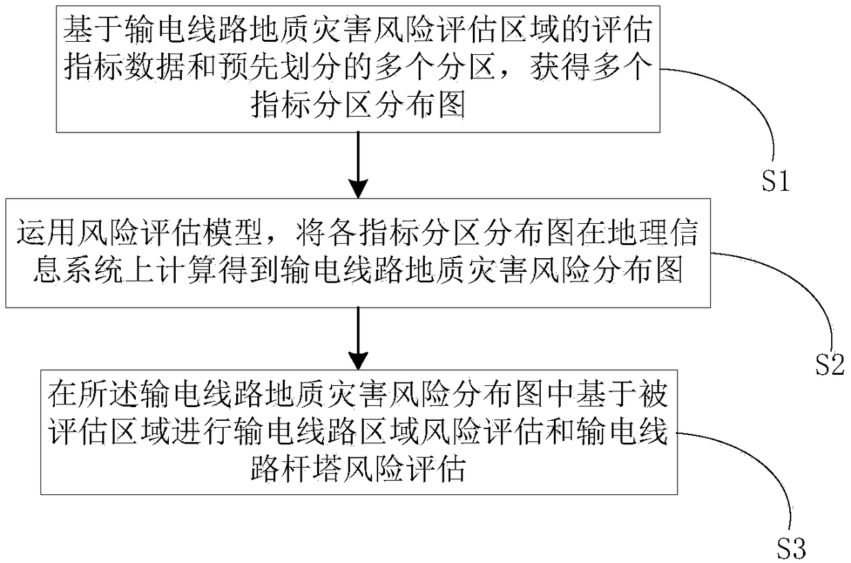
[0049] figure 1 A flow chart of a regional assessment and early warning method for transmission line geological hazards provided by the present invention, such as figure 1 shown, including:
[0050] Step S1, based on the evaluation index data of the geological hazard risk assessment area of the transmission line and the pre-divided multiple partitions, a distribution map of multiple index partitions is obtained;
[0051] Step S2, using the risk assessment model to calculate the regional distribution map of each index on the geographic information system to obtain the distribution map of geological hazard risk of the transmission line;
[0052]Step S3 , performing regional risk assessment of the transmission line and tower risk assessment of the transmission line based on the evaluated ...
PUM
 Abstract
Description
Claims
Application Information
 - R&D
- Intellectual Property
- Life Sciences
- Materials
- Tech Scout
- Unparalleled Data Quality
- Higher Quality Content
- 60% Fewer Hallucinations
Browse by: Latest US Patents, China's latest patents, Technical Efficacy Thesaurus, Application Domain, Technology Topic, Popular Technical Reports.
© 2025 PatSnap. All rights reserved.Legal|Privacy policy|Modern Slavery Act Transparency Statement|Sitemap|About US| Contact US: help@patsnap.com


