
A method for obtaining the distance of a great circle route

An acquisition method, a technology of a circular route, which is applied in the field of acquisition of great circle route distance, can solve problems such as accuracy errors, achieve wide applicability, high precision, and improve the effect of distance calculation accuracy

Active Publication Date: 2021-01-19
XIAN AVIATION COMPUTING TECH RES INST OF AVIATION IND CORP OF CHINA
View PDF4 Cites 0 Cited by
  • Summary
  • Abstract
  • Description
  • Claims
  • Application Information

AI Technical Summary

Problems solved by technology

[0008] In order to solve the accuracy error problem caused by the algorithm itself in the high latitude and high latitude long-distance calculation of the method one and method two that are adopted when obtaining the aircraft route distance in the existing flight management system, the great circle route distance acquisition method provided by the present invention considers the earth According to the actual situation, the flattening rate of the earth is introduced into the calculation to realize the real-time dynamic calculation of the earth's radius. According to the difference in latitude and longitude of the calculation point, the earth's radius at the local location is calculated in real time, and then the distance of the great circle route is calculated, which solves the problem of high-latitude long-distance and ultra-long-distance The accuracy loss during calculation is consistent with the actual situation and improves the calculation accuracy

Method used

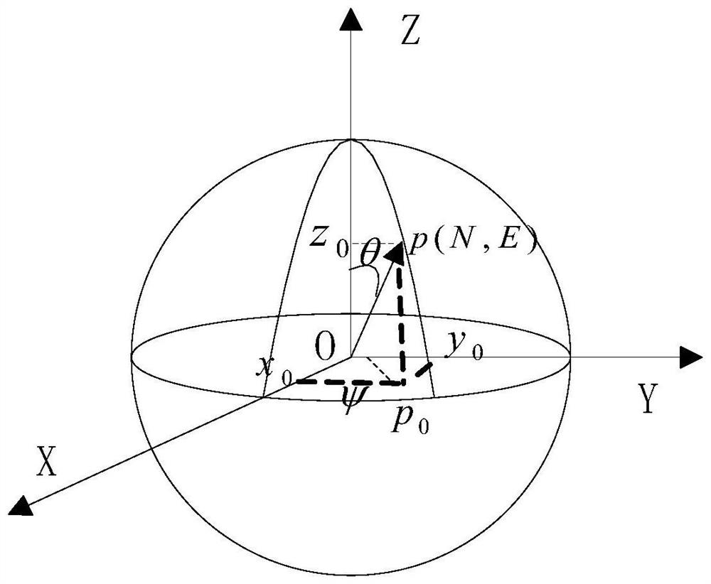

Image

  • A method for obtaining the distance of a great circle route
  • A method for obtaining the distance of a great circle route
  • A method for obtaining the distance of a great circle route

Examples


Embodiment Construction

[0040] Below in conjunction with accompanying drawing, method of the present invention will be further described:

[0041] A method for acquiring the distance of a great circle route, the specific execution steps are as follows:

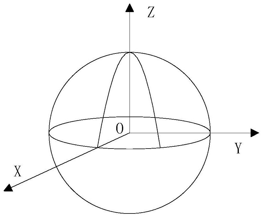
[0042] Step 1: First establish an ellipsoidal coordinate system for the earth: with the center of the earth as the origin, establish an O-XYZ coordinate system. The equator is the basic plane, and an axis perpendicular to the equatorial plane and passing through the center of the earth is called the Z axis, which points to the North Pole as positive; the axis which coincides with the prime meridian plane and the equatorial plane is called the X axis, which is positive to the east, and the Y axis and XZ The plane is perpendicular to the right-hand rule. like figure 1 shown.

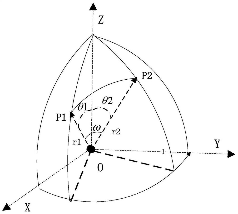
[0043] Step 2: Calculate the corresponding radii R1 and R2 of the starting point P1 and the ending point P2 of the flight segment in the ellipsoidal coordinate system;

[004...


PUM


Abstract

The invention belongs to the field of flight management system design, and relates to a great circle route distance calculation improved method, which comprises the following steps of: 1, establishingan ellipsoidal surface O-for the earth; an XYZ coordinate system; 2) calculating corresponding radiuses R1 and R2 of a starting point P1 and a terminating point P2 of a navigation segment under the ellipsoidal coordinate system; (3) obtaining coordinate vectors of the starting point P1 and the ending point P2 under the ellipsoidal coordinate system according to the corresponding radiuses R1 and R2 of the starting point P1 and the ending point P2 under the ellipsoidal coordinate system; (4), solving a radian included angle [omega] of the point P1 and the point P2 by means of cross multiplication according to the coordinate vectors of the ellipsoidal surfaces of the starting point P1 and the ending point P2; (5) solving a median radius; and (6) calculating the distance D from the starting point P1 to the ending point P2. According to the method, the precision loss during high-latitude long-distance and ultra-long-distance calculation is solved, the method conforms to the actual situation, and the calculation precision is greatly improved.

Description

technical field [0001] The invention belongs to the field of airborne flight management systems, and relates to a method for acquiring great-circle route distance. Background technique [0002] There are two methods for calculating the distance in the existing flight management system: the distance refers to the distance between an aircraft flying from one waypoint to another waypoint. There are two traditional distance calculation methods: [0003] Traditional method 1: approximate distance calculation by plane coordinates (latitude and longitude coordinates): approximately consider two points P1 and P2 on the plane, and set the latitude and longitude coordinates of the two points as P1 (N1, E1) and P2 (N2, E2) respectively. Subtract the square of the subtraction from the latitude and subtract the sum of the squares, open the root sign, and then multiply by the distance value corresponding to each 1 degree of latitude and longitude, set it as a constant coefficient η, and ...

Claims


Application Information

Patent Timeline
Patent Type & Authority Patents(China)
IPC IPC(8): G06F16/29G06F17/15
Inventor 王亮亮薛芳芳米耘锋葛声曹琳李玥
Owner XIAN AVIATION COMPUTING TECH RES INST OF AVIATION IND CORP OF CHINA
Learn More