Map updating control method and system for visual robots

A technology of map update and control method, which can be applied to instruments, computer parts, computing and other directions, and can solve the problems of increasing the computational load of machines, reducing the working efficiency of robots, and low learning ability of robots.

Active Publication Date: 2019-07-05
AMICRO SEMICON CORP
View PDF7 Cites 8 Cited by
  • Summary
  • Abstract
  • Description
  • Claims
  • Application Information

AI Technical Summary

Problems solved by technology

Then, in the scene where the environment of the robot in the same working area does not change, it is of little significance to rebuild the map or update the historical map. Instead, it increases the amount of calculation of the machine, which in turn reduces the working efficiency of the robot, making

Method used


Image

  • Map updating control method and system for visual robots
  • Map updating control method and system for visual robots
  • Map updating control method and system for visual robots

Examples


Embodiment Construction

[0017] The technical solutions in the embodiments of the present invention will be described in detail below with reference to the drawings in the embodiments of the present invention.

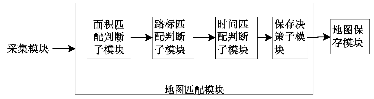
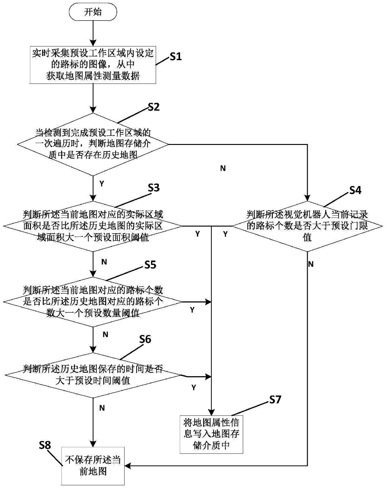
[0018]An embodiment of the present invention provides a map update control method for a visual robot. The map update control method is used to control the visual robot to collect images of landmarks set in a preset working area in real time, wherein the image information of the landmarks includes the features of the landmark images. The point information is mainly collected by the image acquisition sensor installed on the body of the vision robot. After processing, the actual distance information between the road sign and the vision robot can be obtained. It should be noted that the road signs are used to describe the artificially set markers in the environment. The map update control method includes the following steps:

[0019] Step 1. Control the visual robot to traverse the preset working...


PUM


Abstract

The invention discloses a map updating control method and system for visual robots. The method includes the following steps: step 1, obtaining map attribute measurement data corresponding to a currentmap of a preset working area; step 2, judging whether the current map and a pre-stored historical map meet a preset matching degree according to the map attribute measurement data when that a visualrobot traverses the preset working area for one time is detected, determining to preserve the current map, otherwise, determining to not preserve the current map, and preserving the pre-stored historical map; and step3, writing map attribute information corresponding to the current map into a map storage medium to update the map attribute information corresponding to the historical map when determining to preserve the map attribute information corresponding to the current map. Thus, the familiar degrees of the robot on the working area can be enhanced, and the learning capabilities of the robot on the preset working area can be improved.

Description

technical field [0001] The invention belongs to the technical field of intelligent control, and in particular relates to a map update control method and a map update control system for a visual robot. Background technique [0002] The mobile robots currently on the market delete the historical map and start building the map again every time. This is also the characteristic of the slam algorithm. The full name of the slam algorithm is Simultaneous Localization and Mapping, which enables simultaneous positioning and real-time mapping. During the process of traversing tasks in the same working area, the robot often re-establishes the map, and does not save the original map after the new map is established, resulting in the failure of the information recorded in the original map. The historical map mentioned in this manual is equivalent to the aforementioned original map of . [0003] In this way, in the process of repeatedly navigating the same work area, the robot does not us...

Claims


Application Information

Patent Timeline
IPC IPC(8): G01C21/32
CPCG01C21/32G06V20/582G01C21/20G01C21/3826G06V10/74
Inventor 李明赖钦伟
Owner AMICRO SEMICON CORP
Why Eureka
Try Eureka