Open channel water delivery monitoring system based on multi-information fusion
A multi-information fusion and monitoring system technology, applied in the field of open channel water delivery monitoring systems based on multi-information fusion, can solve problems such as affecting the discharge capacity and difficult to measure accurately, and achieve the effect of ensuring accuracy and improving the monitoring system
- Summary
- Abstract
- Description
- Claims
- Application Information
AI Technical Summary
Problems solved by technology
Method used
Image
Examples
Embodiment 1
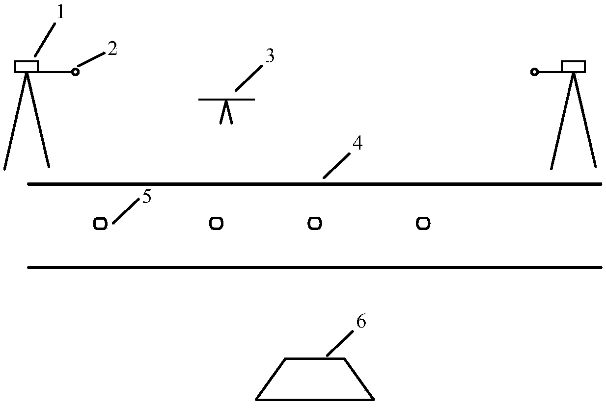
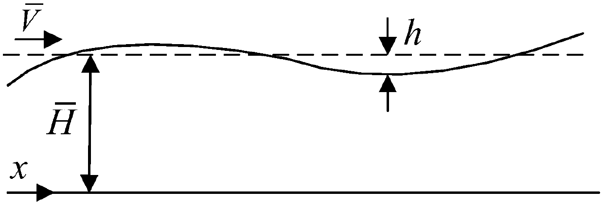
[0042] Such as Figure 1 to Figure 5As shown, the monitoring system of the open channel 4 water delivery system includes a camera 1, a water level gauge 2, a drone 3, a drifting buoy 5, and a main control machine 6. The drone 3 includes an anti-shake camera 1, a water level gauge 2, a positioning sensor, and an inertial measurement unit. Among them, the camera 1 is a CCD camera 1, and the water level gauge 2 adopts telemetry equipment. The CCD camera 1 is used to photograph the movement of the fluid in the open channel 4, and the water level gauge 2 is used to measure the height of the water level. Among them, the UAV 3 is equipped with an anti-shake camera 1, a small water level gauge, a positioning sensor GPS, an inertial measurement unit, and the like. The drifting buoy 5 includes a wave sensor, a positioning sensor GPS, an inertial measurement unit (including an acceleration sensor) and the like. The main control machine 6 mainly includes corresponding monitoring softwa...
Embodiment 2
[0049] Such as Figure 1 to Figure 5 As shown, the monitoring system of the open channel 4 water delivery system includes a camera 1, a water level gauge 2, a drone 3, a drifting buoy 5, and a main control machine 6. The drone 3 includes an anti-shake camera 1, a water level gauge 2, a positioning sensor, and an inertial measurement unit. Among them, the camera 1 is a CCD camera 1, and the water level gauge 2 adopts telemetry equipment. The CCD camera 1 is used to photograph the movement of the fluid in the open channel 4, and the water level gauge 2 is used to measure the height of the water level. Among them, the UAV 3 is equipped with an anti-shake camera 1, a small water level gauge, a positioning sensor GPS, an inertial measurement unit, and the like. The drifting buoy 5 includes a wave sensor, a positioning sensor GPS, an inertial measurement unit (including an acceleration sensor) and the like. The main control machine 6 mainly includes corresponding monitoring softw...
PUM
 Abstract
Description
Claims
Application Information
 - R&D
- Intellectual Property
- Life Sciences
- Materials
- Tech Scout
- Unparalleled Data Quality
- Higher Quality Content
- 60% Fewer Hallucinations
Browse by: Latest US Patents, China's latest patents, Technical Efficacy Thesaurus, Application Domain, Technology Topic, Popular Technical Reports.
© 2025 PatSnap. All rights reserved.Legal|Privacy policy|Modern Slavery Act Transparency Statement|Sitemap|About US| Contact US: help@patsnap.com


