Edge calculation-based high-precision map crowdsourcing updating system
An edge computing, high-precision technology, applied in the field of high-precision map crowdsourcing update system based on edge computing, can solve the problems of large data transmission volume and congestion at the vehicle end and central node, and achieve the goal of reducing delay and data volume Effect
- Summary
- Abstract
- Description
- Claims
- Application Information
AI Technical Summary
Problems solved by technology
Method used
Image

Examples
no. 1 example
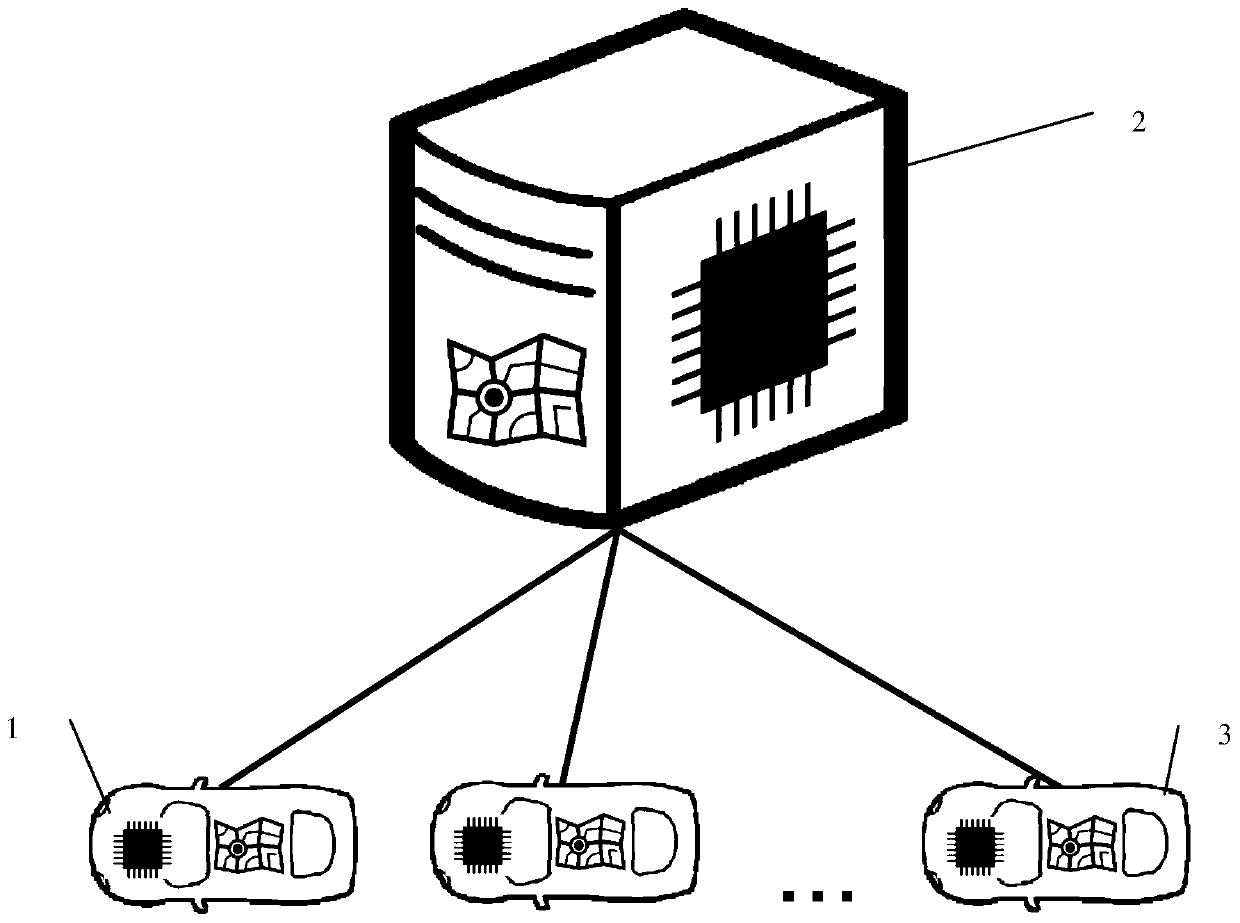
[0037] Such as figure 1 As shown, the high-precision map crowdsourcing update and release system based on edge computing includes at least one information collection terminal 1 , a central node 2 , and at least one map use terminal 3 .
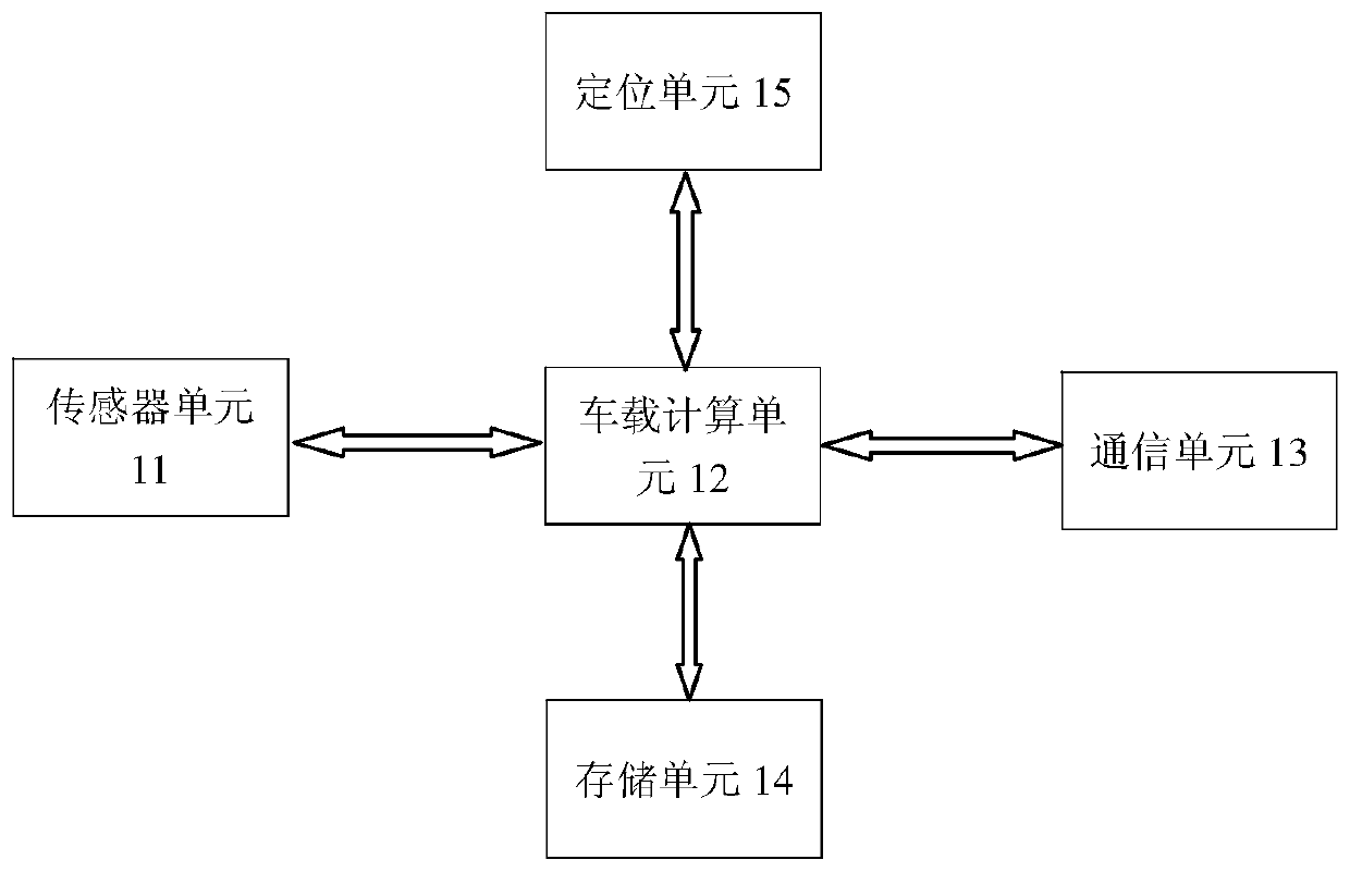
[0038] Information collection terminal 1 can be installed on, for example, a plurality of crowdsourcing vehicles, such as figure 2As shown, the information collection terminal 1 includes a sensor unit 11 , a vehicle-mounted computing unit 12 , a communication unit 13 , a storage unit 14 , and a positioning unit 15 . Wherein, the sensor unit 11 includes one or more sensors, which are used to collect traffic information such as roads and road conditions during the driving of the vehicle, the storage unit 14 is used to store the current version of the high-precision map, and the vehicle-mounted computing unit 12 is used to receive sensor The road information collected by the unit 11, and build a local high-precision map in the current field of ...
no. 2 example
[0048] Similar to Embodiment 1, the present invention provides a second embodiment, wherein the same features as Embodiment 1 will not be described here.
[0049] Since the high-precision map has the characteristics of local construction and local use, the one-layer architecture of the direct communication between the central node 3 and the information collection terminal 1 described in the first embodiment can be further expanded into a multi-layer architecture. One or more intermediate nodes 4 are added between the central node 3 and multiple information collection terminals 1 to be responsible for updating high-precision maps of local areas. Through the distributed architecture of computing node space, the delay of high-precision map update can be further reduced.
[0050] Such as Figure 5 As shown, compared with Embodiment 1, this embodiment adds one or more intermediate nodes 4 between the central node 3 and multiple information collection terminals 1 . The intermediat...
no. 3 example
[0052] Similar to Embodiment 1, the present invention provides a third embodiment, wherein the same features as Embodiment 1 will not be described here again.
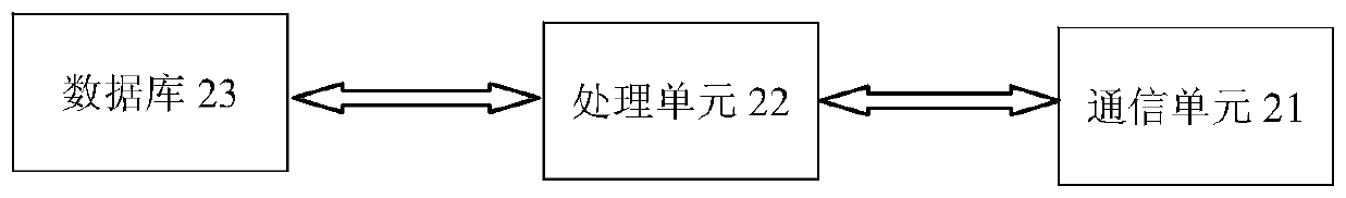
[0053] The difference from Embodiment 1 is that in this implementation, the vehicles can directly communicate with each other, and the first vehicle as the information collection terminal 1 can directly generate incremental map update data through its on-board computing unit 22, and update the incremental map Quantitative map update data is directly sent to the surrounding second vehicles as information collection terminal 1 and / or map use terminal 3 . And the second vehicle can send the incremental map update data to third vehicles around it.
[0054] Therefore, in a local area, the update of the high-precision map can be realized through communication between multiple vehicles without going through the central node 1 or the intermediate node 4, thereby further reducing the delay of updating the high-precision map.
...
PUM
 Abstract
Description
Claims
Application Information
 - Generate Ideas
- Intellectual Property
- Life Sciences
- Materials
- Tech Scout
- Unparalleled Data Quality
- Higher Quality Content
- 60% Fewer Hallucinations
Browse by: Latest US Patents, China's latest patents, Technical Efficacy Thesaurus, Application Domain, Technology Topic, Popular Technical Reports.
© 2025 PatSnap. All rights reserved.Legal|Privacy policy|Modern Slavery Act Transparency Statement|Sitemap|About US| Contact US: help@patsnap.com