Satellite altimetry data collinear processing method

A satellite altimetry and processing method technology, applied in the field of satellite altimetry data processing, can solve the problems of neglect and large errors, and achieve the effect of reducing the lack of data

Inactive Publication Date: 2019-08-30
CHINA UNIV OF PETROLEUM (EAST CHINA)
View PDF4 Cites 0 Cited by
  • Summary
  • Abstract
  • Description
  • Claims
  • Application Information

AI Technical Summary

Problems solved by technology

The reference orbit position obtained by the above method may be located at the edge of all orbits, and then the interpolation calculation error is large, and the observation points at many positions will be ignored

Method used


Image

  • Satellite altimetry data collinear processing method
  • Satellite altimetry data collinear processing method
  • Satellite altimetry data collinear processing method

Examples


Embodiment Construction

[0033] In order to make the purpose, content, and advantages of the present invention clearer, the specific implementation of the present invention will be described in further detail below in conjunction with the accompanying drawings and embodiments:

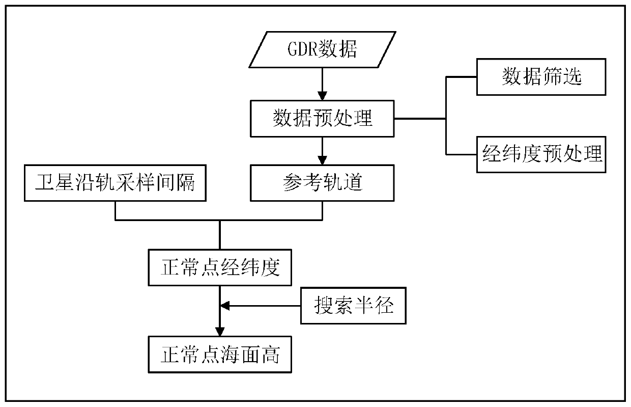
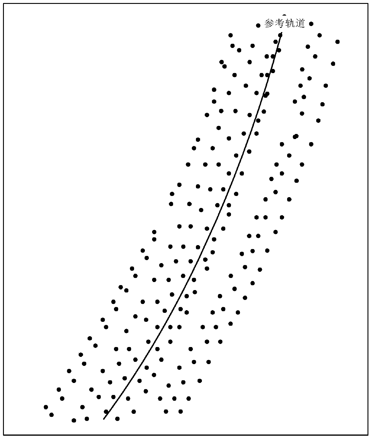
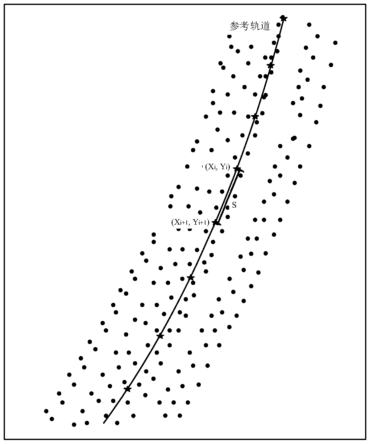
[0034] refer to figure 1 , the specific implementation steps of the present invention are:

[0035] (1) Preprocessing the GDR data of the satellite altimeter to obtain the satellite altimetry data points;

[0036] Among them, the longitude, latitude and sea surface height of the satellite altimetry data points are read from the GDR of the satellite altimeter, and the preprocessing method for the longitude and latitude is:

[0037] Taking the 0-degree meridian as the benchmark, the east longitude is a positive value, and the west longitude is a negative value. The north latitude is 90 minus the latitude value of the location, and the south latitude is 90 plus the latitude value of the location.

[0038] (2) Refer to figure ...


PUM


Abstract

The invention discloses a satellite altimetry data collinear processing method, and relates to the technical field of satellite altimetry data processing. The scheme of the invention is based on satellite altimetry data, and constructs a reference orbit by using a quadratic polynomial, so that discrete data can be more closely approximated; and then, the longitude and latitude of normal points onthe reference orbit are calculated by using the satellite sampling interval along the orbit, so that the data missing is reduced; and finally, the sea surface height of each normal point is determinedby using a weighted distance method, and thus a number of orbits that have the same number and are not closely repeated are fitted into a single orbit.

Description

technical field [0001] The invention relates to the technical field of satellite altimetry data processing, in particular to a collinear processing method for satellite altimetry data. Background technique [0002] Collinear processing is the first step in satellite altimetry data processing. In an ideal state, the satellite orbits of each cycle are closely coincident. However, due to the influence of orbital offset, instruments, gravity and other factors, the repeated orbits of satellites cannot be precisely collinear, and the maximum distance between their trajectories can reach 1 kilometer. Collinear adjustment is a method designed to eliminate satellite orbit errors and determine the mean sea level and its changes based on the characteristics of repetitive satellite altimetry tasks. [0003] When using the traditional collinear processing method, first determine an orbit with the best observation data quality and the largest amount of data in the same orbit number as t...

Claims


Application Information

Patent Timeline
Patent Type & Authority Applications(China)
IPC IPC(8): G01C5/00
CPCG01C5/00
Inventor 孙钦婷万剑华刘善伟
Owner CHINA UNIV OF PETROLEUM (EAST CHINA)
Why Eureka
Try Eureka