High-resolution spaceborne SAR imaging error estimation and compensation method

A technology of imaging error and compensation method, which is applied in the intersection of aerospace and microwave remote sensing, can solve the problems of space-variable defocusing, tropospheric delay error, etc., achieves image quality improvement, reduces disturbance tropospheric delay error, and has wide application prospects. Effect

Active Publication Date: 2019-09-20
NAT UNIV OF DEFENSE TECH
View PDF5 Cites 6 Cited by
  • Summary
  • Abstract
  • Description
  • Claims
  • Application Information

AI Technical Summary

Problems solved by technology

[0005] The purpose of the present invention is: to propose a high-resolution spaceborne SAR imaging error estimation and compensation method, aiming at the disturbance tropospheric delay error, to solve the introduced space variable defocusing problem

Method used


Image

  • High-resolution spaceborne SAR imaging error estimation and compensation method
  • High-resolution spaceborne SAR imaging error estimation and compensation method
  • High-resolution spaceborne SAR imaging error estimation and compensation method

Examples


Embodiment Construction

[0019] The present invention will be further described below in conjunction with the accompanying drawings.

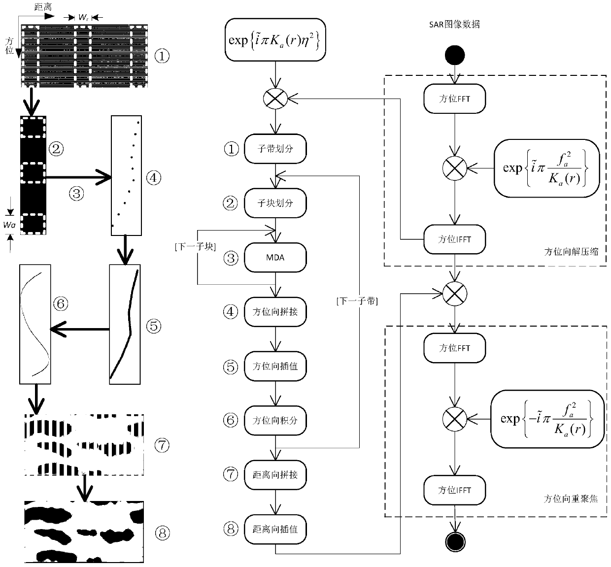
[0020] figure 1 It is a processing schematic diagram and flow chart of the high-resolution spaceborne SAR imaging error estimation and compensation method provided by the present invention, and the whole process is divided into six steps. For the obtained high-resolution spaceborne SAR image, the first step: azimuth decompression and deskewing processing; the second step: dividing subbands and sub-blocks; the third step: sub-block MDA processing; the fourth step: azimuth processing ; The fifth step: range processing; the sixth step: error phase compensation and azimuth refocus processing. Finally, the precisely focused SAR image after the compensation of the disturbance tropospheric delay error is obtained, Figure 5 The above steps are also shown. The detailed description is as follows:

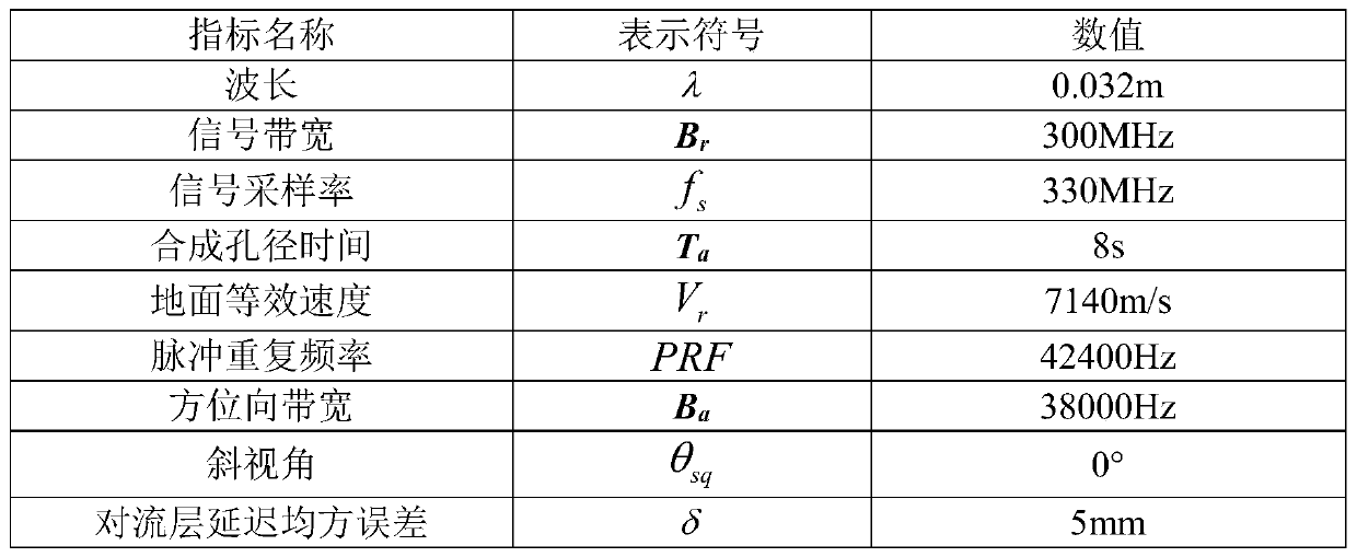
[0021] The parameters of the known high-resolution spaceborne SAR system are...


PUM


Abstract

The invention provides a high-resolution spaceborne SAR imaging error estimation and compensation method aimed at a troposphere disturbing delay error. An obtained high-definition spaceborne SAR image is decompressed in the azimuth to obtain azimuth decompression data; deramping is carried out to obtain deramped azimuth decompression data; the data is divided into sub-band along the distance direction, and then divided to sub-blocks along the azimuth; an MDA algorithm is used to estimate an azimuth frequency modulated inclination error introduced for the troposphere disturbance delay error in each sub-block, and the troposphere disturbing delay error is estimated; the troposphere disturbing delay error is used to compensate the azimuth decompression data; and a result is re-focused in the azimuth to obtain an accurately focused high-definition spaceborne SAR image. The method of the invention can be widely applied to improve the quality of the high-definition SAR image and random error estimation and compensation.

Description

technical field [0001] The invention belongs to the cross-technical field of the combination of aerospace and microwave remote sensing, and in particular relates to a method for estimating and compensating for disturbance tropospheric delay errors in high-resolution spaceborne SAR (Synthetic Aperture Radar, Synthetic Aperture Radar) imaging. Background technique [0002] The spaceborne SAR system is an active radar detection and imaging system, which can observe and image ground targets all-weather and all-weather, and is widely used in land surveying and mapping, ocean surveying and mapping, natural disaster detection, agricultural observation, global carbon and water cycle observation , military reconnaissance and other aspects, it is one of the important sensors in the field of remote sensing [1] . [0003] However, with the proposal and development of high-resolution spaceborne SAR systems, the impact of disturbance delay errors introduced by tropospheric propagation in...

Claims


Application Information

Patent Timeline
Patent Type & Authority Applications(China)
IPC IPC(8): G01S7/40G01S13/90
CPCG01S7/40
Inventor 李德鑫董臻粟毅张永胜何志华余安喜何峰孙造宇金光虎张启雷
Owner NAT UNIV OF DEFENSE TECH
Why Eureka
Try Eureka