An indoor positioning method based on mobile phone geomagnetism and scene images
A scene image, indoor positioning technology, applied in ground navigation, instruments, navigation and other directions, to achieve the effect of improving accuracy and good accuracy
- Summary
- Abstract
- Description
- Claims
- Application Information
AI Technical Summary
Problems solved by technology
Method used
Image


Examples
Embodiment Construction
[0031] The present invention will be described in detail below in combination with specific embodiments.
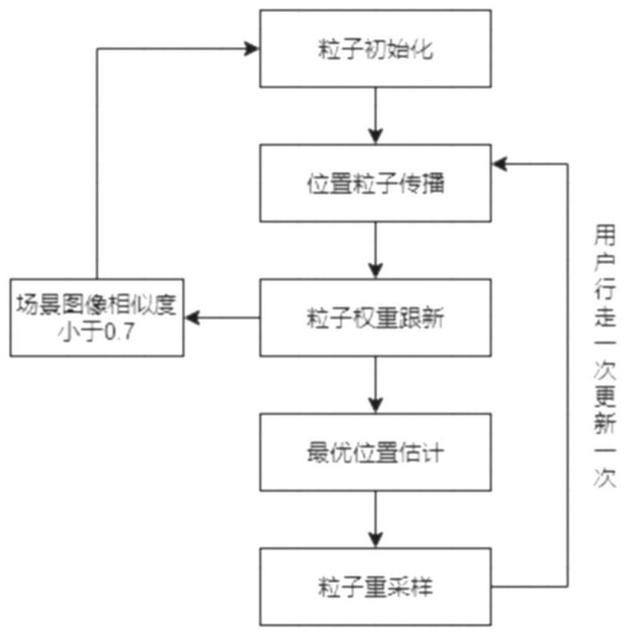
[0032] The present invention proposes a method for indoor positioning based on geomagnetism and scene images. The general framework is as follows figure 1 shown. Specifically follow the steps below to implement.
[0033] Step 1. Offline collection of indoor map fingerprint information
[0034] One fingerprint information corresponds to four measured values and their corresponding positions. In order to collect fingerprint information, the indoor map is divided into 60cm*60cm grids. Each grid is set to a unique position and assigned a position label. Usually there are many roads in an indoor map, and each road is divided into two directions, that is, the main two directions of the road, to collect geomagnetic and scene image information respectively. The measured geomagnetic value is a four-dimensional vector (m x , m y , m z , M), where (m x , m y , m z ) is t...
PUM
 Abstract
Description
Claims
Application Information
 - R&D
- Intellectual Property
- Life Sciences
- Materials
- Tech Scout
- Unparalleled Data Quality
- Higher Quality Content
- 60% Fewer Hallucinations
Browse by: Latest US Patents, China's latest patents, Technical Efficacy Thesaurus, Application Domain, Technology Topic, Popular Technical Reports.
© 2025 PatSnap. All rights reserved.Legal|Privacy policy|Modern Slavery Act Transparency Statement|Sitemap|About US| Contact US: help@patsnap.com