Camera repositioning method based on semantic road sign

A camera and relocation technology, which is applied in the field of relocation, can solve the problems of low relocation accuracy and efficiency, insufficient robustness of the positioning system, and high object discrimination, so as to improve accuracy and efficiency, reduce calculation amount, and enhance robustness. sticky effect

Pending Publication Date: 2019-11-15
NORTHEASTERN UNIV
View PDF5 Cites 0 Cited by
  • Summary
  • Abstract
  • Description
  • Claims
  • Application Information

AI Technical Summary

Problems solved by technology

However, these related semantic SLAM systems are affected by the calculation speed and the positioning accuracy of SLAM itself. These methods using related semantic SLAM systems are basica

Method used


Image

  • Camera repositioning method based on semantic road sign
  • Camera repositioning method based on semantic road sign
  • Camera repositioning method based on semantic road sign

Examples


Embodiment Construction

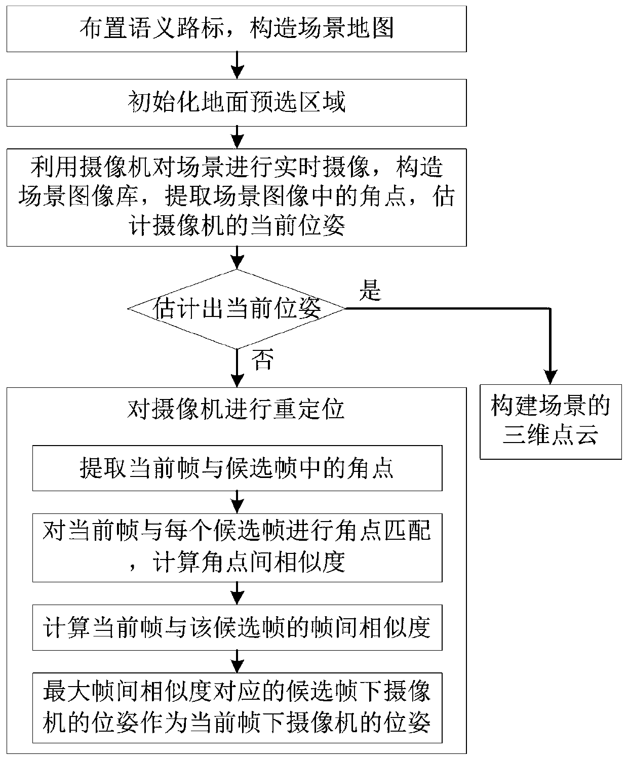
[0029] The present invention will be further described below in conjunction with the accompanying drawings and specific embodiments.

[0030] Such as figure 1 As shown, the camera relocation method based on semantic landmarks of the present invention comprises the following steps:

[0031] Step 1: Arrange semantic landmarks on the ground of the working scene of the camera, and store the coordinates of the center point of each semantic landmark in the SLAM system to form a scene map.

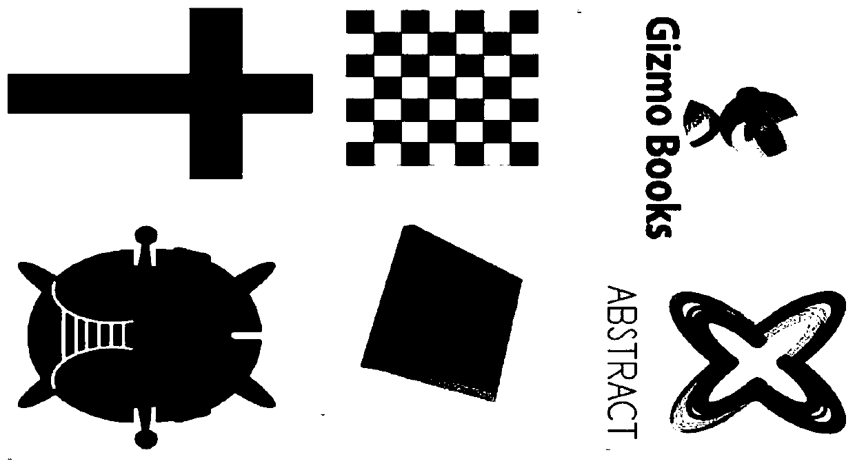
[0032] In this example, if figure 2 As shown, the working scene is a corridor with a length of 200 meters, and the method of arranging semantic signposts is to arrange a semantic signpost every 50cm. Among them, semantic landmarks are markers with obvious characteristics, such as image 3 shown.

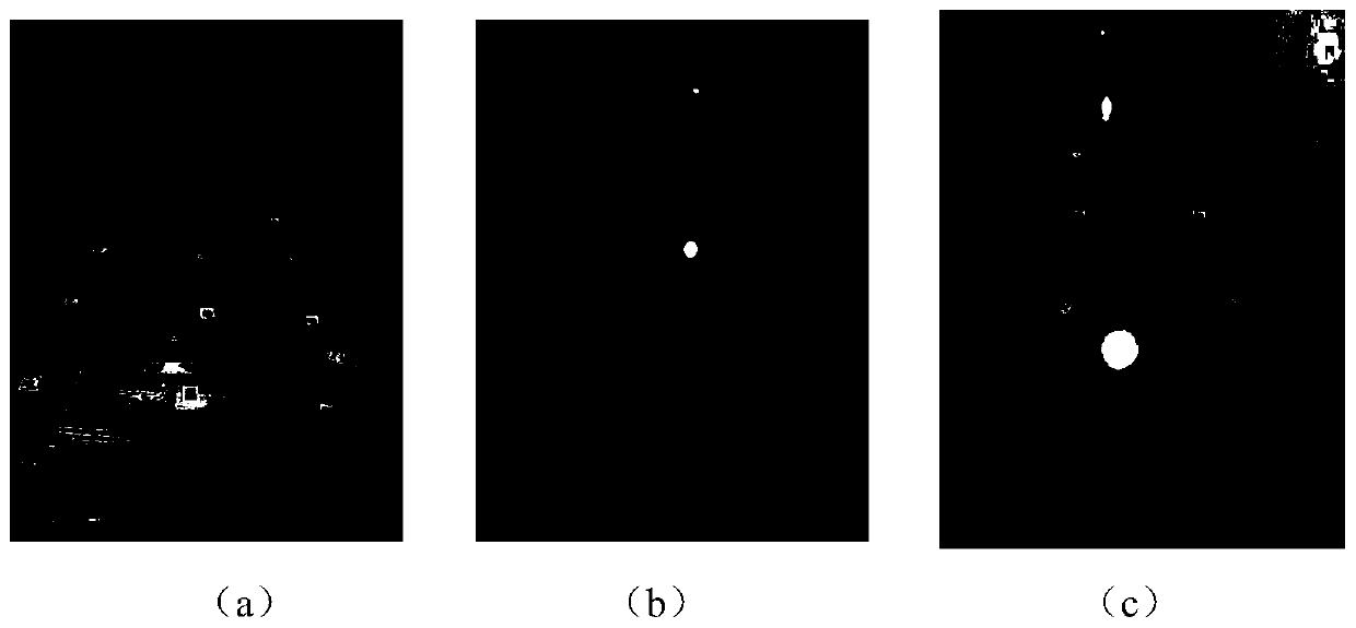
[0033] Step 2: Initialize the ground preselection area.

[0034] In this example, if Figure 4 As shown in , the white box part is the projection of the ground in the camera image coordinate syst...


PUM


Abstract

The invention relates to the technical field of repositioning, and provides a camera repositioning method based on semantic road sign, which comprises the following steps: arranging semantic landmarks, and constructing a scene map; initializing a ground pre-selected area; performing real-time camera shooting on the scene by using a camera to form a scene image library, extracting angular points inthe scene image, estimating the current pose of the camera, and if the current pose can be estimated, constructing a three-dimensional point cloud of the scene; if the current pose cannot be estimated, the camera loses positioning, and repositioning the camera: extracting angular points in the current frame and the candidate frame; carrying out corner point matching on the current frame and the candidate frame, and calculating the similarity between corner points; calculating the inter-frame similarity between the current frame and the candidate frame; and taking the pose of the camera underthe candidate frame corresponding to the maximum inter-frame similarity as the pose of the camera under the current frame. According to the method, the influence of illumination and topographic changes on repositioning can be reduced, the precision and efficiency of repositioning are improved, the robustness of a positioning system is enhanced, and the calculated amount is reduced.

Description

technical field [0001] The invention relates to the technical field of relocation, in particular to a camera relocation method based on semantic landmarks. Background technique [0002] Relocation is one of the most common problems in SLAM (simultaneous localization and mapping, real-time positioning and map construction), which solves the problem that robots or drones lose their positioning during the movement for some reason and cannot continue to work. The problem. The relocation of SLAM is defined as: how to find out its own positioning based on the current sensor observation data of the machine when the environmental map is known. There are mainly several situations that lead to the loss of positioning: 1) The machine is moved after it stops working; 2) Due to environmental factors such as terrain and moving objects, the machine observes an environment with a large difference. These situations cause the machine to think it is in a new environment, when in fact it is i...

Claims


Application Information

Patent Timeline
IPC IPC(8): G06T7/73G06T7/55G06K9/00G06K9/62
CPCG06T7/73G06T7/55G06T2207/10016G06T2207/10028G06V20/10G06V10/751
Inventor 于瑞云费子昂杨硕
Owner NORTHEASTERN UNIV
Why Eureka
Try Eureka