
Mesh generation and visualization method and system based on three-dimensional urban geological model

A technology of grid division and geological model, applied in the field of 3D geological modeling, can solve the problems of large data storage, difficult data exchange and sharing of models, etc., and achieve the effect of reducing the pressure of visualization

Active Publication Date: 2020-01-10
武汉中地数码科技有限公司
View PDF4 Cites 10 Cited by
  • Summary
  • Abstract
  • Description
  • Claims
  • Application Information

AI Technical Summary

Problems solved by technology

[0005] The storage method of the traditional structural model is refined storage, which usually stores points, lines, and planes. The data storage volume is large, and it is difficult to exchange and share data between different models.

Method used


Image

  • Mesh generation and visualization method and system based on three-dimensional urban geological model
  • Mesh generation and visualization method and system based on three-dimensional urban geological model
  • Mesh generation and visualization method and system based on three-dimensional urban geological model

Examples


Embodiment Construction

[0051] In order to make the object, technical solution and advantages of the present invention clearer, the present invention will be further described in detail below in conjunction with the accompanying drawings and specific embodiments. It should be understood that the specific embodiments described here are only used to explain the present invention, not to limit the present invention.

[0052] In the following text, many aspects of the invention will be better understood with reference to the accompanying drawings. Components in the figures are not necessarily drawn to scale. Instead, emphasis is placed on clearly illustrating the components of the invention. Furthermore, like reference numerals indicate corresponding parts throughout the several views of the drawings.

[0053] As used herein, the word "exemplary" or "illustrative" means serving as an example, instance, or illustration. Any implementation described herein as "exemplary" or "illustrative" is not necessa...


PUM


Abstract

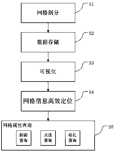
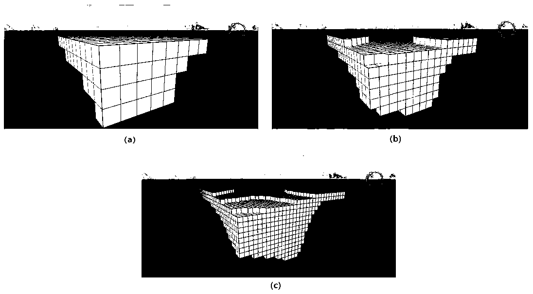
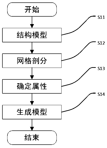
The invention relates to the field of three-dimensional geological modeling, and in particular to a mesh generation and visualization method and system based on a three-dimensional urban geological model, and the method is characterized in that the method comprises the steps: S1, mesh generation: calculating an outer bounding box of a structural model, carrying out the regular mesh generation of the outer bounding box, and generating a regular mesh regular hexahedron attribute model; S2, data storage: storing a central point coordinate value and an attribute value of each subdivided regular hexahedron unit grid in the bounding box; S3, visualization: extracting an outer contour frame of the structure model, pasting a texture picture to the contour frame model, and representing the same geologic model by adopting a plurality of grid units in combination with a multi-detail-level LOD technology; S4, efficiently positioning the grid information; and S5, grid attribute query: dynamically generating a grid according to the returned result set and submitting the grid to the user, wherein the grid attribute query comprises multiple query modes. According to the method, the storage mode ofthe three-dimensional urban geological model is optimized, and visualization of large data volume is supported.

Description

technical field [0001] The invention relates to the field of three-dimensional geological modeling, in particular to a grid division and visualization method and system based on a three-dimensional urban geological model. Background technique [0002] 3D Geology Modeling (3D Geology Modeling) is a discipline based on data / information analysis and synthesis. It combines geological, well logging, geophysical data and various interpretation results or conceptual models to generate a 3D quantitative random model. Technology, in a virtual 3D environment, combines tools such as spatial information management, geological interpretation, spatial analysis and prediction, geostatistics, entity content analysis, and visualization, and uses them for geological analysis. [0003] With the development of my country's economic construction and the continuous improvement of urbanization level, urban geology has been damaged to varying degrees. On the basis of 3D visualization, using the ge...

Claims


Application Information

Patent Timeline
Patent Type & Authority Applications(China)
IPC IPC(8): G06T17/05G06T17/20G06T15/04
CPCG06T17/05G06T17/20G06T15/04G06T2210/12Y02A30/60
Inventor 吴信才吴亮万波尹培培黄胜辉黄波黄颖陈小佩
Owner 武汉中地数码科技有限公司
Learn More