GIS-based refuse landfill site selection method and GIS-based refuse landfill site selection device

A technology for landfills and candidate areas, applied in the information field, can solve the problems of high cost, long time, and large manpower and material resources, and achieve the effect of low cost, high evaluation accuracy, and short time

Pending Publication Date: 2020-02-25
SHAANXI TIANCHENG XINKAI SOFTWARE CO LTD
View PDF3 Cites 3 Cited by
  • Summary
  • Abstract
  • Description
  • Claims
  • Application Information

AI Technical Summary

Problems solved by technology

[0005] The embodiment of the present invention provides a GIS-based landfill site selection method, which aims to solve the problem that the existing site selection of garbage landfills consumes a lot of manpower and material resou

Method used


Image

  • GIS-based refuse landfill site selection method and GIS-based refuse landfill site selection device
  • GIS-based refuse landfill site selection method and GIS-based refuse landfill site selection device
  • GIS-based refuse landfill site selection method and GIS-based refuse landfill site selection device

Examples


Embodiment 1

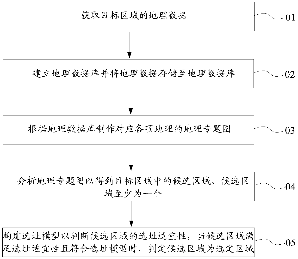
[0025] see figure 1 , the GIS-based landfill siting method of the embodiment of the present invention, comprising steps:

[0026] S01: Obtain geographic data of the target area;

[0027] S02: Establish a geographic database and store geographic data in the geographic database;

[0028] S03: Make geographic thematic maps corresponding to various geography according to the geographic database;

[0029] S04: Analyze the geographic thematic map to obtain candidate areas in the target area, at least one candidate area;

[0030] S05: Build a site selection model to judge the suitability of the candidate area for site selection. When the candidate area meets the site selection suitability and conforms to the site selection model, it is determined that the candidate area is the selected area.

[0031] The site selection method of the embodiment of the present invention is based on the geographic information system platform, and by utilizing the spatial analysis function of the geo...

Embodiment 2

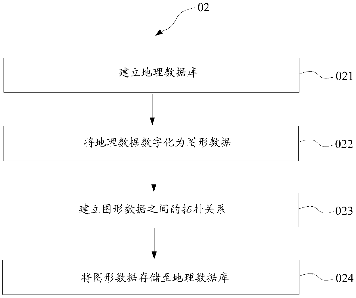
[0038] Further, see figure 2 , step S02 includes the steps of:

[0039] S021: Establish a geographic database;

[0040] S022: Digitize geographic data into graphic data;

[0041] S023: Establish a topological relationship between graphic data;

[0042] S024: Store the graphics data in the geographic database.

[0043] Specifically, in the embodiment of the present invention, a new geographic database file is created in the software ArcGIS Catalog, and the acquired geographic data is digitized into graphic data with geometric shapes and graphic symbols, and the topology between multiple geographic data is established. Relationship, so that the spatial connection and adjacency relationship between the graphic data can be displayed more vividly and intuitively, and finally the graphic data is stored in the geographic database. It is understandable that graphic data has a better display effect. When the data of the geographic database needs to be referenced, the data exported...

Embodiment 3

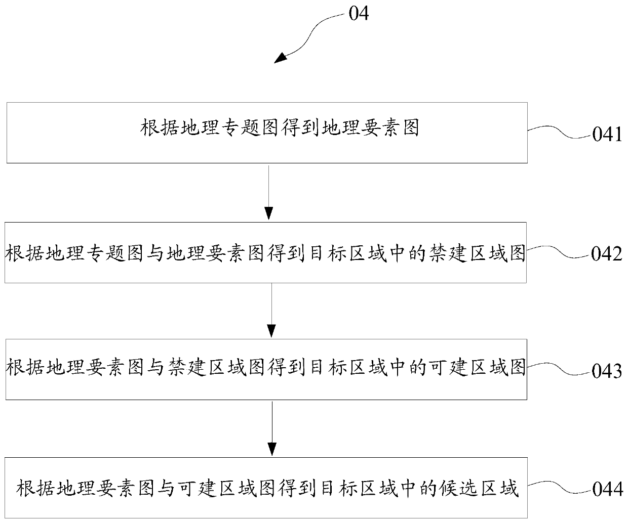
[0047] Further, see image 3 , step S04 includes the steps of:

[0048] S041: Obtain a geographic element map according to the geographic thematic map;

[0049] S042: According to the geographic thematic map and the geographic element map, obtain the prohibited construction area map in the target area;

[0050] S043: Obtain a buildable area map in the target area according to the geographical element map and the forbidden area map;

[0051] S044: Obtain candidate areas in the target area according to the geographic feature map and the buildable area map.

[0052] Specifically, analyzing the geographic thematic map is to conduct spatial analysis on the above-mentioned geographic thematic maps, such as the distribution map of urban water intake points and the distribution map of residential areas, use the buffer function of the geographic information system to analyze the buffer zone, and use the radiation as the radius Make a buffer zone of 800m to obtain the radiation map o...


PUM


Abstract

The invention is suitable for the technical field of information, and provides a GIS-based refuse landfill site selection method, which comprises the steps of obtaining geographic data of a target area; establishing a geographic database and storing the geographic data into the geographic database; making geographic thematic maps corresponding to various geologies according to the geographic database; analyzing the geographic thematic map to obtain at least one candidate region in the target region; and constructing a site selection model to judge the site selection suitability of the candidate region, and when the candidate region meets the site selection suitability and conforms to the site selection model, judging that the candidate region is a selected region. The site selection methoddepends on a geographic information system platform, can utilize the spatial analysis function of the geographic information system and the intuition of result output to quickly and accurately selectthe refuse landfill with less influence on the surrounding environment, and is low in cost, short in time, high in evaluation accuracy, time-saving and labor-saving compared with the traditional manual on-site investigation.

Description

technical field [0001] The invention belongs to the field of information technology, and in particular relates to a GIS-based site selection method and a site selection device for a garbage landfill. Background technique [0002] At present, garbage disposal methods can generally be divided into several methods such as landfill, incineration, and composting. Among them, garbage is buried in landfills. The landfill is a centralized waste storage site under the sanitary landfill method. It is widely used in China because of its low cost and good sanitation. However, the landfill will still have a certain impact on the surrounding environment. As the society's requirements for environmental protection are getting higher and higher, it is particularly important to reasonably select the address of the landfill to minimize the impact on the surrounding environment. [0003] At present, the site selection of waste landfills is mainly conducted by relevant personnel to conduct on-t...

Claims


Application Information

Patent Timeline
IPC IPC(8): G06Q10/04G06F16/29G06Q50/26
CPCG06Q10/043G06F16/29G06Q50/26
Inventor 孙苗强惠子怡
Owner SHAANXI TIANCHENG XINKAI SOFTWARE CO LTD
Why Eureka
Try Eureka