
Positioning correction method, device and system

A coordinate system and mapping relationship technology, applied in satellite radio beacon positioning systems, measuring devices, radio wave measuring systems, etc., can solve the problems of blocking satellite signals, affecting the accuracy of positioning, and failing to meet the precise navigation requirements of intelligent vehicles. Achieve the effect of satisfying precise navigation

Pending Publication Date: 2020-03-27
SAIC MOTOR
View PDF3 Cites 7 Cited by
  • Summary
  • Abstract
  • Description
  • Claims
  • Application Information

AI Technical Summary

Problems solved by technology

However, satellite signals will be affected by many factors, such as trees, urban high-rises, basements and other buildings, which will affect and block satellite signals, and finally affect the accuracy of positioning, which cannot meet the precise navigation needs of smart vehicles

Method used


Image

  • Positioning correction method, device and system
  • Positioning correction method, device and system
  • Positioning correction method, device and system

Examples


Embodiment Construction

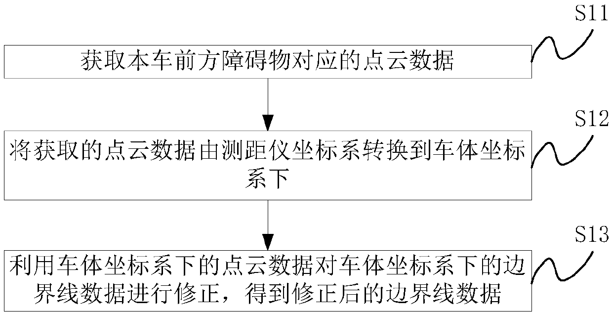
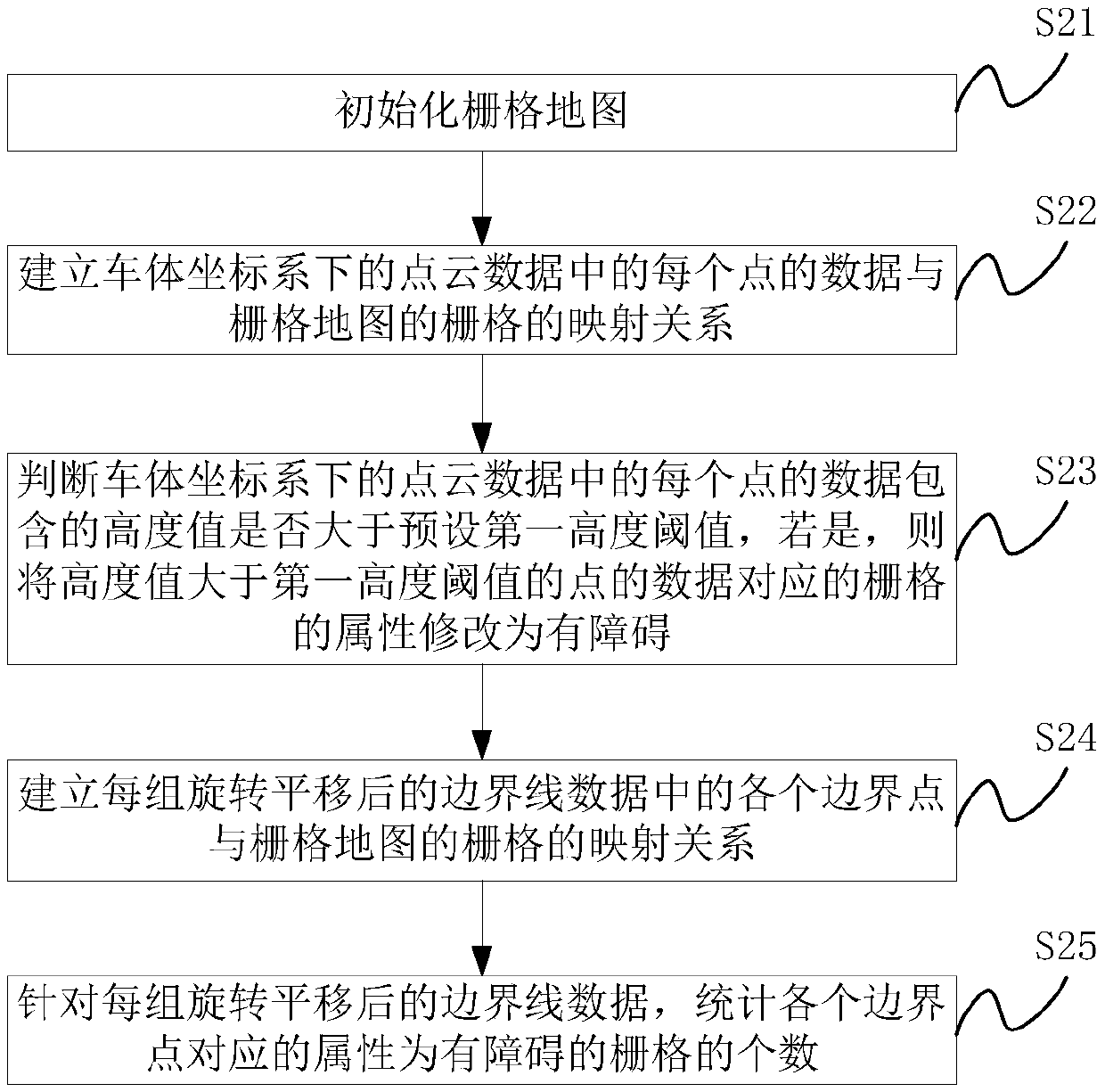
[0051] With the development of ADAS (Advanced Driver Assistance System, Advanced Driver Assistance System) technology, some advanced driver assistance functions have appeared, such as adaptive cruise, lane keeping, automatic braking system and other functions. Vehicle-mounted lidar has been widely used in the field of autonomous driving, and can be used as information input for environmental perception and positioning of autonomous driving. Because trees, urban high-rises, basements and other buildings will affect and block satellite signals, there will be deviations in the positioning results of intelligent vehicles within a certain range. The technical solution of the present invention believes that the single-frame point cloud data of laser radar is accurate. The point cloud data corresponding to the obstacles in front of the vehicle corrects the boundary line data converted from the high-precision map to the vehicle body coordinate system to obtain accurate boundary line da...


PUM


Abstract

The invention belongs to the technical field of intelligent vehicles. The invention provides a positioning correction method, device and system, and the method comprises the steps: correcting the boundary line data, converted into a vehicle body coordinate system, in a high-precision map through employing the point cloud data corresponding to an obstacle in front of a vehicle, obtaining the precise boundary line data of the high-precision map, and meeting the precise navigation demands of an intelligent vehicle.

Description

technical field [0001] The invention relates to the field of intelligent vehicles, and more specifically, to a positioning correction method, device and system. Background technique [0002] Smart vehicles are autonomous vehicles that utilize a variety of sensors and smart road technologies. The smart vehicle uses the satellite positioning system to precisely locate its own longitude and latitude, and retrieves information such as road boundaries and lane lines in the high-precision map, and then transfers to the vehicle body coordinate system to determine the driving direction of the vehicle. However, satellite signals will be affected by many factors, such as trees, urban high-rise buildings, basements and other buildings, which will affect and block satellite signals, and finally affect the accuracy of positioning, which cannot meet the precise navigation needs of smart vehicles. Contents of the invention [0003] In view of this, the present invention proposes a posit...

Claims


Application Information

Patent Timeline
IPC IPC(8): G01S19/45G01S19/40G01S17/08G01C21/28
CPCG01S19/45G01S19/40G01S17/08G01C21/28Y02T10/40
Inventor 刘晓楠金星徐成张显宏
Owner SAIC MOTOR
Learn More