

Time-space domain model modeling method and system for ecological environment monitoring
A technology for environmental monitoring and model modeling, applied in character and pattern recognition, instrumentation, computing, etc., can solve problems such as inability to become, discrete and sparse ecological environment monitoring data, and achieve good classification results.
- Summary
- Abstract
- Description
- Claims
- Application Information
AI Technical Summary
Problems solved by technology
Method used
Image

Examples
Embodiment 1
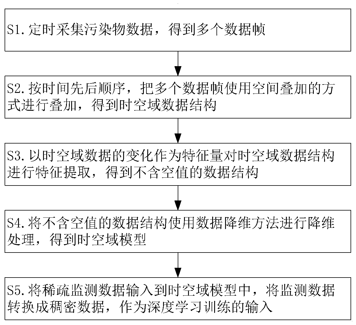
[0034] Such as figure 1 As shown, the present invention provides a kind of time-space domain model modeling method for ecological environment monitoring, comprising the following steps:
[0035] S1. Collect pollutant data regularly to obtain multiple data frames;
[0036] S2. In chronological order, multiple data frames are superimposed using a spatial superposition method to obtain a space-time domain data structure;
[0037] S3. Using the change of the time-space domain data as a feature quantity to perform feature extraction on the time-space domain data structure, and obtain a data structure without null values;
[0038] S4. Use the data dimensionality reduction method to perform dimensionality reduction processing on the data structure that does not contain null values, and obtain the space-time domain model;
[0039] S5. Input the sparse monitoring data into the time-space domain model, and convert the monitoring data into dense data through the time-space domain model...
Embodiment 2
[0060] The effect of PCA algorithm on classification is not obvious in data dimension reduction processing, which is not particularly ideal for the input of building deep learning. Because the data of deep learning needs to be divided into training set and verification set.
[0061] In order to solve the above technical problems, the Laplacian feature mapping algorithm is used in data dimensionality reduction.
[0062] The working principle is explained below: the Laplacian algorithm uses the local angle of the data vector to construct the relationship between the data. If the two data frames are very similar, they should be as close as possible in the target subspace after dimensionality reduction. The specific steps of the algorithm during use are: first, use the KNN algorithm to construct all points into a graph, and connect each point to the nearest K points. In this embodiment, the requirement is to reduce the dimensionality of the data from 4 dimensions, and select 4 as...
Embodiment 3
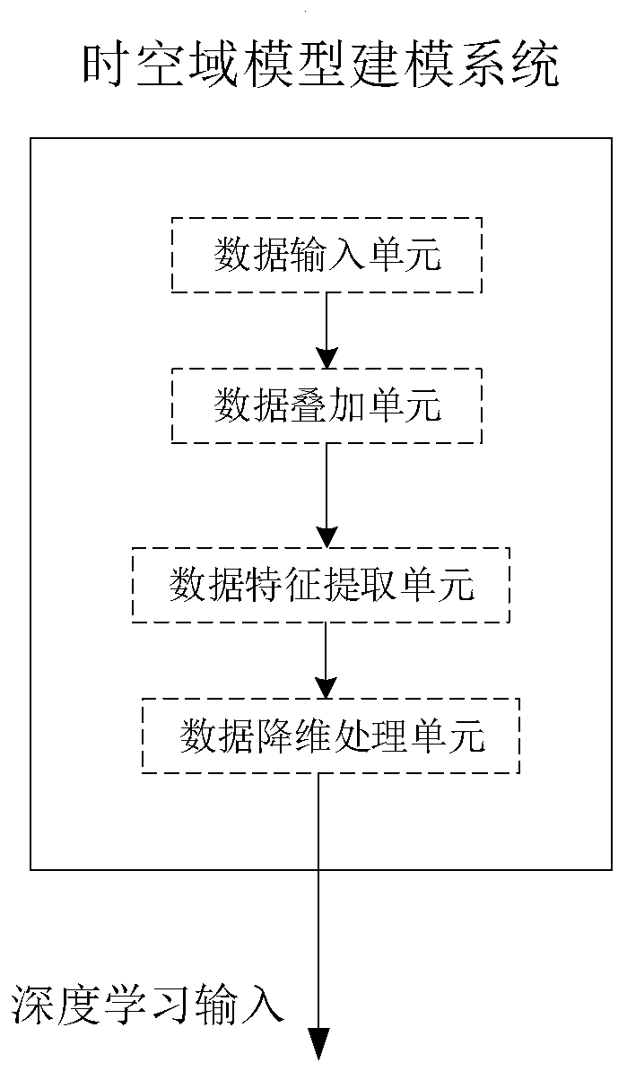
[0064] The present invention also provides the present invention also provides a time-space domain model modeling system for ecological environment monitoring, such as figure 2 As shown, it includes: data input unit, data superposition unit, data feature extraction unit, data dimensionality reduction processing unit;
[0065] The data input unit is used to input multiple data frames obtained according to the collected pollutant information;
[0066] The data superposition unit is used to superimpose multiple data frames using a spatial superposition method to obtain a time-space domain data structure;
[0067] The data feature extraction unit is used to extract the features of the space-time domain data structure using the change of the time-space domain data as a feature quantity, and obtain a data structure without null values;
[0068] The data dimensionality reduction processing unit is used to perform dimensionality reduction processing on a data structure without null ...
PUM
 Abstract
Description
Claims
Application Information