
Burned area detection method based on short-wave infrared and thermal infrared data feature fusion

A fire-burned, short-wave infrared technology, applied in radiation pyrometry, measuring devices, optical radiation measurement, etc., can solve the problem of missed detection of target pixels, and achieve the effect of accurate extraction and suppression of complex background changes.

Active Publication Date: 2020-04-14
TONGJI UNIV
View PDF5 Cites 2 Cited by
  • Summary
  • Abstract
  • Description
  • Claims
  • Application Information

AI Technical Summary

Problems solved by technology

Since the temperature information is also greatly affected by the weather, etc., it is very likely that a large number of target pixels will be missed by only extracting the burnt area by temperature.

Method used


Image

  • Burned area detection method based on short-wave infrared and thermal infrared data feature fusion
  • Burned area detection method based on short-wave infrared and thermal infrared data feature fusion
  • Burned area detection method based on short-wave infrared and thermal infrared data feature fusion

Examples


Embodiment

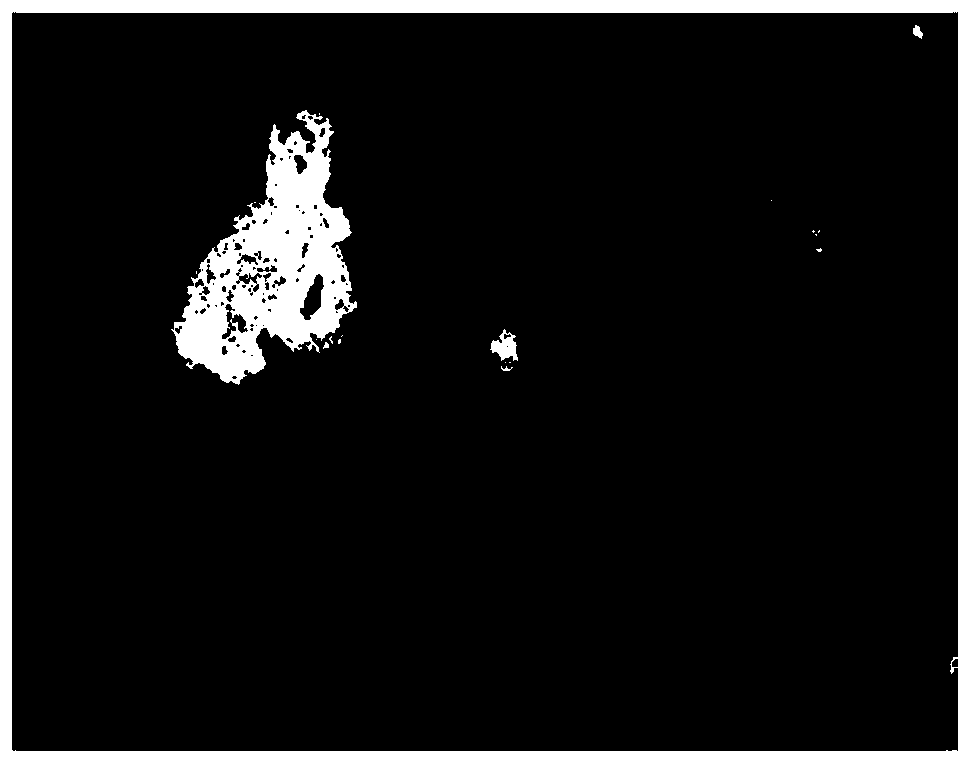
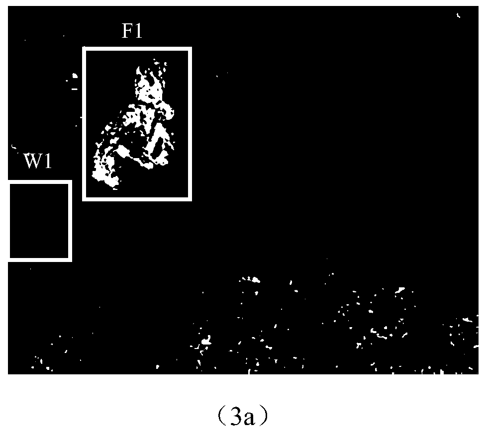
[0072] The experimental data adopts medium-resolution Landsat-8 satellite remote sensing Level 1 (L1) product data, and the map projection is UTM-WGS84 Antarctica polar projection, which comes from the official website of the United States Geological Survey (USGS). The research target is the Grampians National Park Fire (GNPF) in Victoria, southeastern Australia. This experiment uses January 12, 2014 (before the disaster) and January 28, 2014 (after the disaster). Image data.

[0073] Experimental results:

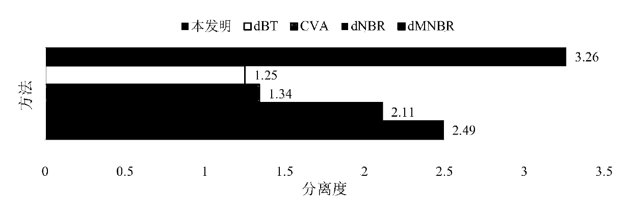
[0074] 1. Analysis of the ability of different methods to separate burnt areas and non-burned areas

[0075] Based on 0.1% random samples, respectively calculate the separation degree of 5 kinds of methods (CVA, dNBR, dMNBR, dBT and the present invention) in the research area to extract the gray scale map of the burnt area. The higher the value, the stronger the ability to separate burned and non-burned areas. see results figure 1 . Depend on figure 1 It can be seen ...


PUM


Abstract

The invention relates to a burned area detection method based on short-wave infrared and thermal infrared data feature fusion. The method comprises the following steps: 1), obtaining Landsat-8 image data before and after a fire in a to-be-detected region, and carrying out the preprocessing of front and rear time-phase images; 2) respectively calculating a difference characteristic dMNBR of front and back time-phase MNBR indexes and a brightness temperature difference characteristic dBT of front and back time phases according to the preprocessed time-phase image; 3) fusing the index differencecharacteristics and the brightness temperature difference characteristics by using a fusion algorithm GTF based on gradient transfer and total variation minimization to generate a burned area grey-scale map; and 4) performing adaptive threshold segmentation on the burned area grey-scale map, generating a binary change detection map about the burned area and the non-burned area, and further realizing extraction of the burned area. Compared with the methods in the prior art, the method has the advantages of suppressing background interference, accurately and quickly extracting the burned area and the like.

Description

technical field [0001] The invention relates to the field of automatic detection of multi-temporal remote sensing images of burnt traces, in particular to a detection method of burnt traces based on feature fusion of Landsat-8 short-wave infrared and thermal infrared data. Background technique [0002] As a world-class major natural disaster, forest fire is often accompanied by the imbalance of ecosystem and the destruction of forest structure. Especially for large-scale forest fires, the traditional extraction of fire traces mostly relies on ground survey and measurement, which is not only greatly affected by the weather but also time-consuming and laborious. [0003] Using satellite observation technology, remote sensing images can be used to directly detect burnt areas on a large scale, which largely avoids many disadvantages of traditional detection. In recent decades, scholars at home and abroad have carried out extensive research on forest fire information extraction ...

Claims


Application Information

Patent Timeline
Patent Type & Authority Applications(China)
IPC IPC(8): G06K9/00G01J5/00
CPCG01J5/00G01J2005/0077G01J5/485G06V20/188
Inventor 柳思聪郑永杰杜谦童小华谢欢冯毅金雁敏刘世杰陈鹏
Owner TONGJI UNIV
Learn More