System and method for realizing tour guide based on mobile phone hand-drawn map photos
A picture and photo technology, applied in the field of mobile phone GPS positioning tour guide system, can solve the problem of insufficient demand for tour guides
- Summary
- Abstract
- Description
- Claims
- Application Information
AI Technical Summary
Problems solved by technology
Method used
Image

Examples
Embodiment Construction
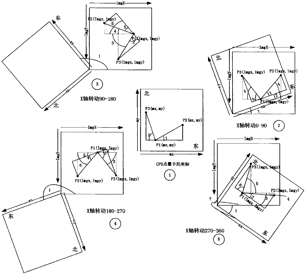
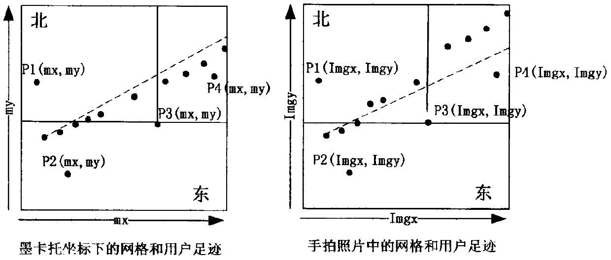
[0048] The implementation of the present invention mainly has two implementation versions, that is, an offline version and an online version. The offline version only needs to implement the offline client, while the online version requires the client system, hand-drawn map collection system, back-end navigation support system, back-end users and map storage system.
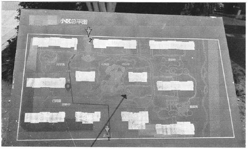
[0049] Offline version: The offline client can be implemented in the form of APP or H5. It can directly obtain the photo map by taking pictures on the mobile phone, set the reference point based on the GPS signal, and conduct a real-time tour guide based on the GPS signal. The offline client supports the line drawing of the photo map, thus supporting the deviation alarm. When H5 is implemented, the GPS coordinate system obtained based on different browsers may be different. For example, the GPS coordinates returned by UC, Baidu, Firefox, 360 browsers, etc. are actually Mars coordinate system (GCJ), so necessary co...
PUM
 Abstract
Description
Claims
Application Information
 - R&D Engineer
- R&D Manager
- IP Professional
- Industry Leading Data Capabilities
- Powerful AI technology
- Patent DNA Extraction
Browse by: Latest US Patents, China's latest patents, Technical Efficacy Thesaurus, Application Domain, Technology Topic.
© 2024 PatSnap. All rights reserved.Legal|Privacy policy|Modern Slavery Act Transparency Statement|Sitemap