Photovoltaic ultra-short-term power forecasting method based on sunflower No.8 satellite cloud atlas
A satellite cloud map, ultra-short-term technology, applied in forecasting, instrumentation, data processing applications, etc., can solve problems such as large gaps and low forecast accuracy, and achieve improved forecast accuracy, ultra-short-term cloud cover accuracy, and forecast accuracy. Effect
- Summary
- Abstract
- Description
- Claims
- Application Information
AI Technical Summary
Problems solved by technology
Method used
Image
Examples
Embodiment 1
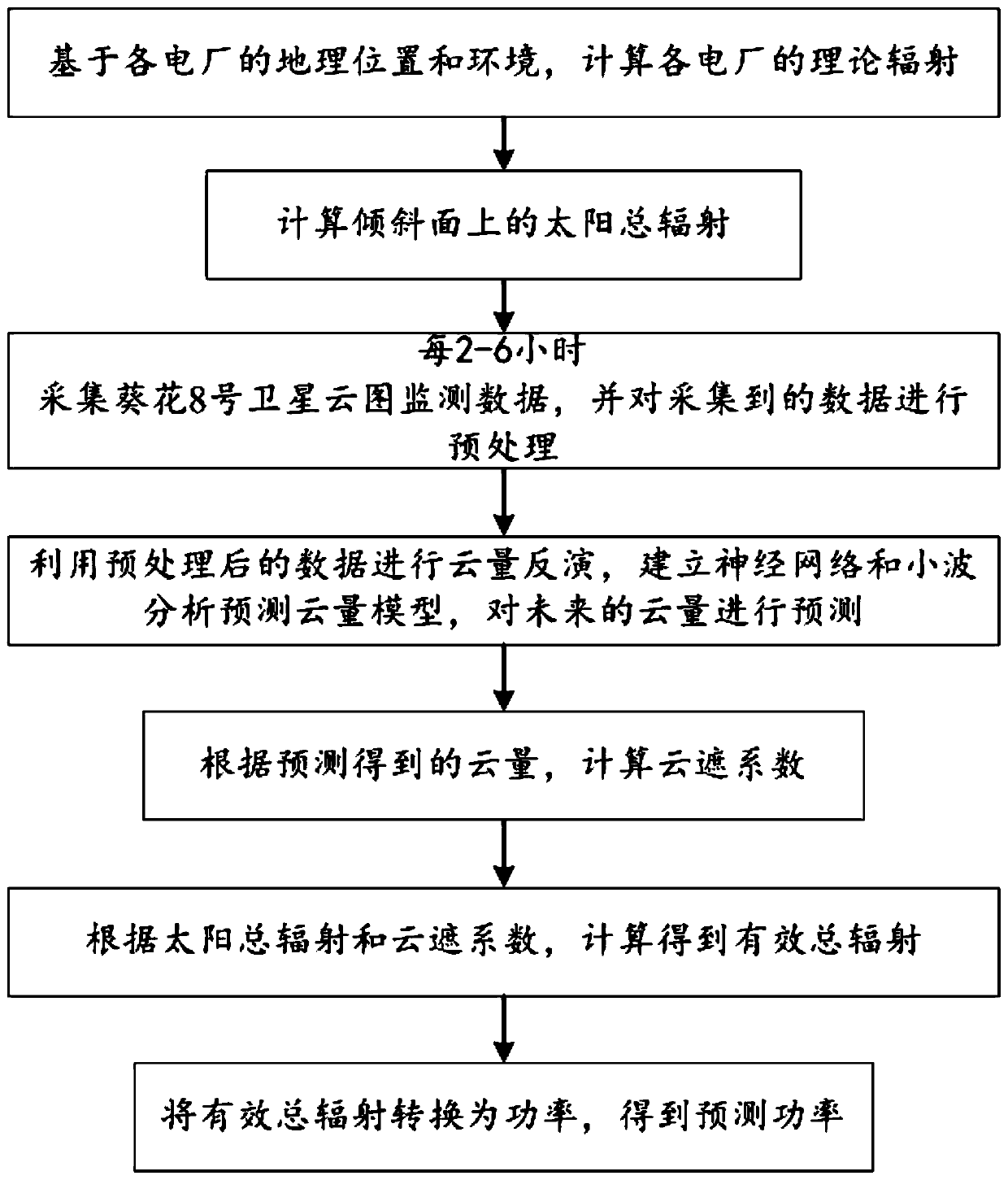
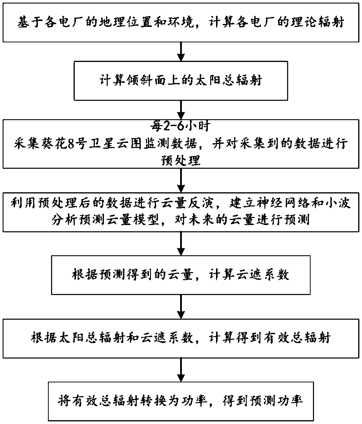
[0050] Such as figure 1 As shown, this embodiment provides a photovoltaic ultra-short-term power forecasting method based on the Sunflower 8 satellite cloud image, including the following steps:
[0051] S1: Calculate the theoretical radiation of each power plant based on the geographical location and environment of each power plant, including: latitude and longitude, altitude, solar altitude angle, solar declination angle, solar hour angle, atmospheric transparency and air quality of each power plant;
[0052] The formula for calculating the solar declination angle is: n is the accumulated days arranged in the order of the number of days;
[0053] The formula for calculating the solar hour angle is: t is Beijing time, ψ is the local longitude;
[0054] The calculation formula of the sun altitude angle is: is the geographic latitude;
[0055] The formula for calculating the solar radiation intensity at any moment in the upper boundary of the atmosphere is: n is the...
PUM
 Abstract
Description
Claims
Application Information
 - R&D
- Intellectual Property
- Life Sciences
- Materials
- Tech Scout
- Unparalleled Data Quality
- Higher Quality Content
- 60% Fewer Hallucinations
Browse by: Latest US Patents, China's latest patents, Technical Efficacy Thesaurus, Application Domain, Technology Topic, Popular Technical Reports.
© 2025 PatSnap. All rights reserved.Legal|Privacy policy|Modern Slavery Act Transparency Statement|Sitemap|About US| Contact US: help@patsnap.com


