

Geological environment bearing capacity analysis method based on AHP-GIS coupling analysis
An AHP-GIS and geological environment technology, applied in geographic information databases, structured data retrieval, resources, etc., can solve problems such as complex screening projects and complicated data
- Summary
- Abstract
- Description
- Claims
- Application Information
AI Technical Summary
Problems solved by technology
Method used
Image

Examples
Embodiment Construction
[0053] In order to make the object, technical solution and advantages of the present invention clearer, the present invention will be further described in detail below in conjunction with the examples. It should be understood that the specific embodiments described here are only used to explain the present invention, not to limit the present invention.
[0054] For the problems existing in the prior art, the present invention provides a kind of geological environment carrying capacity analysis method based on AHP-GIS coupling analysis, below in conjunction with accompanying drawing the present invention is described in detail.
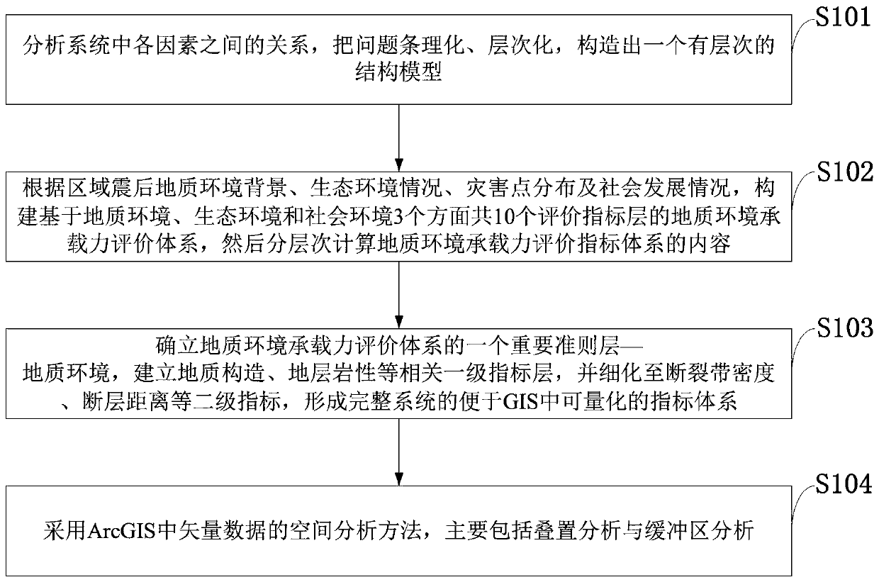
[0055] Such as figure 1 As shown, the geological environment carrying capacity analysis method based on AHP-GIS coupled analysis provided by the embodiments of the present invention may further comprise the steps:
[0056] S101: Analyze the relationship between various factors in the system, organize and hierarchicalize the problem, and construct a hi...
PUM
 Abstract
Description
Claims
Application Information